While takeoff favors the right, the landing view is more dramatic and geographically significant. The approach to GRU offers extended views of São Paulo's massive urban landscape and the Serra da Cantareira, which are more visually distinctive than the FLL departure corridor over relatively flat coastal terrain.
Flown FLL to GRU? Did we get it right?
Flight Path
Fort Lauderdale to Sao Paulo is 4,095 miles (6,590 km), a flight of about 9 hours.
The flight path crosses the Caribbean Sea and passes over or near the northern coast of South America (Venezuela/Colombia region), then continues south over the Amazon Basin and Brazilian interior. At cruise altitude, you may see the Andes Mountains as a distant ridge to the left (west) during the approach to Brazil. The Amazon rainforest dominates the landscape for several hours of the flight, appearing as an unbroken green canopy with river systems visible as darker threads. As you approach São Paulo, the landscape transitions from rainforest to agricultural zones (soy and sugarcane fields) and then to urban development.
Great circle distance and headings ›


Phase by phase
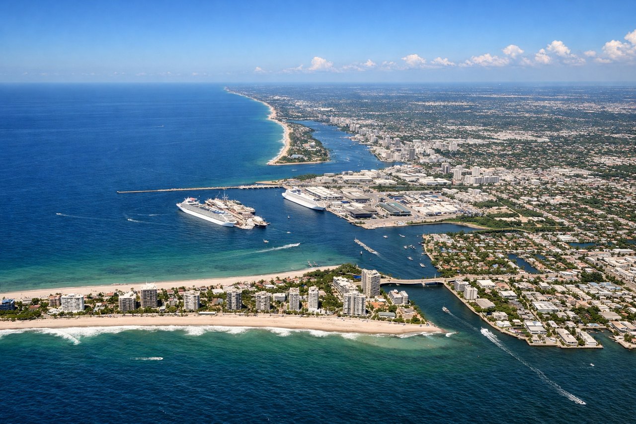
Takeoff from FLL
RIGHTFLL typically departs eastbound (runways 08L/08R or 09L/09R), so right-side seats face north toward the Atlantic coast and Port Everglades. You'll see the intricate waterway system and coastal development clearly before turning south over open ocean.
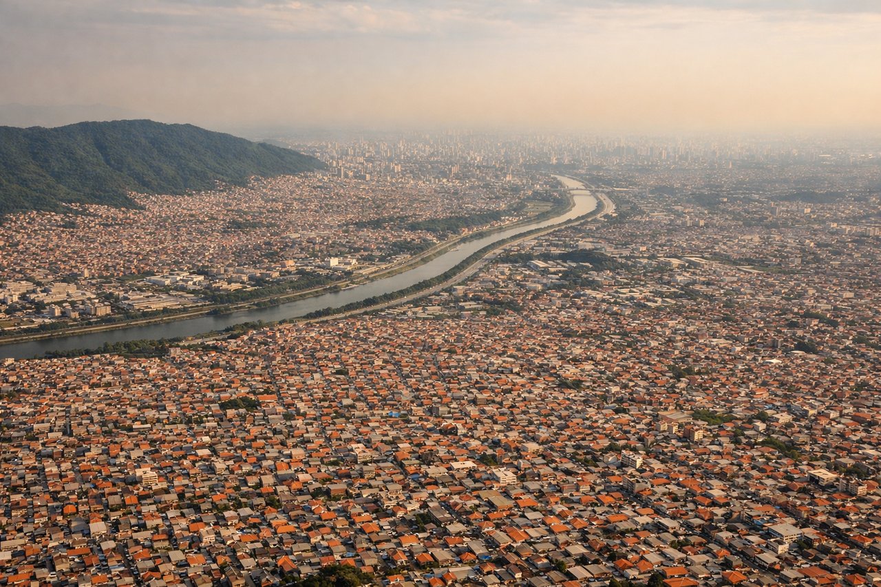
Landing at GRU
LEFTGRU approaches from the northeast (typically runways 09L/09R), so left-side seats face south and southwest toward the city of São Paulo. You'll see the urban sprawl, the Tietê River valley, and the Serra da Cantareira mountains as you descend into the approach corridor.
Will your flight be in sunlight?
Pick a date and time in the Sun Map to watch the sun move across your whole flight.
About This Route
Which side of the plane should I sit on flying from Fort Lauderdale Hollywood International (FLL) to Guarulhos (GRU)?
Sit on the Left side of the plane for the best views on flights from Fort Lauderdale to Sao Paulo. While takeoff favors the right, the landing view is more dramatic and geographically significant. The approach to GRU offers extended views of São Paulo's massive urban landscape and the Serra da Cantareira, which are more visually distinctive than the FLL departure corridor over relatively flat coastal terrain.
What can I see during takeoff from Fort Lauderdale Hollywood International in Fort Lauderdale?
During takeoff from Fort Lauderdale Hollywood International (FLL), sit on the Right side for the best views. FLL typically departs eastbound (runways 08L/08R or 09L/09R), so right-side seats face north toward the Atlantic coast and Port Everglades. You'll see the intricate waterway system and coastal development clearly before turning south over open ocean. Notable sights include: Port Everglades (major shipping channel immediately north), Atlantic Ocean, New River and Intracoastal Waterway system, Miami metropolitan sprawl to the northwest.
What can I see when landing at Guarulhos in Sao Paulo?
When landing at Guarulhos (GRU), sit on the Left side for the best views. GRU approaches from the northeast (typically runways 09L/09R), so left-side seats face south and southwest toward the city of São Paulo. You'll see the urban sprawl, the Tietê River valley, and the Serra da Cantareira mountains as you descend into the approach corridor. Notable sights include: Serra da Cantareira (mountain range to the north/northeast), Tietê River valley and urban São Paulo sprawl, Guarulhos industrial zone, Atlantic Plateau escarpment in distance.
How long is the flight from Fort Lauderdale to Sao Paulo?
The flight from Fort Lauderdale Hollywood International (FLL) to Guarulhos (GRU) takes about 9 hours. The shortest flight path between them is 4,095 miles (6,590 km); winds and air traffic control usually add a few percent.
What does the Fort Lauderdale to Sao Paulo flight path pass over?
The flight path crosses the Caribbean Sea and passes over or near the northern coast of South America (Venezuela/Colombia region), then continues south over the Amazon Basin and Brazilian interior. At cruise altitude, you may see the Andes Mountains as a distant ridge to the left (west) during the approach to Brazil. The Amazon rainforest dominates the landscape for several hours of the flight, appearing as an unbroken green canopy with river systems visible as darker threads. As you approach São Paulo, the landscape transitions from rainforest to agricultural zones (soy and sugarcane fields) and then to urban development.