Firenze to Paris is 546 miles (879 km), a flight of about 1 hour 50 minutes.
The left side wins overall thanks to the Tuscan hill country on departure and, more importantly, the cruise-phase view of the western Alps near Mont Blanc, which the great-circle path skirts just to the south of the flight track — a dramatic mountain payoff that the flatter right side and Paris-plain approach can't match.
Flight Path
The route's midpoint passes near the western Alps close to the Mont Blanc massif and the Franco-Italian border ranges before descending into the Rhône corridor and the plains of central France toward Paris.
Great circle distance and headings ›
.jpg?width=600)


_Panoramica_del_centro_della_citt%C3%A0_dal_lago.jpg?width=600)
.jpg?width=600)
Phase by phase
Takeoff from FLR
LEFTDeparting FLR toward the northwest, the left side looks south over the Tuscan hills, the Chianti countryside, and the Arno valley receding behind Florence. It's classic rolling Tuscan terrain that gives immediate visual interest right after rotation.
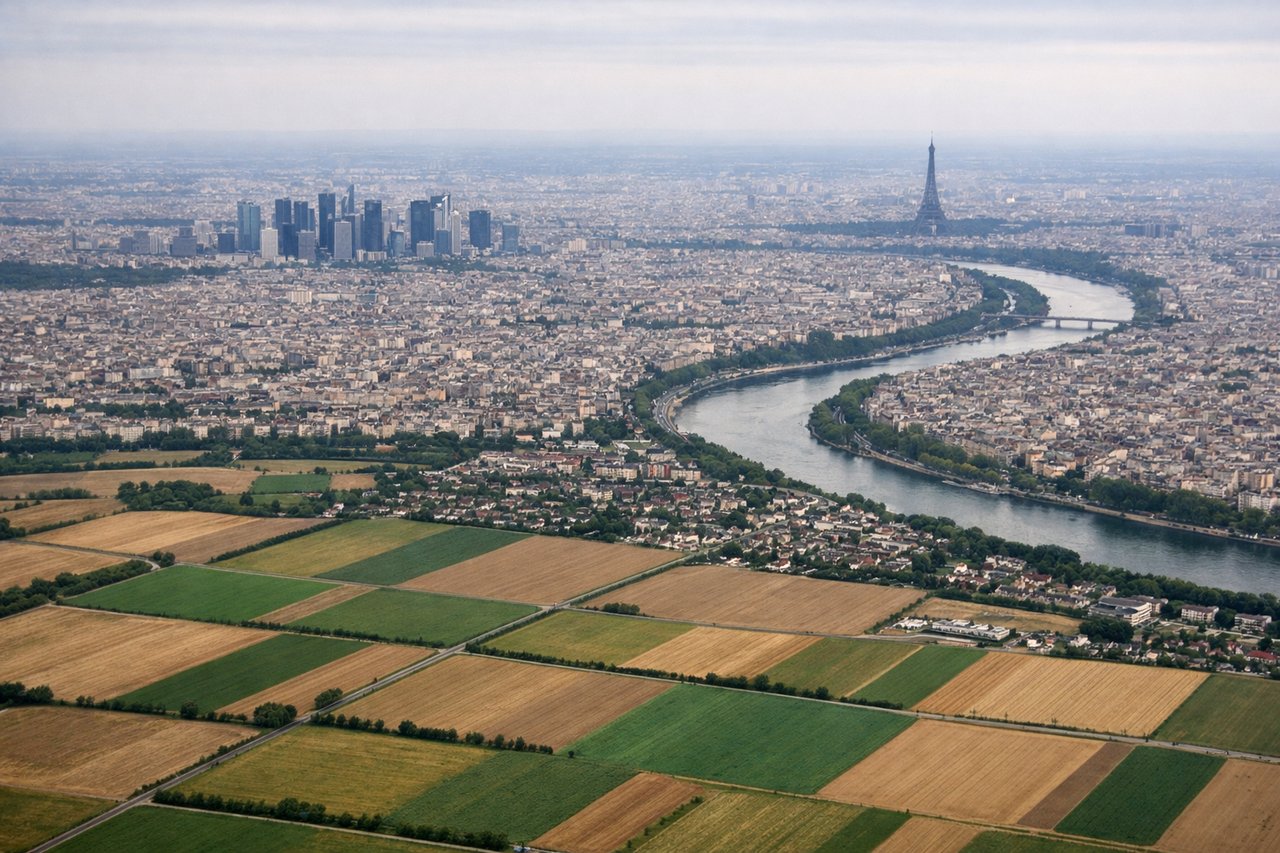
Landing at CDG
RIGHTOn approach into CDG from the east under typical westerly-wind operations, the right side offers brief glimpses of the flat Île-de-France farmland and the outer Paris suburbs, giving a slightly more open, populated view than the left, which mostly faces open fields.
Landmarks on this routeAll landmarks →
Will your flight be in sunlight?
Pick a date and time in the Sun Map to watch the sun move across your whole flight.
About This Route
Which side of the plane should I sit on flying from Peretola (FLR) to Charles De Gaulle (CDG)?
Sit on the Left side of the plane for the best views on flights from Firenze to Paris. The left side wins overall thanks to the Tuscan hill country on departure and, more importantly, the cruise-phase view of the western Alps near Mont Blanc, which the great-circle path skirts just to the south of the flight track — a dramatic mountain payoff that the flatter right side and Paris-plain approach can't match.
What can I see during takeoff from Peretola in Firenze?
During takeoff from Peretola (FLR), sit on the Left side for the best views. Departing FLR toward the northwest, the left side looks south over the Tuscan hills, the Chianti countryside, and the Arno valley receding behind Florence. It's classic rolling Tuscan terrain that gives immediate visual interest right after rotation. Notable sights include: Arno River valley, Chianti hills, Florence cityscape, distant Apennine foothills.
What can I see when landing at Charles De Gaulle in Paris?
When landing at Charles De Gaulle (CDG), sit on the Right side for the best views. On approach into CDG from the east under typical westerly-wind operations, the right side offers brief glimpses of the flat Île-de-France farmland and the outer Paris suburbs, giving a slightly more open, populated view than the left, which mostly faces open fields. Notable sights include: Île-de-France farmland patchwork, Marne river tributaries, outer Paris suburban sprawl, CDG terminal complex.
How long is the flight from Firenze to Paris?
The flight from Peretola (FLR) to Charles De Gaulle (CDG) takes about 1 hour 50 minutes. The shortest flight path between them is 546 miles (879 km); winds and air traffic control usually add a few percent.
What does the Firenze to Paris flight path pass over?
The route's midpoint passes near the western Alps close to the Mont Blanc massif and the Franco-Italian border ranges before descending into the Rhône corridor and the plains of central France toward Paris.