While the takeoff offers good prairie views on the right, the landing approach to DCA provides unmatched views of the Potomac River, National Mall, and Washington's iconic monuments on the left side—making it the superior choice for the overall flight experience.
Flown FOE to DCA? Did we get it right?
Flight Path
Topeka to Washington is 1,000 miles (1,609 km), a flight of about 2 hours 15 minutes.
The flight path crosses central Ohio, passing over or near Columbus and the Scioto River valley, then transitions into the Appalachian foothills of southeastern Ohio and West Virginia. The Appalachian ridge-and-valley topography becomes increasingly visible in the descent phase, with the Blue Ridge Mountains appearing on the horizon as the aircraft approaches Virginia airspace. The Shenandoah Valley may be visible to the left (south) during the final descent into Washington.
Great circle distance and headings ›

Phase by phase
Takeoff from FOE
RIGHTForbes Field typically departs to the east or northeast. Right-side seats capture the Kansas River valley and the gradual transition from Topeka's urban grid to the rolling Flint Hills terrain that dominates the climb-out corridor.
Landing at DCA
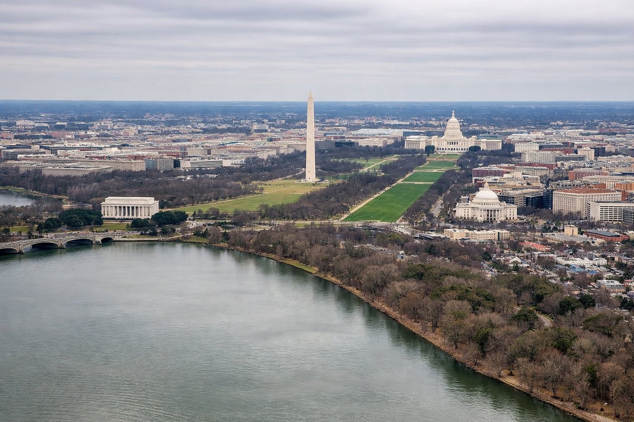
LEFTDCA typically lands from the west on Runway 01 or approaches from the northwest. Left-side seats offer superior views of the Potomac River, the National Mall monuments, and Arlington, Virginia across the river—the defining geographic and cultural features of the Washington descent corridor.
Will your flight be in sunlight?
Pick a date and time in the Sun Map to watch the sun move across your whole flight.
About This Route
Which side of the plane should I sit on flying from Forbes Fld (FOE) to Ronald Reagan Washington National (DCA)?
Sit on the Left side of the plane for the best views on flights from Topeka to Washington. While the takeoff offers good prairie views on the right, the landing approach to DCA provides unmatched views of the Potomac River, National Mall, and Washington's iconic monuments on the left side—making it the superior choice for the overall flight experience.
What can I see during takeoff from Forbes Fld in Topeka?
During takeoff from Forbes Fld (FOE), sit on the Right side for the best views. Forbes Field typically departs to the east or northeast. Right-side seats capture the Kansas River valley and the gradual transition from Topeka's urban grid to the rolling Flint Hills terrain that dominates the climb-out corridor. Notable sights include: Kansas River (visible as a meandering line below), Topeka city grid (receding westward), Flint Hills rolling prairie (expanding eastward), Lake Shawnee (if visible during northeast departure routing).
What can I see when landing at Ronald Reagan Washington National in Washington?
When landing at Ronald Reagan Washington National (DCA), sit on the Left side for the best views. DCA typically lands from the west on Runway 01 or approaches from the northwest. Left-side seats offer superior views of the Potomac River, the National Mall monuments, and Arlington, Virginia across the river—the defining geographic and cultural features of the Washington descent corridor. Notable sights include: Potomac River (prominent in foreground and middle distance), National Mall and Washington Monument (visible as white structures on the left bank), Arlington National Cemetery and Pentagon (across river on right), Tidal Basin (visible as a distinct rectangular water feature).
How long is the flight from Topeka to Washington?
The flight from Forbes Fld (FOE) to Ronald Reagan Washington National (DCA) takes about 2 hours 15 minutes. The shortest flight path between them is 1,000 miles (1,609 km); winds and air traffic control usually add a few percent.
What does the Topeka to Washington flight path pass over?
The flight path crosses central Ohio, passing over or near Columbus and the Scioto River valley, then transitions into the Appalachian foothills of southeastern Ohio and West Virginia. The Appalachian ridge-and-valley topography becomes increasingly visible in the descent phase, with the Blue Ridge Mountains appearing on the horizon as the aircraft approaches Virginia airspace. The Shenandoah Valley may be visible to the left (south) during the final descent into Washington.