Right side scores higher due to the superior Fortaleza departure experience. The takeoff over the Atlantic coastline, harbor, and city beachfront provides dramatic urban and coastal scenery that outweighs the landing advantage of the left side. The 9-hour flight is dominated by open ocean (both sides score low for cruise), making the departure and arrival sequences the primary scenic value. Right side's coastal takeoff is more visually distinctive than left side's suburban Paris approach.
Flown FOR to CDG? Did we get it right?
Flight Path
Fortaleza to Paris is 4,399 miles (7,079 km), a flight of about 9 hours 15 minutes.
North Atlantic Ocean (5+ hours of open water with no visible landmarks), Azores archipelago (occasionally visible at cruise altitude if flight path passes nearby, but typically 200+ miles south of standard routing), Irish coast and Celtic Sea (approaching European airspace), English Channel and southern England (final descent phase)
Great circle distance and headings ›Phase by phase
Takeoff from FOR
RIGHTRight side captures the Fortaleza coastline and Atlantic departure. Runway 13 operations favor eastbound takeoffs, placing right-side passengers directly over the beach, harbor, and coastal city during initial climb. Left side departs inland over flat scrubland.
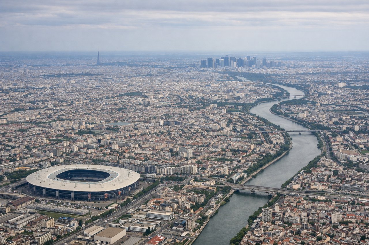
Landing at CDG
LEFTLeft side offers superior approach scenery into CDG. With prevailing westerly winds, aircraft typically descend from the northeast and approach runways 26/27 from the east. Left-side passengers see the Seine River valley, Île-de-France forests, and suburban Paris sprawl during final descent. Right side faces away from the approach corridor.
Will your flight be in sunlight?
Pick a date and time in the Sun Map to watch the sun move across your whole flight.
About This Route
Which side of the plane should I sit on flying from Pinto Martins International (FOR) to Charles De Gaulle (CDG)?
Sit on the Right side of the plane for the best views on flights from Fortaleza to Paris. Right side scores higher due to the superior Fortaleza departure experience. The takeoff over the Atlantic coastline, harbor, and city beachfront provides dramatic urban and coastal scenery that outweighs the landing advantage of the left side. The 9-hour flight is dominated by open ocean (both sides score low for cruise), making the departure and arrival sequences the primary scenic value. Right side's coastal takeoff is more visually distinctive than left side's suburban Paris approach.
What can I see during takeoff from Pinto Martins International in Fortaleza?
During takeoff from Pinto Martins International (FOR), sit on the Right side for the best views. Right side captures the Fortaleza coastline and Atlantic departure. Runway 13 operations favor eastbound takeoffs, placing right-side passengers directly over the beach, harbor, and coastal city during initial climb. Left side departs inland over flat scrubland. Notable sights include: Fortaleza harbor and beachfront, Atlantic coastline, Mucuripe Beach, inland scrubland transitioning to open ocean.
What can I see when landing at Charles De Gaulle in Paris?
When landing at Charles De Gaulle (CDG), sit on the Left side for the best views. Left side offers superior approach scenery into CDG. With prevailing westerly winds, aircraft typically descend from the northeast and approach runways 26/27 from the east. Left-side passengers see the Seine River valley, Île-de-France forests, and suburban Paris sprawl during final descent. Right side faces away from the approach corridor. Notable sights include: Seine River and its meanders, Île-de-France forests and agricultural patchwork, suburban Paris development, CDG airport complex and runways.
How long is the flight from Fortaleza to Paris?
The flight from Pinto Martins International (FOR) to Charles De Gaulle (CDG) takes about 9 hours 15 minutes. The shortest flight path between them is 4,399 miles (7,079 km); winds and air traffic control usually add a few percent.
What does the Fortaleza to Paris flight path pass over?
North Atlantic Ocean (5+ hours of open water with no visible landmarks), Azores archipelago (occasionally visible at cruise altitude if flight path passes nearby, but typically 200+ miles south of standard routing), Irish coast and Celtic Sea (approaching European airspace), English Channel and southern England (final descent phase)