While the El Calafate departure offers dramatic Patagonian scenery, the flight is dominated by 5+ hours of monotonous interior plateau and Atlantic coastal approach with minimal landmarks. The Guarulhos landing into São Paulo's sprawling metropolitan area, with its river systems and urban density, provides significantly more visual interest and landmark variety during the critical final descent phase. Right side captures the more memorable portions of this long route.
Flown FTE to GRU? Did we get it right?
Flight Path
El Calafate to Sao Paulo is 2,309 miles (3,715 km), a flight of about 5 hours 15 minutes.
The flight path crosses the Argentine interior plateau (flat, featureless scrubland for 3+ hours), passes near or over the Paraná River system in northern Argentina/southern Brazil, and approaches São Paulo from the interior plateau before descending into the metropolitan basin. No major mountain ranges, significant lakes, or dramatic terrain features are visible during the long cruise phase over central Argentina and southern Brazil.
Great circle distance and headings ›


Phase by phase
Takeoff from FTE
LEFTEl Calafate sits on the edge of Patagonian steppe with Lake Argentino visible immediately west of the airport. Left-side departure offers views of the glacial lake system and the Andes foothills rising to the west, providing immediate terrain drama during climb-out.
Landing at GRU
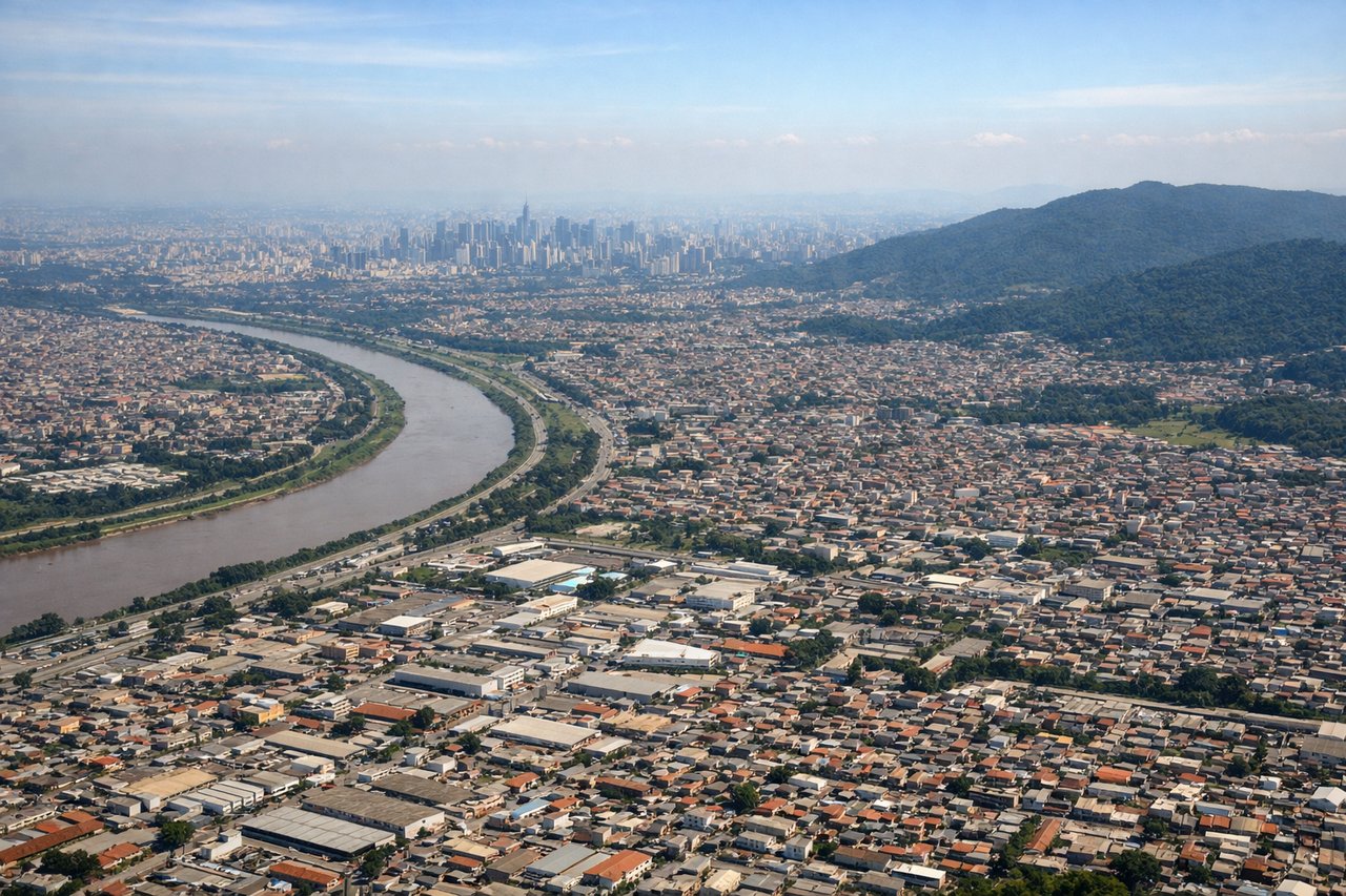
RIGHTThe approach to Guarulhos crosses the densely urbanized São Paulo metropolitan area, one of South America's largest cities. Right-side descent offers sweeping views of the city's sprawl, the Tietê River system, and surrounding industrial zones—far more visually complex than the left side's approach over rural interior plateau.
Will your flight be in sunlight?
Pick a date and time in the Sun Map to watch the sun move across your whole flight.
About This Route
Which side of the plane should I sit on flying from El Calafate - Commander Armando Tola International Airport (FTE) to Guarulhos (GRU)?
Sit on the Right side of the plane for the best views on flights from El Calafate to Sao Paulo. While the El Calafate departure offers dramatic Patagonian scenery, the flight is dominated by 5+ hours of monotonous interior plateau and Atlantic coastal approach with minimal landmarks. The Guarulhos landing into São Paulo's sprawling metropolitan area, with its river systems and urban density, provides significantly more visual interest and landmark variety during the critical final descent phase. Right side captures the more memorable portions of this long route.
What can I see during takeoff from El Calafate - Commander Armando Tola International Airport in El Calafate?
During takeoff from El Calafate - Commander Armando Tola International Airport (FTE), sit on the Left side for the best views. El Calafate sits on the edge of Patagonian steppe with Lake Argentino visible immediately west of the airport. Left-side departure offers views of the glacial lake system and the Andes foothills rising to the west, providing immediate terrain drama during climb-out. Notable sights include: Lake Argentino (turquoise glacial water), Perito Moreno Glacier region (distant peaks), Andes foothills, Patagonian steppe.
What can I see when landing at Guarulhos in Sao Paulo?
When landing at Guarulhos (GRU), sit on the Right side for the best views. The approach to Guarulhos crosses the densely urbanized São Paulo metropolitan area, one of South America's largest cities. Right-side descent offers sweeping views of the city's sprawl, the Tietê River system, and surrounding industrial zones—far more visually complex than the left side's approach over rural interior plateau. Notable sights include: São Paulo metropolitan sprawl, Tietê River and reservoirs, Guarulhos industrial zone, Serra da Cantareira mountains (northern backdrop).
How long is the flight from El Calafate to Sao Paulo?
The flight from El Calafate - Commander Armando Tola International Airport (FTE) to Guarulhos (GRU) takes about 5 hours 15 minutes. The shortest flight path between them is 2,309 miles (3,715 km); winds and air traffic control usually add a few percent.
What does the El Calafate to Sao Paulo flight path pass over?
The flight path crosses the Argentine interior plateau (flat, featureless scrubland for 3+ hours), passes near or over the Paraná River system in northern Argentina/southern Brazil, and approaches São Paulo from the interior plateau before descending into the metropolitan basin. No major mountain ranges, significant lakes, or dramatic terrain features are visible during the long cruise phase over central Argentina and southern Brazil.