Right-side seats capture the superior geography on departure (Brahmaputra meanders and Shillong Plateau), and while left wins on landing, the takeoff experience is more visually distinctive and sustained. The flight path itself runs roughly southwest, so right-side views of the Brahmaputra system dominate the longer initial climb phase.
Flown GAU to CCU? Did we get it right?
Flight Path
Guwahati to Calcutta is 310 miles (498 km), a flight of about 1 hour 15 minutes.
The flight path crosses the Meghalaya plateau region (Shillong area remains visible to the south at mid-flight), then transitions over the Bengal plains. The Damodar River valley becomes visible in the approach to Calcutta. No major mountain ranges cross the direct route—the terrain gradually descends from Assam's foothills toward the flat Ganges delta.
Great circle distance and headings ›Phase by phase
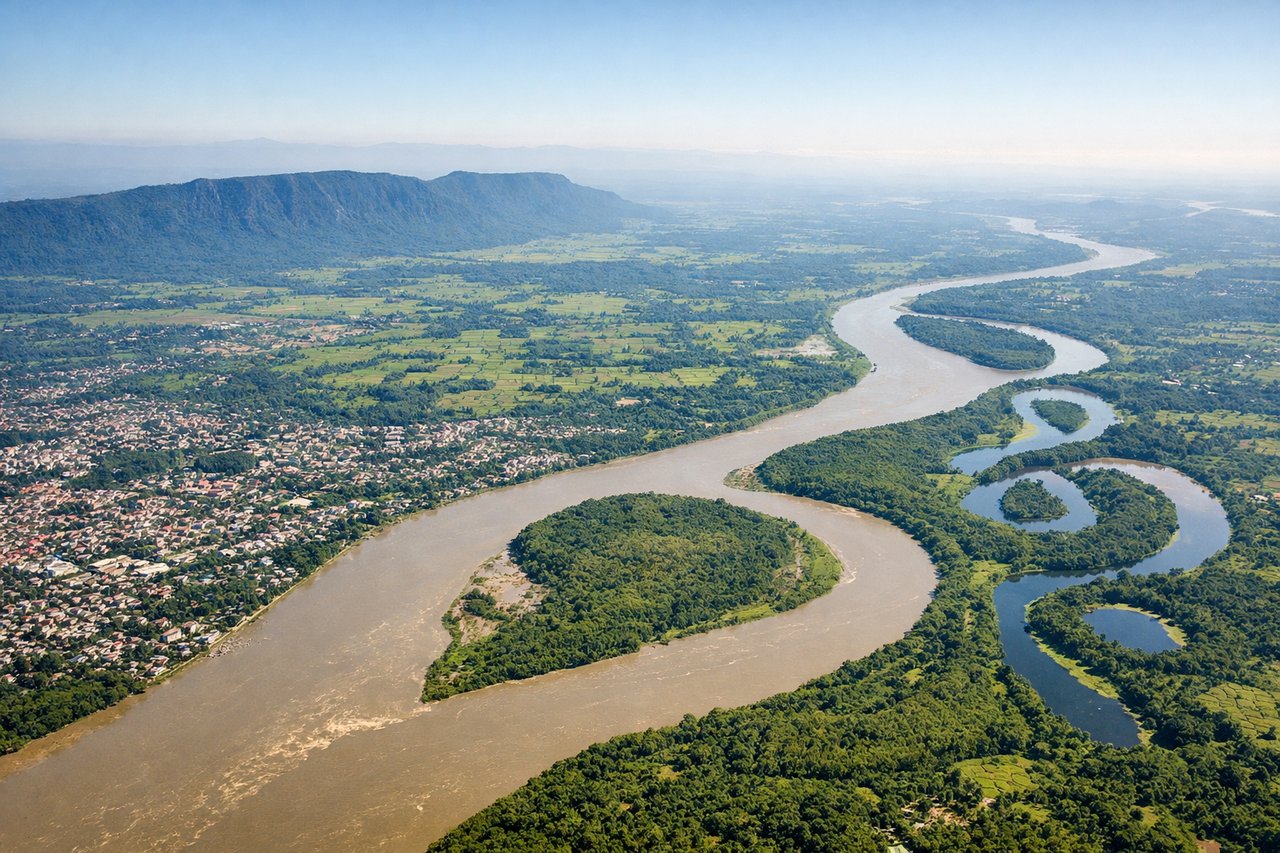
Takeoff from GAU
RIGHTGuwahati typically departs eastbound (Runway 02/20 operations favor easterly departures). Right-side seats capture the Brahmaputra River's wide meanders as you climb, plus the Shillong Plateau's forested ridges rising to the south. Left side faces the flat Assam plains with less visual interest.
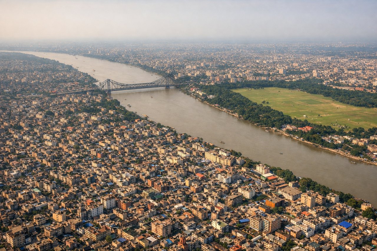
Landing at CCU
LEFTApproaching Calcutta typically uses westbound runways (Runway 09/27 operations favor westerly approaches). Left-side seats offer views of the Hooghly River's dramatic curves through the city, the Sundarbans wetlands to the south, and the Ganges delta's intricate waterways. Right side faces inland with less distinctive geography.
Will your flight be in sunlight?
Pick a date and time in the Sun Map to watch the sun move across your whole flight.
About This Route
Which side of the plane should I sit on flying from Lokpriya Gopinath Bordoloi International Airport (GAU) to Netaji Subhash Chandra Bose International (CCU)?
Sit on the Right side of the plane for the best views on flights from Guwahati to Calcutta. Right-side seats capture the superior geography on departure (Brahmaputra meanders and Shillong Plateau), and while left wins on landing, the takeoff experience is more visually distinctive and sustained. The flight path itself runs roughly southwest, so right-side views of the Brahmaputra system dominate the longer initial climb phase.
What can I see during takeoff from Lokpriya Gopinath Bordoloi International Airport in Guwahati?
During takeoff from Lokpriya Gopinath Bordoloi International Airport (GAU), sit on the Right side for the best views. Guwahati typically departs eastbound (Runway 02/20 operations favor easterly departures). Right-side seats capture the Brahmaputra River's wide meanders as you climb, plus the Shillong Plateau's forested ridges rising to the south. Left side faces the flat Assam plains with less visual interest. Notable sights include: Brahmaputra River (multiple oxbow bends visible below), Shillong Plateau escarpment (southern horizon), Guwahati city sprawl (immediate departure area), tea gardens and forest patches (mid-distance).
What can I see when landing at Netaji Subhash Chandra Bose International in Calcutta?
When landing at Netaji Subhash Chandra Bose International (CCU), sit on the Left side for the best views. Approaching Calcutta typically uses westbound runways (Runway 09/27 operations favor westerly approaches). Left-side seats offer views of the Hooghly River's dramatic curves through the city, the Sundarbans wetlands to the south, and the Ganges delta's intricate waterways. Right side faces inland with less distinctive geography. Notable sights include: Hooghly River (multiple sharp bends through Calcutta), Sundarbans mangrove forests (southern approach), Ganges delta waterways (eastern approach), Calcutta's urban grid and Howrah Bridge area (final descent).
How long is the flight from Guwahati to Calcutta?
The flight from Lokpriya Gopinath Bordoloi International Airport (GAU) to Netaji Subhash Chandra Bose International (CCU) takes about 1 hour 15 minutes. The shortest flight path between them is 310 miles (498 km); winds and air traffic control usually add a few percent.
What does the Guwahati to Calcutta flight path pass over?
The flight path crosses the Meghalaya plateau region (Shillong area remains visible to the south at mid-flight), then transitions over the Bengal plains. The Damodar River valley becomes visible in the approach to Calcutta. No major mountain ranges cross the direct route—the terrain gradually descends from Assam's foothills toward the flat Ganges delta.