The right side consistently offers more textured terrain — plateau hills near Gaya, glimpses of Bangladesh's river deltas and Myanmar's coastal hills during cruise, and finally the Chao Phraya delta and Bangkok skyline on approach — compared to the flatter, less varied views on the left.
Flown GAY to BKK? Did we get it right?
Flight Path
Gaya to Bangkok is 1,281 miles (2,062 km), a flight of about 3 hours 10 minutes.
The flight path crosses the Ganges-Brahmaputra delta region near Bangladesh, then the forested hills of western Myanmar (Chin Hills foothills) before descending over the Gulf of Martaban and into the Chao Phraya lowlands of central Thailand.
Great circle distance and headings ›

Phase by phase
Takeoff from GAY
RIGHTDeparting Gaya to the ESE, the right (south-facing) side looks over the rolling Chotanagpur Plateau with its patchwork of forested hills and reservoirs, while the left side only shows the flat, featureless Ganges plain stretching toward Patna.
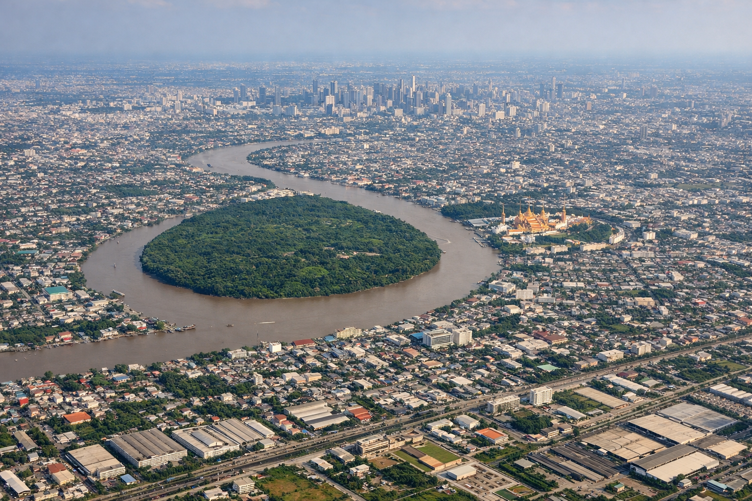
Landing at BKK
RIGHTOn approach into Suvarnabhumi from the north, the right side offers views over the Chao Phraya River delta and Bangkok's dense skyline and canals, while the left side mostly faces flat agricultural land with no distinctive features.
Will your flight be in sunlight?
Pick a date and time in the Sun Map to watch the sun move across your whole flight.
About This Route
Which side of the plane should I sit on flying from Gaya (GAY) to Suvarnabhumi Airport (BKK)?
Sit on the Right side of the plane for the best views on flights from Gaya to Bangkok. The right side consistently offers more textured terrain — plateau hills near Gaya, glimpses of Bangladesh's river deltas and Myanmar's coastal hills during cruise, and finally the Chao Phraya delta and Bangkok skyline on approach — compared to the flatter, less varied views on the left.
What can I see during takeoff from Gaya in Gaya?
During takeoff from Gaya (GAY), sit on the Right side for the best views. Departing Gaya to the ESE, the right (south-facing) side looks over the rolling Chotanagpur Plateau with its patchwork of forested hills and reservoirs, while the left side only shows the flat, featureless Ganges plain stretching toward Patna. Notable sights include: Chotanagpur Plateau uplands, scattered reservoirs, Son River valley.
What can I see when landing at Suvarnabhumi Airport in Bangkok?
When landing at Suvarnabhumi Airport (BKK), sit on the Right side for the best views. On approach into Suvarnabhumi from the north, the right side offers views over the Chao Phraya River delta and Bangkok's dense skyline and canals, while the left side mostly faces flat agricultural land with no distinctive features. Notable sights include: Chao Phraya River delta, Bangkok skyline, aquaculture ponds near the Gulf of Thailand.
How long is the flight from Gaya to Bangkok?
The flight from Gaya (GAY) to Suvarnabhumi Airport (BKK) takes about 3 hours 10 minutes. The shortest flight path between them is 1,281 miles (2,062 km); winds and air traffic control usually add a few percent.
What does the Gaya to Bangkok flight path pass over?
The flight path crosses the Ganges-Brahmaputra delta region near Bangladesh, then the forested hills of western Myanmar (Chin Hills foothills) before descending over the Gulf of Martaban and into the Chao Phraya lowlands of central Thailand.