The right side scores marginally higher due to better views during both takeoff (Bear Paw Mountains and high plains terrain) and landing (Atlanta skyline and Piedmont approach). However, this entire route crosses relatively flat to gently rolling terrain for most of the 1,100+ mile journey, making both sides comparatively modest. The flight passes over the Great Plains, Mississippi River valley, and Tennessee plateau—none offering dramatic scenery. Neither side reaches 2.5 because the route lacks mountains, coastlines, or significant urban centers along the cruise segment.
Flown GGW to ATL? Did we get it right?
Flight Path
Glasgow to Atlanta is 1,525 miles (2,454 km), a flight of about 3 hours 15 minutes.
Missouri River valley (northern Missouri), Mississippi River crossing (near Memphis area), Tennessee River valley, Appalachian foothills (distant eastern horizon during cruise)
Great circle distance and headings ›

Phase by phase
Takeoff from GGW
RIGHTGlasgow Valley County Airport sits in the high plains of northeastern Montana. The right (south/southeast) side offers slightly better views of the rolling terrain and distant mountain ridges of the Northern Great Plains during climb-out, while the left side faces open prairie with minimal relief.
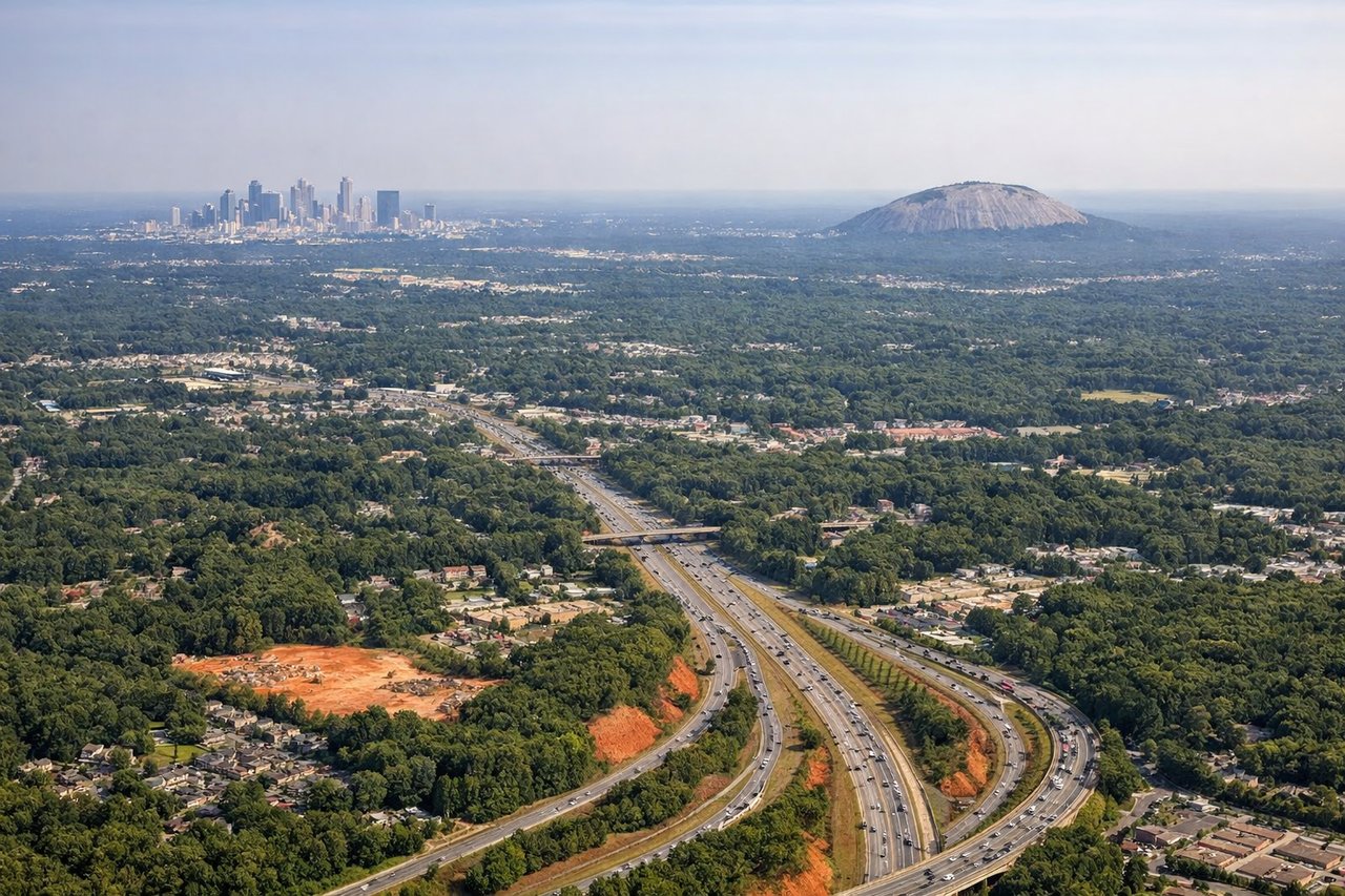
Landing at ATL
RIGHTThe approach to Atlanta from the northwest brings the right (south/southeast) side into view of the Piedmont terrain, suburban sprawl, and the city skyline. The left side faces open terrain with fewer distinctive features during descent.
Will your flight be in sunlight?
Pick a date and time in the Sun Map to watch the sun move across your whole flight.
About This Route
Which side of the plane should I sit on flying from Glasgow Valley County Airport Wokal Field (GGW) to The William B Hartsfield Atlanta International (ATL)?
Sit on the Right side of the plane for the best views on flights from Glasgow to Atlanta. The right side scores marginally higher due to better views during both takeoff (Bear Paw Mountains and high plains terrain) and landing (Atlanta skyline and Piedmont approach). However, this entire route crosses relatively flat to gently rolling terrain for most of the 1,100+ mile journey, making both sides comparatively modest. The flight passes over the Great Plains, Mississippi River valley, and Tennessee plateau—none offering dramatic scenery. Neither side reaches 2.5 because the route lacks mountains, coastlines, or significant urban centers along the cruise segment.
What can I see during takeoff from Glasgow Valley County Airport Wokal Field in Glasgow?
During takeoff from Glasgow Valley County Airport Wokal Field (GGW), sit on the Right side for the best views. Glasgow Valley County Airport sits in the high plains of northeastern Montana. The right (south/southeast) side offers slightly better views of the rolling terrain and distant mountain ridges of the Northern Great Plains during climb-out, while the left side faces open prairie with minimal relief. Notable sights include: Bear Paw Mountains (distant southeast), Fort Belknap Indian Reservation terrain, Missouri River valley (far distance).
What can I see when landing at The William B Hartsfield Atlanta International in Atlanta?
When landing at The William B Hartsfield Atlanta International (ATL), sit on the Right side for the best views. The approach to Atlanta from the northwest brings the right (south/southeast) side into view of the Piedmont terrain, suburban sprawl, and the city skyline. The left side faces open terrain with fewer distinctive features during descent. Notable sights include: Atlanta skyline and downtown core, Hartsfield-Jackson International Airport runways, Piedmont plateau terrain, suburban development corridors.
How long is the flight from Glasgow to Atlanta?
The flight from Glasgow Valley County Airport Wokal Field (GGW) to The William B Hartsfield Atlanta International (ATL) takes about 3 hours 15 minutes. The shortest flight path between them is 1,525 miles (2,454 km); winds and air traffic control usually add a few percent.
What does the Glasgow to Atlanta flight path pass over?
Missouri River valley (northern Missouri), Mississippi River crossing (near Memphis area), Tennessee River valley, Appalachian foothills (distant eastern horizon during cruise)