Rio De Janeiro to Belo Horizonte is 224 miles (361 km), a flight of about 1 hour 15 minutes.
While takeoff favors left seats for Guanabara Bay and Serra da Carioca views, the landing approach into CNF provides more sustained and dramatic scenery on the right side—the Serra do Espinhaço foothills, Belo Horizonte's urban pattern, and Pampulha Lagoon are all right-side features during the descent.
Flight Path
The flight path climbs northwest from Rio, crossing the Serra da Mantiqueira's lower foothills around 40 miles inland. The terrain transitions from coastal mountains to the interior plateau. The Paraíba do Sul river valley lies to the north of the direct track. As the aircraft approaches Belo Horizonte, the landscape flattens into the central Brazilian plateau with scattered towns and agricultural areas visible below. The Serra do Espinhaço becomes increasingly prominent on the northern horizon during descent.
Great circle distance and headings ›Phase by phase
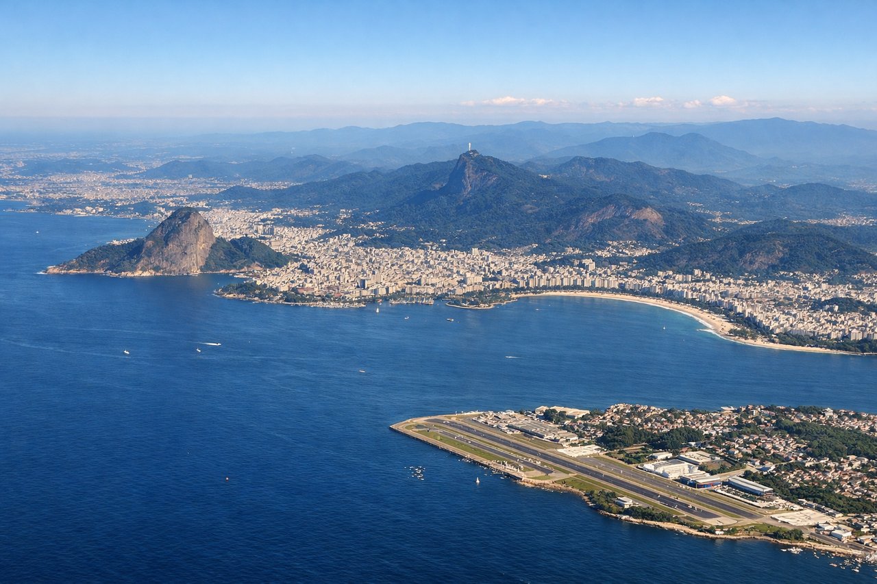
Takeoff from GIG
LEFTGIG typically departs runway 10L/28R or 10R/28L depending on wind. Northwestbound departures favor left seats for views of Guanabara Bay's eastern shoreline and the Serra da Carioca mountain range receding behind the airport.
Landing at CNF
RIGHTApproaching CNF from the southeast, right-side seats capture the descent through the Serra do Espinhaço foothills and the Belo Horizonte urban sprawl spreading across the plateau. The city's grid pattern and surrounding ridgelines are distinctive on approach.
Landmarks on this routeAll landmarks →
Will your flight be in sunlight?
Pick a date and time in the Sun Map to watch the sun move across your whole flight.
About This Route
Which side of the plane should I sit on flying from Galeao Antonio Carlos Jobim (GIG) to Tancredo Neves (CNF)?
Sit on the Right side of the plane for the best views on flights from Rio De Janeiro to Belo Horizonte. While takeoff favors left seats for Guanabara Bay and Serra da Carioca views, the landing approach into CNF provides more sustained and dramatic scenery on the right side—the Serra do Espinhaço foothills, Belo Horizonte's urban pattern, and Pampulha Lagoon are all right-side features during the descent.
What can I see during takeoff from Galeao Antonio Carlos Jobim in Rio De Janeiro?
During takeoff from Galeao Antonio Carlos Jobim (GIG), sit on the Left side for the best views. GIG typically departs runway 10L/28R or 10R/28L depending on wind. Northwestbound departures favor left seats for views of Guanabara Bay's eastern shoreline and the Serra da Carioca mountain range receding behind the airport. Notable sights include: Guanabara Bay (immediate south and east), Serra da Carioca peaks (west-northwest), Niterói across the bay (southeast), Christ the Redeemer statue area on distant ridgeline (west).
What can I see when landing at Tancredo Neves in Belo Horizonte?
When landing at Tancredo Neves (CNF), sit on the Right side for the best views. Approaching CNF from the southeast, right-side seats capture the descent through the Serra do Espinhaço foothills and the Belo Horizonte urban sprawl spreading across the plateau. The city's grid pattern and surrounding ridgelines are distinctive on approach. Notable sights include: Serra do Espinhaço ridgeline (north and west), Belo Horizonte city grid (center and south), Pampulha Lagoon (northwest of city center), surrounding plateau terrain (all directions).
How long is the flight from Rio De Janeiro to Belo Horizonte?
The flight from Galeao Antonio Carlos Jobim (GIG) to Tancredo Neves (CNF) takes about 1 hour 15 minutes. The shortest flight path between them is 224 miles (361 km); winds and air traffic control usually add a few percent.
What does the Rio De Janeiro to Belo Horizonte flight path pass over?
The flight path climbs northwest from Rio, crossing the Serra da Mantiqueira's lower foothills around 40 miles inland. The terrain transitions from coastal mountains to the interior plateau. The Paraíba do Sul river valley lies to the north of the direct track. As the aircraft approaches Belo Horizonte, the landscape flattens into the central Brazilian plateau with scattered towns and agricultural areas visible below. The Serra do Espinhaço becomes increasingly prominent on the northern horizon during descent.