While takeoff favors the right, the landing approach over Osaka Bay and the airport's artificial island is more visually distinctive and memorable. The bay's geography and KIX's unique island setting outweigh the Han River estuary views.
Flight Path
The flight path crosses the Korea Strait (Tsushima Strait) at roughly 35°N 130°E, with Tsushima Island visible to the left (west) during mid-flight. The Seto Inland Sea becomes visible to the right (east) as the aircraft descends toward Kansai. No major mountain ranges are visible at cruise altitude, but the Chugoku Mountains form a distant haze on the eastern horizon during approach.
Great circle distance and headings ›Phase by phase
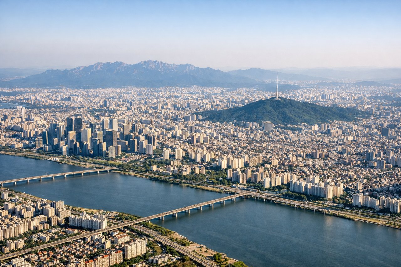
Takeoff from GMP
RIGHTRight-side seats capture the Han River estuary and Incheon's industrial waterfront during the initial climb. GMP typically departs runway 14R/32L; northbound departures offer the best river views before turning southeast toward Japan.
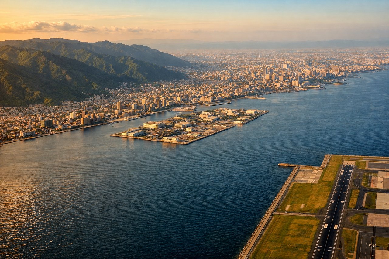
Landing at KIX
LEFTLeft-side seats provide views of Osaka Bay's distinctive shape and Kobe's waterfront during descent. KIX typically uses runway 06L/24R; southbound approaches descend over the bay, offering clear views of the artificial island and surrounding water.
Will your flight be in sunlight?
See exactly which side of the plane gets sun and shade at your departure time.
About This Route
Which side of the plane should I sit on flying from Gimpo (GMP) to Kansai International (KIX)?
Sit on the Left side of the plane for the best views on flights from Seoul to Osaka. While takeoff favors the right, the landing approach over Osaka Bay and the airport's artificial island is more visually distinctive and memorable. The bay's geography and KIX's unique island setting outweigh the Han River estuary views.
What can I see during takeoff from Gimpo in Seoul?
During takeoff from Gimpo (GMP), sit on the Right side for the best views. Right-side seats capture the Han River estuary and Incheon's industrial waterfront during the initial climb. GMP typically departs runway 14R/32L; northbound departures offer the best river views before turning southeast toward Japan. Notable sights include: Han River estuary (Hangang-gun), Incheon port and container terminals, Seoul city grid to the east, Yellow Sea horizon.
What can I see when landing at Kansai International in Osaka?
When landing at Kansai International (KIX), sit on the Left side for the best views. Left-side seats provide views of Osaka Bay's distinctive shape and Kobe's waterfront during descent. KIX typically uses runway 06L/24R; southbound approaches descend over the bay, offering clear views of the artificial island and surrounding water. Notable sights include: Osaka Bay (Osaka-wan), Kobe city waterfront and port, Awaji Island, Kansai International Airport's artificial island.
How long is the flight from Seoul to Osaka?
The flight from Gimpo (GMP) to Kansai International (KIX) takes Approximately 2 hours 15 minutes.
What does the Seoul to Osaka flight path pass over?
The flight path crosses the Korea Strait (Tsushima Strait) at roughly 35°N 130°E, with Tsushima Island visible to the left (west) during mid-flight. The Seto Inland Sea becomes visible to the right (east) as the aircraft descends toward Kansai. No major mountain ranges are visible at cruise altitude, but the Chugoku Mountains form a distant haze on the eastern horizon during approach.