Seoul to Seattle is 5,186 miles (8,346 km), a flight of about 9 hours 30 minutes.
While the right side wins at takeoff for Seoul city views, the left side dominates the majority of the transpacific flight. Over the North Pacific routing, the left side faces generally south toward the Aleutian Island chain as the great circle arc passes near it, and critically delivers the Mount Rainier and Seattle approach views on arrival, which are among the most dramatic urban-mountain panoramas in North American aviation.
Flight Path
The great circle route from Seoul to Seattle arcs northeast over the Sea of Japan, crosses the southern Kamchatka Peninsula and its volcanic peaks, then tracks across the North Pacific near the Aleutian Islands chain. The route passes south of Kodiak Island and crosses the Gulf of Alaska before making landfall over the British Columbia coast and the Coast Mountains, descending over the Cascade Range into Seattle.
Great circle distance and headings ›

Phase by phase
Takeoff from GMP
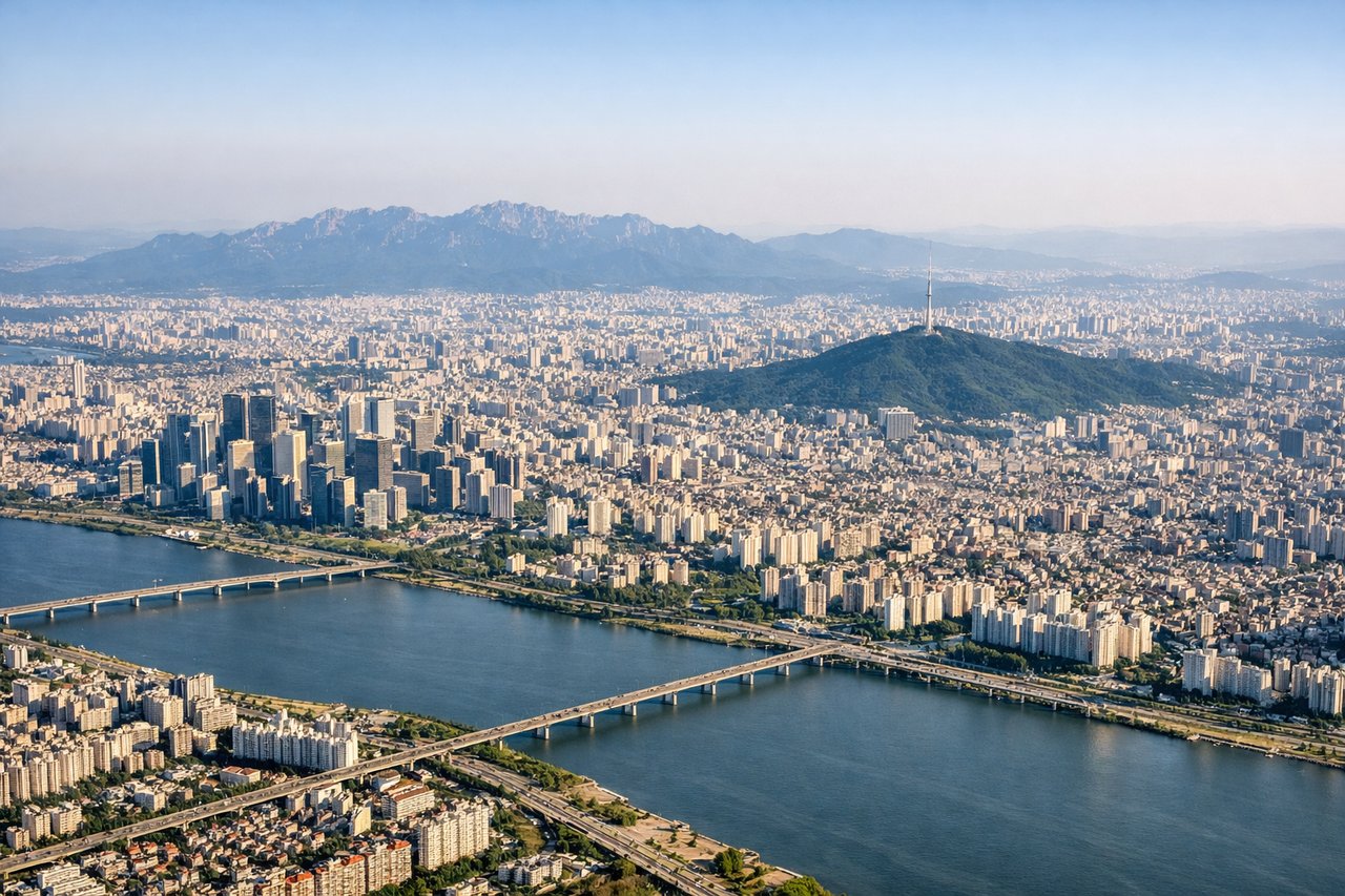
RIGHTGimpo's primary departure runway 32L sends aircraft northwest over the Han River estuary and the western coast of the Korean Peninsula. The right side faces south and east, giving clear views back over Seoul's dense urban grid, the Han River winding through the city, and Bukhansan's granite peaks rising above the northern suburbs.
Landing at SEA
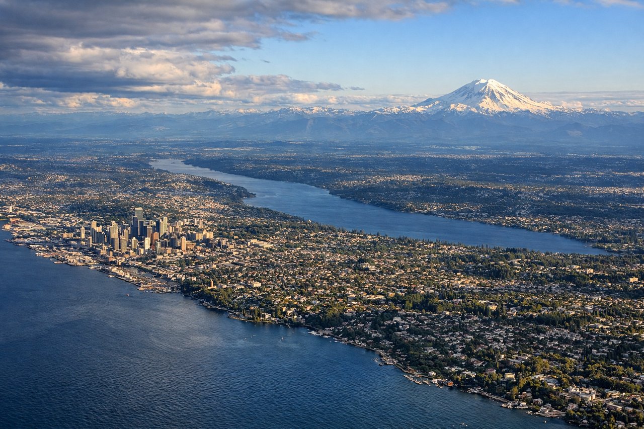
LEFTSeaTac primarily uses runways 16L/16R for southbound arrivals, meaning aircraft approach from the north tracking south. The left side faces east and gives direct views of the Cascade Range including Mount Rainier, the Seattle city skyline, Lake Washington, and Puget Sound as the aircraft descends over the region.
Landmarks on this routeAll landmarks →
Will your flight be in sunlight?
Pick a date and time in the Sun Map to watch the sun move across your whole flight.
About This Route
Which side of the plane should I sit on flying from Gimpo (GMP) to Seattle Tacoma International (SEA)?
Sit on the Left side of the plane for the best views on flights from Seoul to Seattle. While the right side wins at takeoff for Seoul city views, the left side dominates the majority of the transpacific flight. Over the North Pacific routing, the left side faces generally south toward the Aleutian Island chain as the great circle arc passes near it, and critically delivers the Mount Rainier and Seattle approach views on arrival, which are among the most dramatic urban-mountain panoramas in North American aviation.
What can I see during takeoff from Gimpo in Seoul?
During takeoff from Gimpo (GMP), sit on the Right side for the best views. Gimpo's primary departure runway 32L sends aircraft northwest over the Han River estuary and the western coast of the Korean Peninsula. The right side faces south and east, giving clear views back over Seoul's dense urban grid, the Han River winding through the city, and Bukhansan's granite peaks rising above the northern suburbs. Notable sights include: Han River and its bridges through central Seoul, Bukhansan granite ridgeline to the northeast, Namsan hill and N Seoul Tower in the city center, Incheon coastal mudflats and islands to the west.
What can I see when landing at Seattle Tacoma International in Seattle?
When landing at Seattle Tacoma International (SEA), sit on the Left side for the best views. SeaTac primarily uses runways 16L/16R for southbound arrivals, meaning aircraft approach from the north tracking south. The left side faces east and gives direct views of the Cascade Range including Mount Rainier, the Seattle city skyline, Lake Washington, and Puget Sound as the aircraft descends over the region. Notable sights include: Mount Rainier volcanic cone to the southeast, Seattle downtown skyline and Elliott Bay, Lake Washington stretching north-south east of the city, Puget Sound and the Olympic Peninsula beyond.
How long is the flight from Seoul to Seattle?
The flight from Gimpo (GMP) to Seattle Tacoma International (SEA) takes about 9 hours 30 minutes. The shortest flight path between them is 5,186 miles (8,346 km); winds and air traffic control usually add a few percent.
What does the Seoul to Seattle flight path pass over?
The great circle route from Seoul to Seattle arcs northeast over the Sea of Japan, crosses the southern Kamchatka Peninsula and its volcanic peaks, then tracks across the North Pacific near the Aleutian Islands chain. The route passes south of Kodiak Island and crosses the Gulf of Alaska before making landfall over the British Columbia coast and the Coast Mountains, descending over the Cascade Range into Seattle.