The right side scores 3.5 versus left's 2.5 because the descent into Phoenix provides substantially more dramatic terrain variety—the Sonoran Desert, South Mountain range, and Salt River valley create visual interest that the left side's flat desert approach cannot match. While the Grand Rapids departure offers some Great Lakes and glacial terrain interest, the Phoenix landing's desert-mountain contrast and urban sprawl against natural features provide superior scenic value for the full flight.
Flown GRR to PHX? Did we get it right?
Flight Path
Grand Rapids to Phoenix is 1,571 miles (2,528 km), a flight of about 3 hours 15 minutes.
Iowa farmland and rolling terrain during cruise; transition from Great Lakes glacial landscape to Great Plains; crossing the Mississippi River valley; Missouri River drainage systems; entry into the High Plains with increasing elevation; Colorado Front Range visible on the horizon as the flight approaches the Rocky Mountain region; transition into the Colorado Plateau with mesas and canyon country becoming visible; final approach over the Sonoran Desert and Salt River valley
Great circle distance and headings ›


Phase by phase
Takeoff from GRR
LEFTGrand Rapids sits in Michigan's Lower Peninsula with the Grand River valley and surrounding Great Lakes shoreline visible during climb-out. Left side captures the immediate landscape departing northeastward over water and glacial terrain.
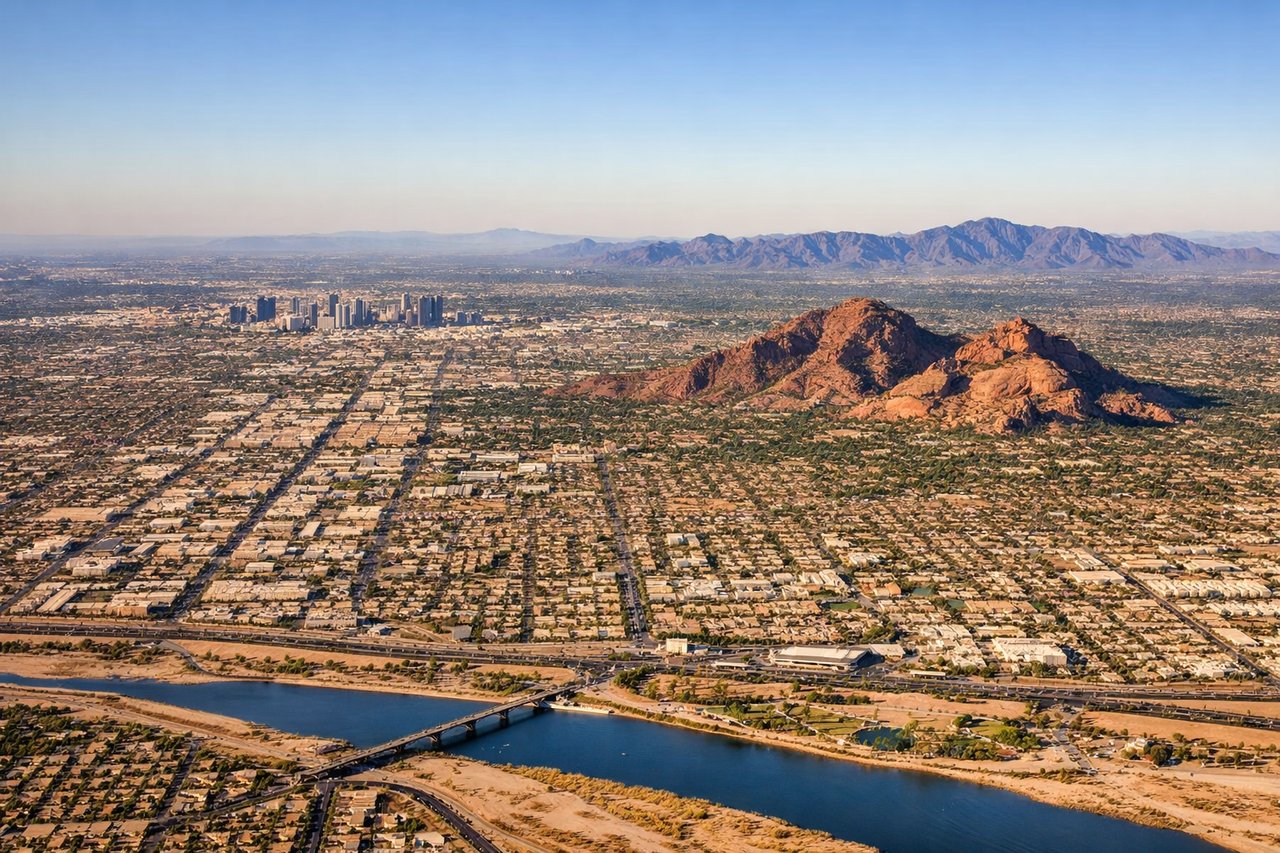
Landing at PHX
RIGHTThe right side during descent into Phoenix captures the dramatic Sonoran Desert landscape, the Salt River valley, and the urban sprawl of Phoenix against the backdrop of the South Mountain range. This provides far more visual interest than the left side's flat desert approach.
Will your flight be in sunlight?
Pick a date and time in the Sun Map to watch the sun move across your whole flight.
About This Route
Which side of the plane should I sit on flying from Gerald R Ford International (GRR) to Phoenix Sky Harbor International (PHX)?
Sit on the Right side of the plane for the best views on flights from Grand Rapids to Phoenix. The right side scores 3.5 versus left's 2.5 because the descent into Phoenix provides substantially more dramatic terrain variety—the Sonoran Desert, South Mountain range, and Salt River valley create visual interest that the left side's flat desert approach cannot match. While the Grand Rapids departure offers some Great Lakes and glacial terrain interest, the Phoenix landing's desert-mountain contrast and urban sprawl against natural features provide superior scenic value for the full flight.
What can I see during takeoff from Gerald R Ford International in Grand Rapids?
During takeoff from Gerald R Ford International (GRR), sit on the Left side for the best views. Grand Rapids sits in Michigan's Lower Peninsula with the Grand River valley and surrounding Great Lakes shoreline visible during climb-out. Left side captures the immediate landscape departing northeastward over water and glacial terrain. Notable sights include: Grand River valley, Lake Michigan eastern shoreline, glacial moraine topography, Grand Rapids urban grid.
What can I see when landing at Phoenix Sky Harbor International in Phoenix?
When landing at Phoenix Sky Harbor International (PHX), sit on the Right side for the best views. The right side during descent into Phoenix captures the dramatic Sonoran Desert landscape, the Salt River valley, and the urban sprawl of Phoenix against the backdrop of the South Mountain range. This provides far more visual interest than the left side's flat desert approach. Notable sights include: South Mountain range, Salt River valley, Phoenix metropolitan sprawl, Sonoran Desert saguaro forest.
How long is the flight from Grand Rapids to Phoenix?
The flight from Gerald R Ford International (GRR) to Phoenix Sky Harbor International (PHX) takes about 3 hours 15 minutes. The shortest flight path between them is 1,571 miles (2,528 km); winds and air traffic control usually add a few percent.
What does the Grand Rapids to Phoenix flight path pass over?
Iowa farmland and rolling terrain during cruise; transition from Great Lakes glacial landscape to Great Plains; crossing the Mississippi River valley; Missouri River drainage systems; entry into the High Plains with increasing elevation; Colorado Front Range visible on the horizon as the flight approaches the Rocky Mountain region; transition into the Colorado Plateau with mesas and canyon country becoming visible; final approach over the Sonoran Desert and Salt River valley