Granada to Miami is 4,457 miles (7,173 km), a flight of about 9 hours 15 minutes.
Right side scores 3.5 versus left's 2.5 due to superior scenery on both legs. Takeoff features the dramatic Sierra Nevada mountains immediately visible, while landing showcases the Everglades wetlands and Miami's coastal development. Left side is dominated by extended ocean crossing with minimal visual interest, and the Mediterranean coast during departure is distant and less compelling than the mountain drama on the right.
Flight Path
North Atlantic Ocean crossing (5+ hours over open water with no visible landmarks), Azores archipelago potentially visible if flight path passes nearby (depending on routing), Caribbean waters approaching Florida, Gulf Stream current visible as color variation in ocean (subtle, altitude-dependent)
Great circle distance and headings ›


Phase by phase
Takeoff from GRX
RIGHTRight side captures the Sierra Nevada mountain range immediately after departure from Granada's runway 27 (westbound). The dramatic peaks and foothills provide immediate visual interest during climb-out, whereas the left side faces toward the Mediterranean coast at a distance.
Landing at MIA
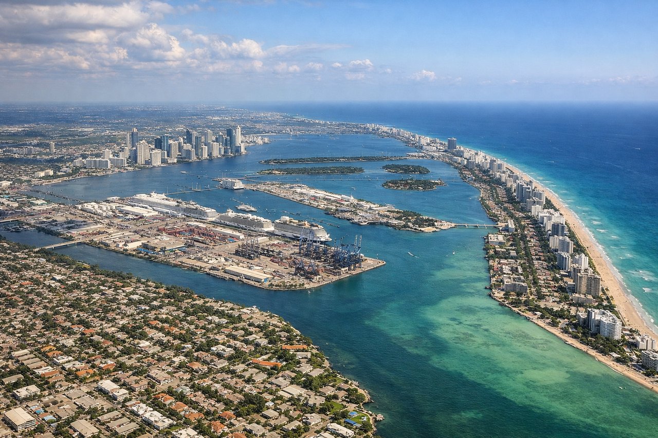
RIGHTRight side (north) provides superior approach scenery into Miami. Depending on typical easterly wind conditions favoring runway 09, the aircraft descends from the northwest, offering views of the Everglades wetlands, Lake Okeechobee, and the Florida peninsula's transition from inland swamps to coastal development. Left side faces the Atlantic Ocean with minimal distinguishing features.
Landmarks on this routeAll landmarks →
Will your flight be in sunlight?
Pick a date and time in the Sun Map to watch the sun move across your whole flight.
About This Route
Which side of the plane should I sit on flying from Granada (GRX) to Miami International (MIA)?
Sit on the Right side of the plane for the best views on flights from Granada to Miami. Right side scores 3.5 versus left's 2.5 due to superior scenery on both legs. Takeoff features the dramatic Sierra Nevada mountains immediately visible, while landing showcases the Everglades wetlands and Miami's coastal development. Left side is dominated by extended ocean crossing with minimal visual interest, and the Mediterranean coast during departure is distant and less compelling than the mountain drama on the right.
What can I see during takeoff from Granada in Granada?
During takeoff from Granada (GRX), sit on the Right side for the best views. Right side captures the Sierra Nevada mountain range immediately after departure from Granada's runway 27 (westbound). The dramatic peaks and foothills provide immediate visual interest during climb-out, whereas the left side faces toward the Mediterranean coast at a distance. Notable sights include: Sierra Nevada peaks (3,000+ m elevation), Granada city sprawl below, Mediterranean Sea on distant horizon, Málaga coastal plain to the south.
What can I see when landing at Miami International in Miami?
When landing at Miami International (MIA), sit on the Right side for the best views. Right side (north) provides superior approach scenery into Miami. Depending on typical easterly wind conditions favoring runway 09, the aircraft descends from the northwest, offering views of the Everglades wetlands, Lake Okeechobee, and the Florida peninsula's transition from inland swamps to coastal development. Left side faces the Atlantic Ocean with minimal distinguishing features. Notable sights include: Lake Okeechobee (large freshwater lake), Everglades wetlands and sawgrass marshes, Miami metropolitan sprawl and Biscayne Bay, Florida Keys visible on distant southern horizon.
How long is the flight from Granada to Miami?
The flight from Granada (GRX) to Miami International (MIA) takes about 9 hours 15 minutes. The shortest flight path between them is 4,457 miles (7,173 km); winds and air traffic control usually add a few percent.
What does the Granada to Miami flight path pass over?
North Atlantic Ocean crossing (5+ hours over open water with no visible landmarks), Azores archipelago potentially visible if flight path passes nearby (depending on routing), Caribbean waters approaching Florida, Gulf Stream current visible as color variation in ocean (subtle, altitude-dependent)