While the takeoff offers mountain views on the right, the landing approach on the left provides more dramatic and iconic scenery—the Potomac River and Washington's monuments are more visually distinctive than the Blue Ridge departure. The left side captures the flight's geographic climax.
Flown GSP to DCA? Did we get it right?
Flight Path
Greenville/Greer/Spartanburg to Washington is 396 miles (637 km), a flight of about 1 hour 35 minutes.
The flight path crosses the Appalachian Piedmont, then transitions into the Mid-Atlantic Piedmont. Notable midpoint features include the Shenandoah Valley (visible to the left/north around 1 hour into flight if clear), the ridge-and-valley topography of the Blue Ridge system (gradually receding behind), and the Rappahannock River valley (visible on approach to the Washington area). The terrain progressively flattens from west to east. On clear days, the Shenandoah National Park ridgeline may be visible as a distant feature to the north around cruise altitude.
Great circle distance and headings ›Phase by phase
Takeoff from GSP
RIGHTRight-side seats capture the Blue Ridge Mountains immediately after departure. GSP sits on the western edge of the Piedmont, and climbing eastbound, the right wing shows the ridge line clearly within the first 15-20 minutes of flight.
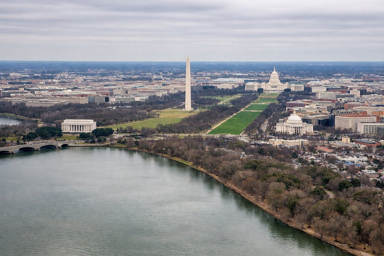
Landing at DCA
LEFTLeft-side seats offer views of the Potomac River and Washington's urban grid during descent into DCA. The river is the defining geographic feature on approach, and left seats face it directly as the aircraft descends along the standard westbound approach corridor.
Will your flight be in sunlight?
Pick a date and time in the Sun Map to watch the sun move across your whole flight.
About This Route
Which side of the plane should I sit on flying from Greenville-Spartanburg International Airport (GSP) to Ronald Reagan Washington National (DCA)?
Sit on the Left side of the plane for the best views on flights from Greenville/Greer/Spartanburg to Washington. While the takeoff offers mountain views on the right, the landing approach on the left provides more dramatic and iconic scenery—the Potomac River and Washington's monuments are more visually distinctive than the Blue Ridge departure. The left side captures the flight's geographic climax.
What can I see during takeoff from Greenville-Spartanburg International Airport in Greenville/Greer/Spartanburg?
During takeoff from Greenville-Spartanburg International Airport (GSP), sit on the Right side for the best views. Right-side seats capture the Blue Ridge Mountains immediately after departure. GSP sits on the western edge of the Piedmont, and climbing eastbound, the right wing shows the ridge line clearly within the first 15-20 minutes of flight. Notable sights include: Blue Ridge Mountains (southwest-to-northeast ridge visible at 10-15 miles), Greenville urban sprawl (directly below during initial climb), Saluda River valley (threading through foothills to the west), Spartanburg industrial corridor (visible to the northwest)..
What can I see when landing at Ronald Reagan Washington National in Washington?
When landing at Ronald Reagan Washington National (DCA), sit on the Left side for the best views. Left-side seats offer views of the Potomac River and Washington's urban grid during descent into DCA. The river is the defining geographic feature on approach, and left seats face it directly as the aircraft descends along the standard westbound approach corridor. Notable sights include: Potomac River (wide, meandering, clearly visible at 3,000-5,000 feet), Washington Monument and National Mall (visible in the urban core), Arlington, Virginia urban area (south of the river), Theodore Roosevelt Island (small but distinctive in the river near the airport)..
How long is the flight from Greenville/Greer/Spartanburg to Washington?
The flight from Greenville-Spartanburg International Airport (GSP) to Ronald Reagan Washington National (DCA) takes about 1 hour 35 minutes. The shortest flight path between them is 396 miles (637 km); winds and air traffic control usually add a few percent.
What does the Greenville/Greer/Spartanburg to Washington flight path pass over?
The flight path crosses the Appalachian Piedmont, then transitions into the Mid-Atlantic Piedmont. Notable midpoint features include the Shenandoah Valley (visible to the left/north around 1 hour into flight if clear), the ridge-and-valley topography of the Blue Ridge system (gradually receding behind), and the Rappahannock River valley (visible on approach to the Washington area). The terrain progressively flattens from west to east. On clear days, the Shenandoah National Park ridgeline may be visible as a distant feature to the north around cruise altitude.