Greenvile to Denver is 669 miles (1,077 km), a flight of about 2 hours 25 minutes.
While the right side is marginally better at takeoff from GVT, the left side delivers the defining visual payoff of this route: a sustained broadside panorama of the entire Colorado Front Range during descent into Denver, which is one of the most spectacular approach views in the continental US.
Flight Path
The flight crosses the Texas Panhandle's flat shortgrass prairie, the Canadian River breaks near Amarillo, the Caprock Escarpment marking the edge of the Llano Estacado, then transitions into the high plains of eastern Colorado. The Purgatoire River drainage and the Comanche National Grassland are visible in southeastern Colorado before the terrain gradually rises toward the Palmer Divide and the Front Range becomes visible on the western horizon roughly 100 miles out from Denver.
Great circle distance and headings ›Phase by phase
Takeoff from GVT
RIGHTGVT's primary runway is oriented roughly east-west (Runway 17/35 and 13/31). Departing westbound toward DEN, the right side faces north, giving views over the rolling blackland prairie of Hunt County and the city of Greenville itself. The left side faces south into open farmland with less to see.
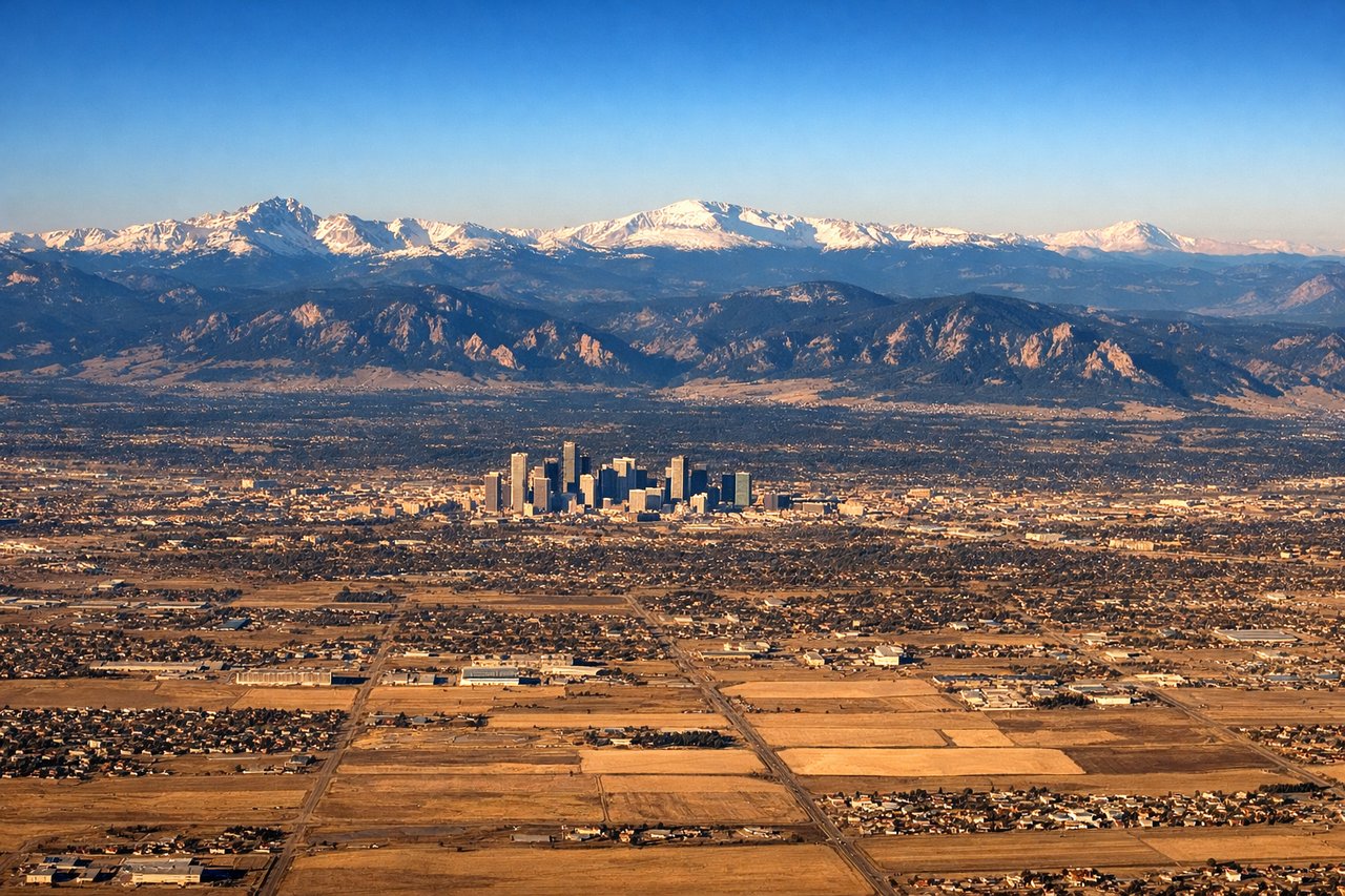
Landing at DEN
LEFTDEN's primary arrival runways from the east and southeast (Runways 16L/R or 34L/R oriented north-south) mean aircraft approach from the east. On the left side facing south, you get a clear broadside view of the entire Front Range — from Pikes Peak in the south to Longs Peak in the north — as the aircraft descends over the plains. The right side faces north toward open prairie with far less drama.
Landmarks on this routeAll landmarks →
Will your flight be in sunlight?
Pick a date and time in the Sun Map to watch the sun move across your whole flight.
About This Route
Which side of the plane should I sit on flying from Majors (GVT) to Denver International (DEN)?
Sit on the Left side of the plane for the best views on flights from Greenvile to Denver. While the right side is marginally better at takeoff from GVT, the left side delivers the defining visual payoff of this route: a sustained broadside panorama of the entire Colorado Front Range during descent into Denver, which is one of the most spectacular approach views in the continental US.
What can I see during takeoff from Majors in Greenvile?
During takeoff from Majors (GVT), sit on the Right side for the best views. GVT's primary runway is oriented roughly east-west (Runway 17/35 and 13/31). Departing westbound toward DEN, the right side faces north, giving views over the rolling blackland prairie of Hunt County and the city of Greenville itself. The left side faces south into open farmland with less to see. Notable sights include: Greenville city grid, Lake Tawakoni to the south-southwest, Hunt County farmland patchwork, Lake Lavon reservoir to the west.
What can I see when landing at Denver International in Denver?
When landing at Denver International (DEN), sit on the Left side for the best views. DEN's primary arrival runways from the east and southeast (Runways 16L/R or 34L/R oriented north-south) mean aircraft approach from the east. On the left side facing south, you get a clear broadside view of the entire Front Range — from Pikes Peak in the south to Longs Peak in the north — as the aircraft descends over the plains. The right side faces north toward open prairie with far less drama. Notable sights include: Front Range of the Rocky Mountains (Pikes Peak to Longs Peak), Denver city skyline, Rocky Mountain Arsenal National Wildlife Refuge, Chatfield Reservoir.
How long is the flight from Greenvile to Denver?
The flight from Majors (GVT) to Denver International (DEN) takes about 2 hours 25 minutes. The shortest flight path between them is 669 miles (1,077 km); winds and air traffic control usually add a few percent.
What does the Greenvile to Denver flight path pass over?
The flight crosses the Texas Panhandle's flat shortgrass prairie, the Canadian River breaks near Amarillo, the Caprock Escarpment marking the edge of the Llano Estacado, then transitions into the high plains of eastern Colorado. The Purgatoire River drainage and the Comanche National Grassland are visible in southeastern Colorado before the terrain gradually rises toward the Palmer Divide and the Front Range becomes visible on the western horizon roughly 100 miles out from Denver.