Both sides score equally at 2.5 due to the flight's fundamental constraint: this is a 7+ hour journey over predominantly open ocean (Arabian Sea, Indian Ocean, Bay of Bengal) with limited terrain drama on either side. The right side edges ahead marginally because Singapore's approach offers denser urban-industrial scenery and the Johor Strait provides a defined geographic feature, whereas Baku's departure, while featuring the Caspian coastline, quickly transitions to featureless open water. Neither side achieves higher than 2.5 because the cruise phase—comprising 6+ hours—consists almost entirely of ocean with no visible landmarks, mountains, or islands of note along the typical flight corridor.
Flown GYD to SIN? Did we get it right?
Flight Path
Baku to Singapore is 4,313 miles (6,941 km), a flight of about 7 hours 15 minutes.
The flight path crosses the Arabian Sea (no visible landmarks), passes south of the Arabian Peninsula and Oman, traverses the Indian Ocean with no major island groups in the direct routing, and approaches the Bay of Bengal. Notable geographic features along or near the route include the Strait of Hormuz region (far to the south of typical cruise altitude visibility), the Indian subcontinent's southern tip (visible only if flight path deviates north, which is uncommon), and the Andaman Sea approaching Southeast Asia. The vast majority of the 7+ hour flight occurs over open ocean with no terrain features visible from cruise altitude.
Great circle distance and headings ›Phase by phase
Takeoff from GYD
LEFTLeft side captures the Caspian Sea coastline and Absheron Peninsula immediately after departure from northward-facing runways 34/35. The initial climb-out provides views of Baku's harbor and the oil platforms dotting the shallow Caspian waters before the aircraft turns southeast toward the open sea.
Landing at SIN
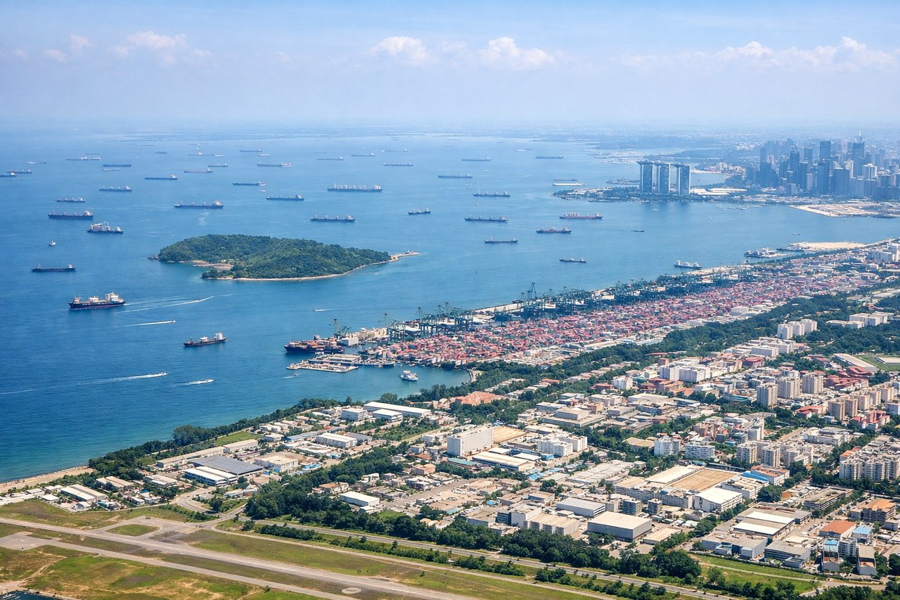
RIGHTRight side during approach to Singapore Changi offers views of the Johor Strait, Malaysia's southern coast, and the dense urban-industrial landscape of Singapore's eastern and northern sectors. The descent and approach pattern (typically runway 02 during NE Monsoon or runway 20 during SW Monsoon) provides extended views of Singapore's harbor, container terminals, and the island's developed coastline.
Will your flight be in sunlight?
Pick a date and time in the Sun Map to watch the sun move across your whole flight.
About This Route
Which side of the plane should I sit on flying from Heydar Aliyev International Airport (GYD) to Singapore Changi (SIN)?
Sit on the Right side of the plane for the best views on flights from Baku to Singapore. Both sides score equally at 2.5 due to the flight's fundamental constraint: this is a 7+ hour journey over predominantly open ocean (Arabian Sea, Indian Ocean, Bay of Bengal) with limited terrain drama on either side. The right side edges ahead marginally because Singapore's approach offers denser urban-industrial scenery and the Johor Strait provides a defined geographic feature, whereas Baku's departure, while featuring the Caspian coastline, quickly transitions to featureless open water. Neither side achieves higher than 2.5 because the cruise phase—comprising 6+ hours—consists almost entirely of ocean with no visible landmarks, mountains, or islands of note along the typical flight corridor.
What can I see during takeoff from Heydar Aliyev International Airport in Baku?
During takeoff from Heydar Aliyev International Airport (GYD), sit on the Left side for the best views. Left side captures the Caspian Sea coastline and Absheron Peninsula immediately after departure from northward-facing runways 34/35. The initial climb-out provides views of Baku's harbor and the oil platforms dotting the shallow Caspian waters before the aircraft turns southeast toward the open sea. Notable sights include: Baku harbor and city skyline, Absheron Peninsula coastline, Caspian Sea oil platforms, initial water transition.
What can I see when landing at Singapore Changi in Singapore?
When landing at Singapore Changi (SIN), sit on the Right side for the best views. Right side during approach to Singapore Changi offers views of the Johor Strait, Malaysia's southern coast, and the dense urban-industrial landscape of Singapore's eastern and northern sectors. The descent and approach pattern (typically runway 02 during NE Monsoon or runway 20 during SW Monsoon) provides extended views of Singapore's harbor, container terminals, and the island's developed coastline. Notable sights include: Johor Strait and Malaysian coast, Singapore's container port and harbor facilities, Changi area industrial zones, Singapore's eastern urban development.
How long is the flight from Baku to Singapore?
The flight from Heydar Aliyev International Airport (GYD) to Singapore Changi (SIN) takes about 7 hours 15 minutes. The shortest flight path between them is 4,313 miles (6,941 km); winds and air traffic control usually add a few percent.
What does the Baku to Singapore flight path pass over?
The flight path crosses the Arabian Sea (no visible landmarks), passes south of the Arabian Peninsula and Oman, traverses the Indian Ocean with no major island groups in the direct routing, and approaches the Bay of Bengal. Notable geographic features along or near the route include the Strait of Hormuz region (far to the south of typical cruise altitude visibility), the Indian subcontinent's southern tip (visible only if flight path deviates north, which is uncommon), and the Andaman Sea approaching Southeast Asia. The vast majority of the 7+ hour flight occurs over open ocean with no terrain features visible from cruise altitude.