Right side scores higher (3.5 vs 2.5) due to superior scenic variety across the full flight. Takeoff offers the Caspian Sea and Baku's coastal transition; the cruise phase crosses the Caucasus Mountains and Central Asian highlands with visible terrain variation; landing provides Taiwan's dramatic volcanic peaks, the Taipei Basin, and the Taiwan Strait. Left side is dominated by extended periods of flat Central Asian plains and open ocean with minimal landmark density.
Flown GYD to TPE? Did we get it right?
Flight Path
Baku to Taipei is 4,158 miles (6,691 km), a flight of about 7 hours 15 minutes.
Caucasus Mountains (particularly the Greater Caucasus range visible 1-2 hours after departure), Caspian Sea's eastern shore, Turkmenistan's Kopet Dag mountains, Afghanistan's Hindu Kush range (distant, far south of typical flight path), Tajikistan's Pamir Mountains, western China's Taklamakan Desert region, Tibet's high plateau terrain, and the transition into Southeast Asia's monsoon climate zone with increasing cloud cover approaching Taiwan
Great circle distance and headings ›Phase by phase
Takeoff from GYD
RIGHTRight side captures the Caspian Sea coastline and the dramatic transition from Baku's urban sprawl to open water. The Absheron Peninsula's distinctive geography and the contrast between city and sea provide immediate visual interest during climb-out.
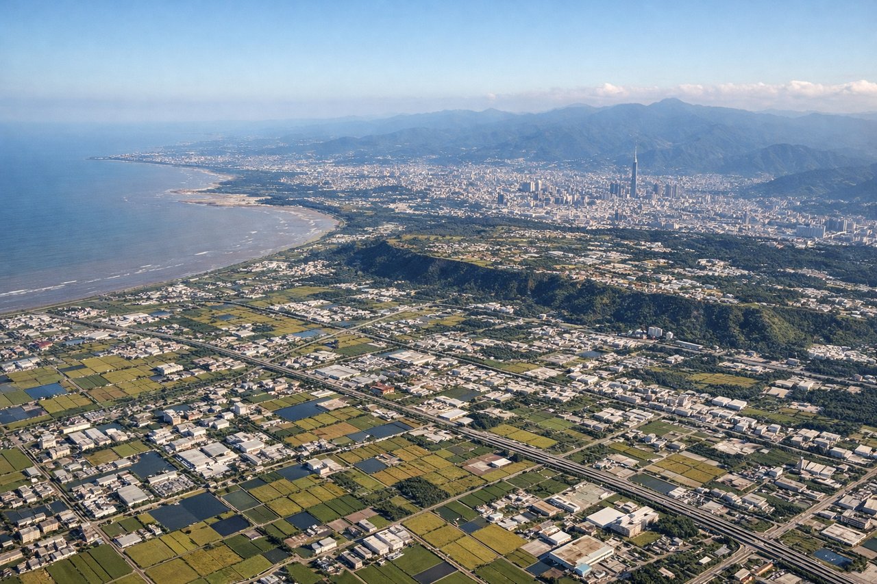
Landing at TPE
RIGHTRight side offers superior approach scenery with Taiwan's dramatic northeastern coastline, the Taipei Basin's urban sprawl, and the transition from the Taiwan Strait to mountainous terrain. The approach into TPE typically descends over the Strait with views of the island's rugged topography and the city's distinctive geography.
Will your flight be in sunlight?
Pick a date and time in the Sun Map to watch the sun move across your whole flight.
About This Route
Which side of the plane should I sit on flying from Heydar Aliyev International Airport (GYD) to Chiang Kai Shek International (TPE)?
Sit on the Right side of the plane for the best views on flights from Baku to Taipei. Right side scores higher (3.5 vs 2.5) due to superior scenic variety across the full flight. Takeoff offers the Caspian Sea and Baku's coastal transition; the cruise phase crosses the Caucasus Mountains and Central Asian highlands with visible terrain variation; landing provides Taiwan's dramatic volcanic peaks, the Taipei Basin, and the Taiwan Strait. Left side is dominated by extended periods of flat Central Asian plains and open ocean with minimal landmark density.
What can I see during takeoff from Heydar Aliyev International Airport in Baku?
During takeoff from Heydar Aliyev International Airport (GYD), sit on the Right side for the best views. Right side captures the Caspian Sea coastline and the dramatic transition from Baku's urban sprawl to open water. The Absheron Peninsula's distinctive geography and the contrast between city and sea provide immediate visual interest during climb-out. Notable sights include: Baku city center and harbor, Absheron Peninsula coastline, Caspian Sea, oil platforms dotting the shallow waters.
What can I see when landing at Chiang Kai Shek International in Taipei?
When landing at Chiang Kai Shek International (TPE), sit on the Right side for the best views. Right side offers superior approach scenery with Taiwan's dramatic northeastern coastline, the Taipei Basin's urban sprawl, and the transition from the Taiwan Strait to mountainous terrain. The approach into TPE typically descends over the Strait with views of the island's rugged topography and the city's distinctive geography. Notable sights include: Taiwan Strait waters, Taipei Basin and city skyline, Yangmingshan volcanic peaks, northeastern Taiwan's coastal mountains.
How long is the flight from Baku to Taipei?
The flight from Heydar Aliyev International Airport (GYD) to Chiang Kai Shek International (TPE) takes about 7 hours 15 minutes. The shortest flight path between them is 4,158 miles (6,691 km); winds and air traffic control usually add a few percent.
What does the Baku to Taipei flight path pass over?
Caucasus Mountains (particularly the Greater Caucasus range visible 1-2 hours after departure), Caspian Sea's eastern shore, Turkmenistan's Kopet Dag mountains, Afghanistan's Hindu Kush range (distant, far south of typical flight path), Tajikistan's Pamir Mountains, western China's Taklamakan Desert region, Tibet's high plateau terrain, and the transition into Southeast Asia's monsoon climate zone with increasing cloud cover approaching Taiwan