The right side offers more consistent visual interest across the flight: Vietnam's delta and highlands on departure, and a genuinely scenic island approach into Cebu with city, strait, and mountain views on arrival, while the left side faces mostly open, featureless water for both phases.
Flown HAN to CEB? Did we get it right?
Flight Path
Hanoi to Cebu is 1,422 miles (2,289 km), a flight of about 3 hours 10 minutes.
Extended open-water crossing of the South China Sea, with the route passing north of the Spratly Islands shoals before descending into the Visayan Sea region of the central Philippines.
Great circle distance and headings ›Phase by phase
Takeoff from HAN
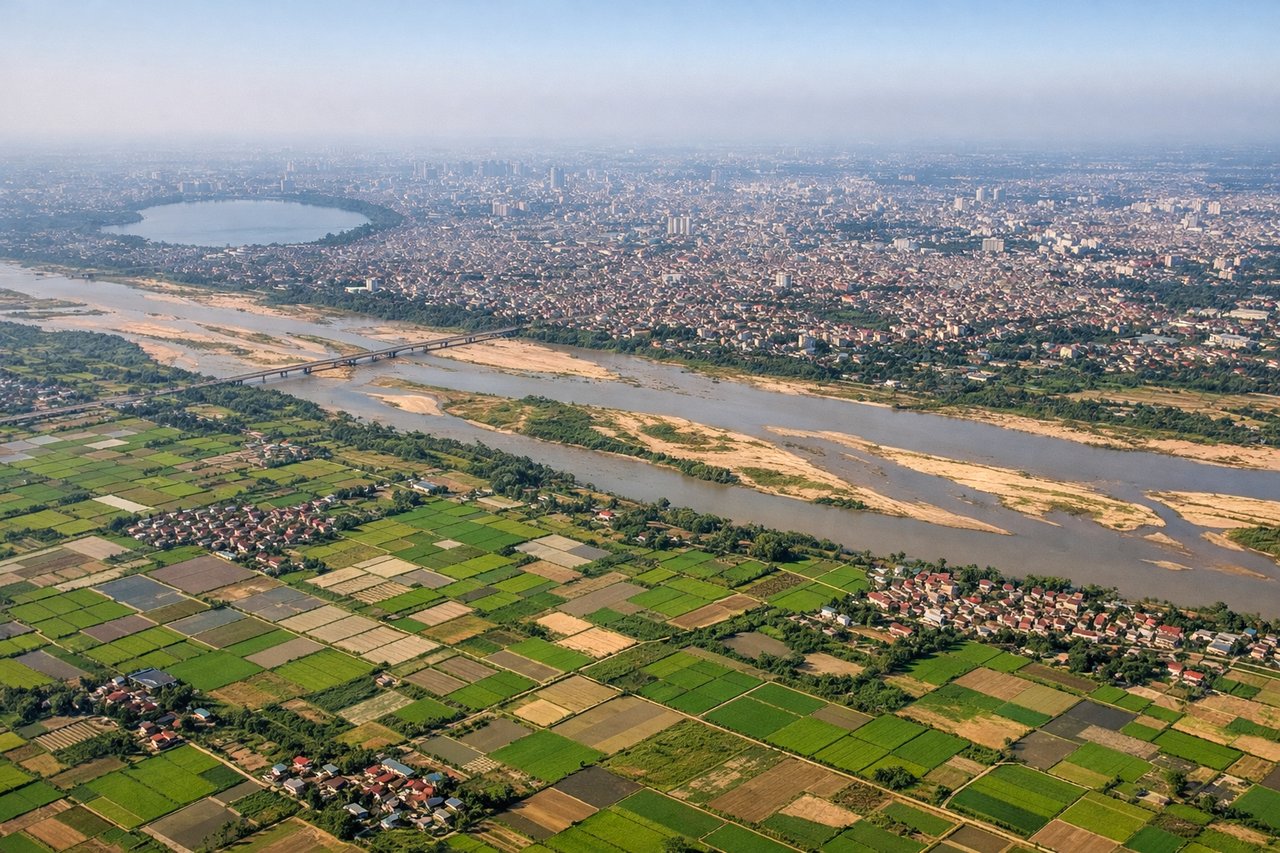
RIGHTClimbing out of Hanoi, the route bends south-southwest before settling on its Philippines-bound track, putting the Red River Delta's patchwork rice fields and the low Hoa Binh/Ba Vi highlands on the right. The left side mostly shows the flatter delta toward the Gulf of Tonkin, with less relief.
Landing at CEB
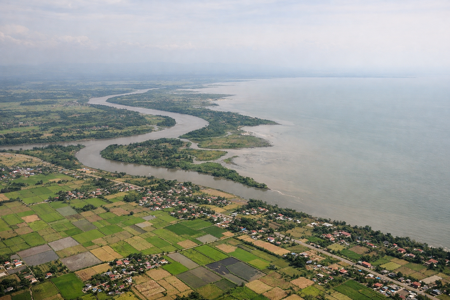
RIGHTOn approach into Mactan-Cebu, the right side typically faces west toward Cebu Island itself, revealing Cebu City's dense skyline, the harbor, and the island's central mountain spine, with Negros Island's volcanic ridgeline visible across the Tañon Strait on clear days. The left side mainly shows open Camotes Sea with little to see.
Will your flight be in sunlight?
Pick a date and time in the Sun Map to watch the sun move across your whole flight.
About This Route
Which side of the plane should I sit on flying from Noibai International (HAN) to Mactan Cebu International Airport (CEB)?
Sit on the Right side of the plane for the best views on flights from Hanoi to Cebu. The right side offers more consistent visual interest across the flight: Vietnam's delta and highlands on departure, and a genuinely scenic island approach into Cebu with city, strait, and mountain views on arrival, while the left side faces mostly open, featureless water for both phases.
What can I see during takeoff from Noibai International in Hanoi?
During takeoff from Noibai International (HAN), sit on the Right side for the best views. Climbing out of Hanoi, the route bends south-southwest before settling on its Philippines-bound track, putting the Red River Delta's patchwork rice fields and the low Hoa Binh/Ba Vi highlands on the right. The left side mostly shows the flatter delta toward the Gulf of Tonkin, with less relief. Notable sights include: Red River and its delta tributaries, Ba Vi/Hoa Binh highlands, Hanoi's outskirts and reservoirs.
What can I see when landing at Mactan Cebu International Airport in Cebu?
When landing at Mactan Cebu International Airport (CEB), sit on the Right side for the best views. On approach into Mactan-Cebu, the right side typically faces west toward Cebu Island itself, revealing Cebu City's dense skyline, the harbor, and the island's central mountain spine, with Negros Island's volcanic ridgeline visible across the Tañon Strait on clear days. The left side mainly shows open Camotes Sea with little to see. Notable sights include: Cebu City skyline and port, Mactan-Cebu Bridge, Cebu's central mountain ridge, Negros Island's volcanic silhouette across Tañon Strait.
How long is the flight from Hanoi to Cebu?
The flight from Noibai International (HAN) to Mactan Cebu International Airport (CEB) takes about 3 hours 10 minutes. The shortest flight path between them is 1,422 miles (2,289 km); winds and air traffic control usually add a few percent.
What does the Hanoi to Cebu flight path pass over?
Extended open-water crossing of the South China Sea, with the route passing north of the Spratly Islands shoals before descending into the Visayan Sea region of the central Philippines.