The takeoff from Hanoi offers more visually distinctive features—the Red River Delta's intricate waterways and the contrast between urban and rural landscapes are more striking than the landing approach. However, both legs have merit; left seats on descent provide good mountain views.
Flown HAN to CRK? Did we get it right?
Flight Path
Hanoi to Mabalacat is 1,054 miles (1,695 km), a flight of about 2 hours 15 minutes.
Gulf of Tonkin coastline (northeast of Hanoi), Hainan Island (China, distant right), Tonkin Gulf waters, northern Luzon coastline approaching the Philippines, South China Sea transition zone
Great circle distance and headings ›

Phase by phase
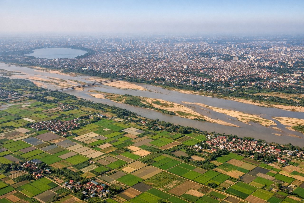
Takeoff from HAN
RIGHTRight-side seats offer views of the Red River Delta and Hanoi's urban sprawl during the initial climb-out northeastward. The delta's intricate waterways and patchwork of rice paddies are distinctive from altitude, and you'll see the transition from city to rural landscape clearly.
Landing at CRK
LEFTLeft-side seats provide excellent views during descent into Clark. You'll see Luzon's central plain, the Zambales Mountains to the west, and the approach over agricultural land and small towns leading to the airport. The topography is more dramatic on the left side of the descent path.
Will your flight be in sunlight?
Pick a date and time in the Sun Map to watch the sun move across your whole flight.
About This Route
Which side of the plane should I sit on flying from Noibai International (HAN) to Clark International Airport / Clark Air Base (CRK)?
Sit on the Right side of the plane for the best views on flights from Hanoi to Mabalacat. The takeoff from Hanoi offers more visually distinctive features—the Red River Delta's intricate waterways and the contrast between urban and rural landscapes are more striking than the landing approach. However, both legs have merit; left seats on descent provide good mountain views.
What can I see during takeoff from Noibai International in Hanoi?
During takeoff from Noibai International (HAN), sit on the Right side for the best views. Right-side seats offer views of the Red River Delta and Hanoi's urban sprawl during the initial climb-out northeastward. The delta's intricate waterways and patchwork of rice paddies are distinctive from altitude, and you'll see the transition from city to rural landscape clearly. Notable sights include: Red River Delta, Hanoi city center, Thai Nguyen Province highlands (distant), Gulf of Tonkin coastline.
What can I see when landing at Clark International Airport / Clark Air Base in Mabalacat?
When landing at Clark International Airport / Clark Air Base (CRK), sit on the Left side for the best views. Left-side seats provide excellent views during descent into Clark. You'll see Luzon's central plain, the Zambales Mountains to the west, and the approach over agricultural land and small towns leading to the airport. The topography is more dramatic on the left side of the descent path. Notable sights include: Zambales Mountains, Luzon central plain, Pampanga province rice fields, Mount Pinatubo (distant, weather permitting).
How long is the flight from Hanoi to Mabalacat?
The flight from Noibai International (HAN) to Clark International Airport / Clark Air Base (CRK) takes about 2 hours 15 minutes. The shortest flight path between them is 1,054 miles (1,695 km); winds and air traffic control usually add a few percent.
What does the Hanoi to Mabalacat flight path pass over?
Gulf of Tonkin coastline (northeast of Hanoi), Hainan Island (China, distant right), Tonkin Gulf waters, northern Luzon coastline approaching the Philippines, South China Sea transition zone