Hanoi to Fuzhou is 936 miles (1,506 km), a flight of about 2 hours 30 minutes.
Right-side seats capture the more dramatic geography: the Red River Delta's intricate waterways during takeoff and the transition to coastal terrain. While the landing favors the left, the takeoff views are more visually distinctive and geographically complex.
Flight Path
The flight path crosses the Gulf of Tonkin at roughly 22.5°N, 108°E. Mid-flight offers views of the Tonkin coastline, including the limestone karst formations around Ha Long Bay (visible as a hazy grey-green mass on the right/east side around 20.8°N, 107.2°E). As the aircraft continues northeast toward Fuzhou, the Wuyi Mountains become visible on the left/west side, appearing as a distant forested ridge. The final approach descends over the Min River valley and its agricultural plains before reaching Changle airport.
Great circle distance and headings ›Phase by phase
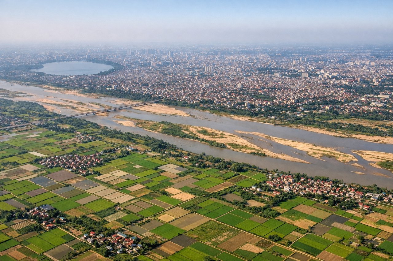
Takeoff from HAN
RIGHTRight-side seats offer views of the Red River Delta and Hanoi's urban sprawl as the aircraft climbs northeastward. The delta's agricultural patchwork and waterways are distinctive from altitude, and you'll see the transition from city to rural landscape clearly.
Landing at FOC
LEFTLeft-side seats provide excellent views during descent into Fuzhou. You'll see the Min River estuary, Fuzhou's urban core, and the surrounding coastal hills. The approach typically descends from the northwest, making the left side ideal for viewing the city and waterfront.
Will your flight be in sunlight?
Pick a date and time in the Sun Map to watch the sun move across your whole flight.
About This Route
Which side of the plane should I sit on flying from Noibai International (HAN) to Changle (FOC)?
Sit on the Right side of the plane for the best views on flights from Hanoi to Fuzhou. Right-side seats capture the more dramatic geography: the Red River Delta's intricate waterways during takeoff and the transition to coastal terrain. While the landing favors the left, the takeoff views are more visually distinctive and geographically complex.
What can I see during takeoff from Noibai International in Hanoi?
During takeoff from Noibai International (HAN), sit on the Right side for the best views. Right-side seats offer views of the Red River Delta and Hanoi's urban sprawl as the aircraft climbs northeastward. The delta's agricultural patchwork and waterways are distinctive from altitude, and you'll see the transition from city to rural landscape clearly. Notable sights include: Red River Delta (immediate foreground), Hanoi city grid (left-center), Thai Nguyen highlands (distant right horizon), Gulf of Tonkin coastline (far right edge).
What can I see when landing at Changle in Fuzhou?
When landing at Changle (FOC), sit on the Left side for the best views. Left-side seats provide excellent views during descent into Fuzhou. You'll see the Min River estuary, Fuzhou's urban core, and the surrounding coastal hills. The approach typically descends from the northwest, making the left side ideal for viewing the city and waterfront. Notable sights include: Min River estuary (center-left), Fuzhou urban area (left-center), Wuyi Mountains foothills (left horizon), Minjiang River valley (foreground).
How long is the flight from Hanoi to Fuzhou?
The flight from Noibai International (HAN) to Changle (FOC) takes about 2 hours 30 minutes. The shortest flight path between them is 936 miles (1,506 km); winds and air traffic control usually add a few percent.
What does the Hanoi to Fuzhou flight path pass over?
The flight path crosses the Gulf of Tonkin at roughly 22.5°N, 108°E. Mid-flight offers views of the Tonkin coastline, including the limestone karst formations around Ha Long Bay (visible as a hazy grey-green mass on the right/east side around 20.8°N, 107.2°E). As the aircraft continues northeast toward Fuzhou, the Wuyi Mountains become visible on the left/west side, appearing as a distant forested ridge. The final approach descends over the Min River valley and its agricultural plains before reaching Changle airport.