Right side scores higher (3.5 vs 2.5) because it captures two distinct scenic phases: the Red River delta's agricultural landscape and urban Hanoi during departure, then transitions to Ise Bay's coastal drama and the Kii Peninsula's mountains during descent. Left side remains predominantly flat and agricultural throughout, with minimal terrain variation or landmark density.
Flown HAN to NGO? Did we get it right?
Flight Path
Hanoi to Nagoya is 2,100 miles (3,380 km), a flight of about 4 hours 35 minutes.
East China Sea crossing with no significant landmarks; the flight path crosses open water for approximately 1 hour 15 minutes between the Vietnamese and Japanese coasts. Approaching Japan, the Izu Peninsula's volcanic ridges may be visible on clear days, followed by the Kii Peninsula's forested mountains as the aircraft descends toward Nagoya.
Great circle distance and headings ›

Phase by phase
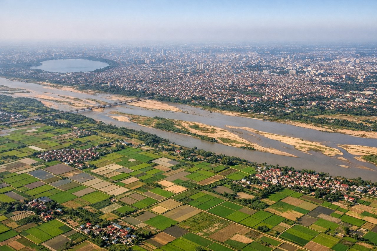
Takeoff from HAN
RIGHTRight side captures Hanoi's urban sprawl and the Red River delta during initial climb. Left side faces inland toward flat agricultural plains with minimal visual interest during departure.
Landing at NGO
RIGHTRight side offers views of Ise Bay and the Kii Peninsula's mountainous terrain during descent and approach to Nagoya. Left side faces inland toward the Nobi Plain, which is flat and densely urban with minimal scenic variation.
Will your flight be in sunlight?
Pick a date and time in the Sun Map to watch the sun move across your whole flight.
About This Route
Which side of the plane should I sit on flying from Noibai International (HAN) to Chubu Centrair International Airport (NGO)?
Sit on the Right side of the plane for the best views on flights from Hanoi to Nagoya. Right side scores higher (3.5 vs 2.5) because it captures two distinct scenic phases: the Red River delta's agricultural landscape and urban Hanoi during departure, then transitions to Ise Bay's coastal drama and the Kii Peninsula's mountains during descent. Left side remains predominantly flat and agricultural throughout, with minimal terrain variation or landmark density.
What can I see during takeoff from Noibai International in Hanoi?
During takeoff from Noibai International (HAN), sit on the Right side for the best views. Right side captures Hanoi's urban sprawl and the Red River delta during initial climb. Left side faces inland toward flat agricultural plains with minimal visual interest during departure. Notable sights include: Red River delta with its distinctive patchwork of rice paddies, Hanoi city center and Tay Ho district, Hoan Kiem Lake reflecting sunlight.
What can I see when landing at Chubu Centrair International Airport in Nagoya?
When landing at Chubu Centrair International Airport (NGO), sit on the Right side for the best views. Right side offers views of Ise Bay and the Kii Peninsula's mountainous terrain during descent and approach to Nagoya. Left side faces inland toward the Nobi Plain, which is flat and densely urban with minimal scenic variation. Notable sights include: Ise Bay with its distinctive coastal geography, Kii Peninsula's forested mountains rising from the coast, Nagoya's urban sprawl and port facilities, Chita Peninsula extending into the bay.
How long is the flight from Hanoi to Nagoya?
The flight from Noibai International (HAN) to Chubu Centrair International Airport (NGO) takes about 4 hours 35 minutes. The shortest flight path between them is 2,100 miles (3,380 km); winds and air traffic control usually add a few percent.
What does the Hanoi to Nagoya flight path pass over?
East China Sea crossing with no significant landmarks; the flight path crosses open water for approximately 1 hour 15 minutes between the Vietnamese and Japanese coasts. Approaching Japan, the Izu Peninsula's volcanic ridges may be visible on clear days, followed by the Kii Peninsula's forested mountains as the aircraft descends toward Nagoya.