Right side scores higher (3.0 vs 2.5) due to superior scenic content during both takeoff and landing. The Red River Delta's agricultural texture and Hanoi's urban character during departure, combined with the Pearl River estuary and Shenzhen's dramatic skyline during approach, provide more visual variety and landmark density than the left side's inland terrain and open-water views.
Flown HAN to SZX? Did we get it right?
Flight Path
Hanoi to Shenzhen is 522 miles (840 km), a flight of about 1 hour 15 minutes.
Coastal transition zone between Hanoi and Shenzhen: the Gulf of Tonkin's northern reaches, Haiphong's industrial port area, the Guangxi-Vietnam border region with limestone karst formations visible as distant peaks, and the approach to the Pearl River Delta's northern tributaries. The flight path crosses from the Red River system into the Pearl River watershed, with the South China Sea visible to the east throughout the cruise phase.
Great circle distance and headings ›Phase by phase
Takeoff from HAN
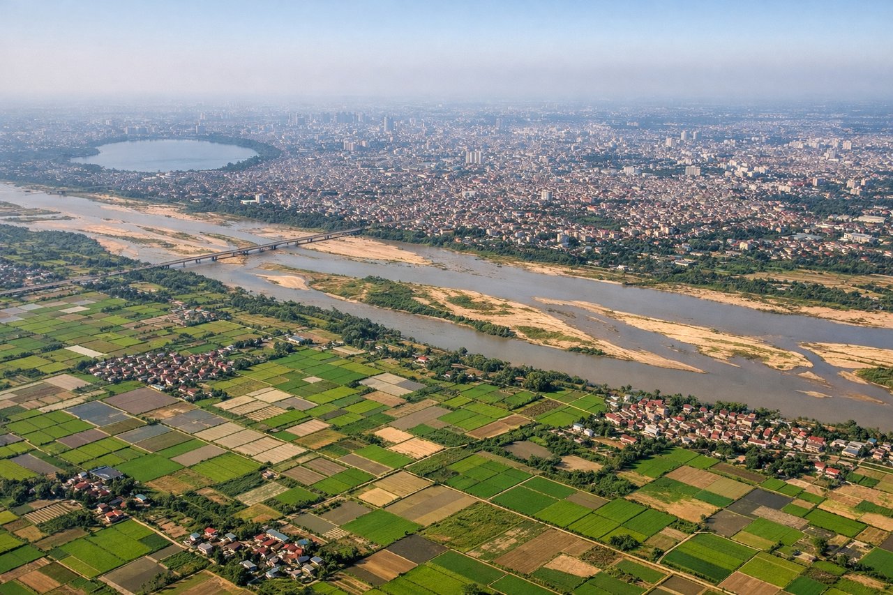
RIGHTRight side captures the Red River Delta and Hanoi's urban sprawl during initial climb. The delta's agricultural patchwork and waterways are distinctive from 3,000–8,000 feet. Left side faces inland terrain with less visual interest during departure.
Landing at SZX
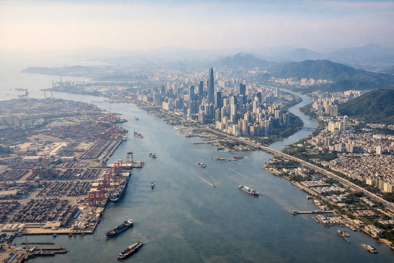
RIGHTRight side offers superior approach scenery into Shenzhen. Passengers see the Pearl River estuary, Shenzhen's high-rise skyline, and the transition from water to urban development. Left side faces open water and lacks distinctive landmarks during descent.
Will your flight be in sunlight?
Pick a date and time in the Sun Map to watch the sun move across your whole flight.
About This Route
Which side of the plane should I sit on flying from Noibai International (HAN) to Baoan (SZX)?
Sit on the Right side of the plane for the best views on flights from Hanoi to Shenzhen. Right side scores higher (3.0 vs 2.5) due to superior scenic content during both takeoff and landing. The Red River Delta's agricultural texture and Hanoi's urban character during departure, combined with the Pearl River estuary and Shenzhen's dramatic skyline during approach, provide more visual variety and landmark density than the left side's inland terrain and open-water views.
What can I see during takeoff from Noibai International in Hanoi?
During takeoff from Noibai International (HAN), sit on the Right side for the best views. Right side captures the Red River Delta and Hanoi's urban sprawl during initial climb. The delta's agricultural patchwork and waterways are distinctive from 3,000–8,000 feet. Left side faces inland terrain with less visual interest during departure. Notable sights include: Red River Delta with its intricate canal and paddy field grid, Hanoi city center and Tay Ho district waterfront, Long Bien Bridge area.
What can I see when landing at Baoan in Shenzhen?
When landing at Baoan (SZX), sit on the Right side for the best views. Right side offers superior approach scenery into Shenzhen. Passengers see the Pearl River estuary, Shenzhen's high-rise skyline, and the transition from water to urban development. Left side faces open water and lacks distinctive landmarks during descent. Notable sights include: Pearl River estuary with its complex waterway network, Shenzhen's central business district skyline, Qianhai Bay development zone, Victoria Harbour approach corridor.
How long is the flight from Hanoi to Shenzhen?
The flight from Noibai International (HAN) to Baoan (SZX) takes about 1 hour 15 minutes. The shortest flight path between them is 522 miles (840 km); winds and air traffic control usually add a few percent.
What does the Hanoi to Shenzhen flight path pass over?
Coastal transition zone between Hanoi and Shenzhen: the Gulf of Tonkin's northern reaches, Haiphong's industrial port area, the Guangxi-Vietnam border region with limestone karst formations visible as distant peaks, and the approach to the Pearl River Delta's northern tributaries. The flight path crosses from the Red River system into the Pearl River watershed, with the South China Sea visible to the east throughout the cruise phase.