The takeoff from Hanoi offers more sustained scenic value with the Red River Delta's distinctive agricultural landscape and the transition into mountainous terrain. While the Vancouver landing is dramatic, the Hanoi departure provides a longer window of visually interesting geography during the initial climb phase.
Flown HAN to YVR? Did we get it right?
Flight Path
Hanoi to Vancouver is 6,718 miles (10,811 km), a flight of about 15 hours 20 minutes.
The flight path crosses the Tibetan Plateau and Himalayas (visible on northbound routing through central Asia), then transitions over the steppes of Mongolia and Russia, the Bering Strait region, and Alaska's interior mountains before descending toward the Pacific Northwest. Key visible landmarks include the Altai Mountains, Lake Baikal region, the Alaska Range, and the Cascade Range approaching Vancouver.
Great circle distance and headings ›


Phase by phase
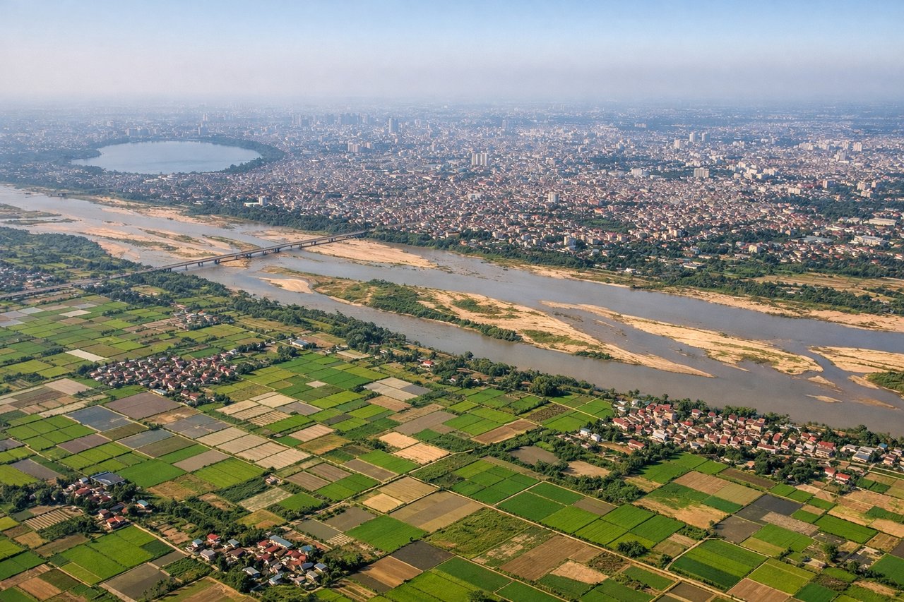
Takeoff from HAN
RIGHTRight-side seats offer views of the Red River Delta and Hanoi's urban sprawl immediately after departure. The aircraft climbs northwestward over the delta's patchwork of rice paddies and waterways before turning toward the northwest flight corridor.
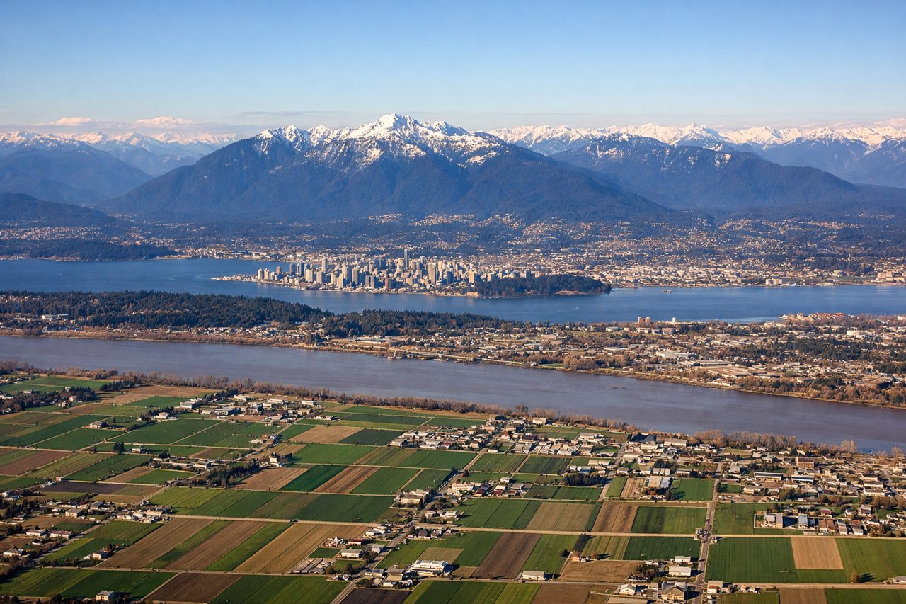
Landing at YVR
LEFTLeft-side seats provide excellent views during the descent into Vancouver. The aircraft approaches from the southeast over the Strait of Georgia, offering views of the North Shore Mountains, Vancouver Island, and the city's waterfront geography.
Will your flight be in sunlight?
Pick a date and time in the Sun Map to watch the sun move across your whole flight.
About This Route
Which side of the plane should I sit on flying from Noibai International (HAN) to Vancouver International (YVR)?
Sit on the Right side of the plane for the best views on flights from Hanoi to Vancouver. The takeoff from Hanoi offers more sustained scenic value with the Red River Delta's distinctive agricultural landscape and the transition into mountainous terrain. While the Vancouver landing is dramatic, the Hanoi departure provides a longer window of visually interesting geography during the initial climb phase.
What can I see during takeoff from Noibai International in Hanoi?
During takeoff from Noibai International (HAN), sit on the Right side for the best views. Right-side seats offer views of the Red River Delta and Hanoi's urban sprawl immediately after departure. The aircraft climbs northwestward over the delta's patchwork of rice paddies and waterways before turning toward the northwest flight corridor. Notable sights include: Red River Delta (agricultural grid pattern), Hanoi city center and Tay Ho district (urban density), Thai Nguyen Province highlands (distant northwest), Gulf of Tonkin coastline (eastern horizon).
What can I see when landing at Vancouver International in Vancouver?
When landing at Vancouver International (YVR), sit on the Left side for the best views. Left-side seats provide excellent views during the descent into Vancouver. The aircraft approaches from the southeast over the Strait of Georgia, offering views of the North Shore Mountains, Vancouver Island, and the city's waterfront geography. Notable sights include: North Shore Mountains (Grouse, Seymour, Cypress peaks), Strait of Georgia and Gulf Islands, Vancouver Island's eastern coastline, Greater Vancouver urban area and False Creek.
How long is the flight from Hanoi to Vancouver?
The flight from Noibai International (HAN) to Vancouver International (YVR) takes about 15 hours 20 minutes. The shortest flight path between them is 6,718 miles (10,811 km); winds and air traffic control usually add a few percent.
What does the Hanoi to Vancouver flight path pass over?
The flight path crosses the Tibetan Plateau and Himalayas (visible on northbound routing through central Asia), then transitions over the steppes of Mongolia and Russia, the Bering Strait region, and Alaska's interior mountains before descending toward the Pacific Northwest. Key visible landmarks include the Altai Mountains, Lake Baikal region, the Alaska Range, and the Cascade Range approaching Vancouver.