Both sides score equally at 2.5 due to the flight's geography: the route crosses primarily flat terrain (Sindh plains, Rajasthan, and Thai lowlands) with no mountains or dramatic coastlines. The right side edges ahead marginally because the Indus River valley departure and the approach over the Chao Phraya delta provide slightly more visual structure and landmark density than the left side's more monotonous plains views. However, this is a fundamentally flat-terrain route with limited scenic drama on either side.
Flown HDD to BKK? Did we get it right?
Flight Path
Hyderabad to Bangkok is 2,249 miles (3,620 km), a flight of about 4 hours 55 minutes.
Thar Desert (visible as tan, featureless expanse during cruise), Rajasthan plains, transition from Pakistani to Indian airspace over the border region, Thai Central Plains with scattered towns and agricultural fields, approach to Bangkok's delta region with increasing urban density
Great circle distance and headings ›Phase by phase
Takeoff from HDD
RIGHTRight side captures the Indus River valley and agricultural plains immediately after departure from HDD's runway 02/20. The river's braided channels and irrigation networks are visually distinctive during climb-out, whereas the left side faces open desert with minimal terrain variation.
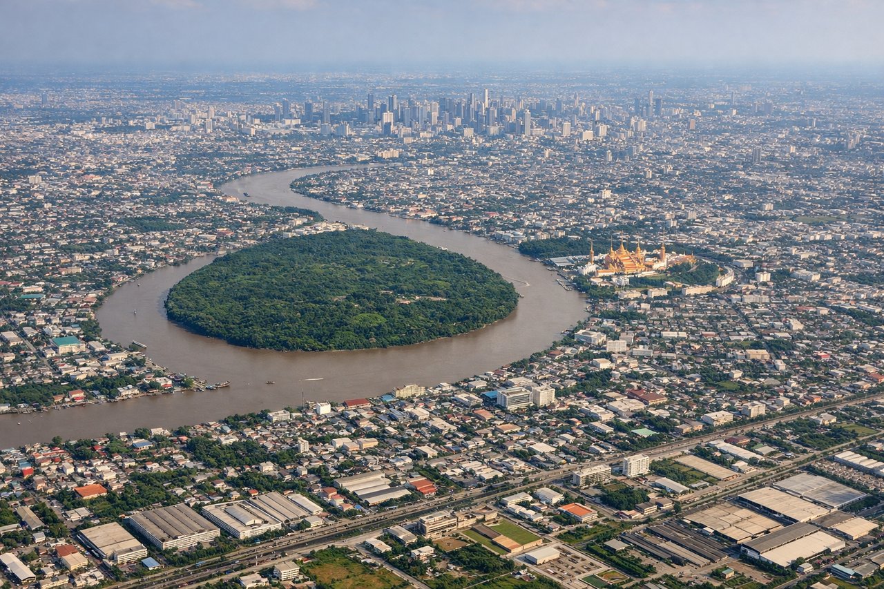
Landing at BKK
LEFTLeft side during approach to BKK offers views of the Chao Phraya River delta, Bangkok's sprawling urban area, and the transition from agricultural plains to dense city infrastructure. The right side faces open countryside and industrial zones with less visual interest during descent.
Will your flight be in sunlight?
Pick a date and time in the Sun Map to watch the sun move across your whole flight.
About This Route
Which side of the plane should I sit on flying from Hyderabad (HDD) to Suvarnabhumi Airport (BKK)?
Sit on the Right side of the plane for the best views on flights from Hyderabad to Bangkok. Both sides score equally at 2.5 due to the flight's geography: the route crosses primarily flat terrain (Sindh plains, Rajasthan, and Thai lowlands) with no mountains or dramatic coastlines. The right side edges ahead marginally because the Indus River valley departure and the approach over the Chao Phraya delta provide slightly more visual structure and landmark density than the left side's more monotonous plains views. However, this is a fundamentally flat-terrain route with limited scenic drama on either side.
What can I see during takeoff from Hyderabad in Hyderabad?
During takeoff from Hyderabad (HDD), sit on the Right side for the best views. Right side captures the Indus River valley and agricultural plains immediately after departure from HDD's runway 02/20. The river's braided channels and irrigation networks are visually distinctive during climb-out, whereas the left side faces open desert with minimal terrain variation. Notable sights include: Indus River valley with visible irrigation channels, Hyderabad city grid receding behind, flat Sindh plains extending eastward.
What can I see when landing at Suvarnabhumi Airport in Bangkok?
When landing at Suvarnabhumi Airport (BKK), sit on the Left side for the best views. Left side during approach to BKK offers views of the Chao Phraya River delta, Bangkok's sprawling urban area, and the transition from agricultural plains to dense city infrastructure. The right side faces open countryside and industrial zones with less visual interest during descent. Notable sights include: Chao Phraya River delta with its distinctive meanders, Bangkok's urban sprawl and elevated expressways, rice paddies and fish farms in the delta floodplain.
How long is the flight from Hyderabad to Bangkok?
The flight from Hyderabad (HDD) to Suvarnabhumi Airport (BKK) takes about 4 hours 55 minutes. The shortest flight path between them is 2,249 miles (3,620 km); winds and air traffic control usually add a few percent.
What does the Hyderabad to Bangkok flight path pass over?
Thar Desert (visible as tan, featureless expanse during cruise), Rajasthan plains, transition from Pakistani to Indian airspace over the border region, Thai Central Plains with scattered towns and agricultural fields, approach to Bangkok's delta region with increasing urban density