While takeoff offers good urban/mountain views on the right, the landing approach over the Strait of Malacca and island geography provides more dramatic and geographically distinctive scenery. Left seats capture the transition from open ocean to Singapore's maritime landscape, which is the more memorable segment of this transpacific route.
Flown HHR to SIN? Did we get it right?
Flight Path
Hawthorne to Singapore is 8,767 miles (14,108 km), a flight of about 16 hours 30 minutes.
Flight crosses the Pacific Ocean for roughly 8 hours with minimal visible landmarks—open water dominates. Passes north of Hawaii (not visible on typical routing). Crosses the International Date Line. Approaches Asia over the Philippine Sea, then passes over or near the Philippines' eastern coast (Luzon visible on some routings), before descending into Southeast Asian airspace. Final approach crosses the Strait of Malacca and Malaysian waters into Singapore.
Great circle distance and headings ›

Phase by phase
Takeoff from HHR
RIGHTHawthorne Municipal typically departs eastbound (Runway 24/06 favors 24 for westerlies). Right-side seats face north toward Los Angeles basin and Santa Monica Mountains during initial climb, offering urban sprawl and coastal geography. Left side shows inland desert and less distinctive terrain.
Landing at SIN
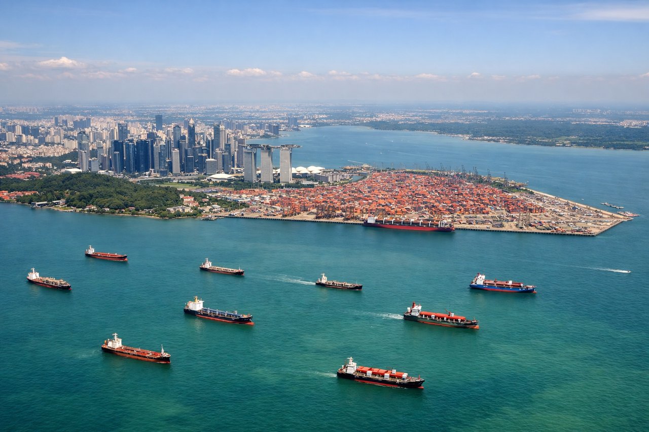
LEFTApproach to Singapore Changi typically uses Runways 02L/02R or 20L/20R depending on wind. Eastbound approaches (common for transpacific arrivals) descend over the Strait of Malacca and Malaysian peninsula. Left seats face south toward the Riau Islands and Indonesian waters, showing the transition from open water to Singapore's island geography and port infrastructure.
Will your flight be in sunlight?
Pick a date and time in the Sun Map to watch the sun move across your whole flight.
About This Route
Which side of the plane should I sit on flying from Jack Northrop Fld Hawthorne Muni (HHR) to Singapore Changi (SIN)?
Sit on the Left side of the plane for the best views on flights from Hawthorne to Singapore. While takeoff offers good urban/mountain views on the right, the landing approach over the Strait of Malacca and island geography provides more dramatic and geographically distinctive scenery. Left seats capture the transition from open ocean to Singapore's maritime landscape, which is the more memorable segment of this transpacific route.
What can I see during takeoff from Jack Northrop Fld Hawthorne Muni in Hawthorne?
During takeoff from Jack Northrop Fld Hawthorne Muni (HHR), sit on the Right side for the best views. Hawthorne Municipal typically departs eastbound (Runway 24/06 favors 24 for westerlies). Right-side seats face north toward Los Angeles basin and Santa Monica Mountains during initial climb, offering urban sprawl and coastal geography. Left side shows inland desert and less distinctive terrain. Notable sights include: Santa Monica Mountains (north), Los Angeles urban grid extending east, Pacific Ocean coastline (west), Long Beach port facilities (southeast).
What can I see when landing at Singapore Changi in Singapore?
When landing at Singapore Changi (SIN), sit on the Left side for the best views. Approach to Singapore Changi typically uses Runways 02L/02R or 20L/20R depending on wind. Eastbound approaches (common for transpacific arrivals) descend over the Strait of Malacca and Malaysian peninsula. Left seats face south toward the Riau Islands and Indonesian waters, showing the transition from open water to Singapore's island geography and port infrastructure. Notable sights include: Strait of Malacca (west/northwest), Riau Islands archipelago (southwest), Singapore Changi's eastern coastline and reclaimed land (east), Johor Strait and Malaysian peninsula (north).
How long is the flight from Hawthorne to Singapore?
The flight from Jack Northrop Fld Hawthorne Muni (HHR) to Singapore Changi (SIN) takes about 16 hours 30 minutes. The shortest flight path between them is 8,767 miles (14,108 km); winds and air traffic control usually add a few percent.
What does the Hawthorne to Singapore flight path pass over?
Flight crosses the Pacific Ocean for roughly 8 hours with minimal visible landmarks—open water dominates. Passes north of Hawaii (not visible on typical routing). Crosses the International Date Line. Approaches Asia over the Philippine Sea, then passes over or near the Philippines' eastern coast (Luzon visible on some routings), before descending into Southeast Asian airspace. Final approach crosses the Strait of Malacca and Malaysian waters into Singapore.