Hibbing to Minneapolis is 174 miles (280 km), a flight of about 55 minutes.
While takeoff favors the right for the Iron Range views, the landing approach provides more dramatic and varied geography. The descent into MSP on the left side showcases the Minnesota River valley, the Mississippi River, and the urban transition—more visually interesting than the relatively uniform forest during climb-out.
Flight Path
The flight path crosses from the Mesabi Iron Range through central Minnesota's lake country and boreal forest transition zone. Notable midpoint features include Mille Lacs Lake (if visible to the east depending on exact routing), the gradual transition from mining-affected landscape to pristine forest and wetlands, and the beginning of the Minnesota River valley system as you approach the Twin Cities. The landscape gradually shifts from the rocky, lake-dotted Iron Range terrain to flatter, more densely forested areas with extensive wetland complexes.
Great circle distance and headings ›Phase by phase
Takeoff from HIB
RIGHTRight side captures the Iron Range landscape and the chain of lakes that define the Hibbing area. Hibbing typically departs to the south or southeast, and the right window frames the forested terrain and water features that characterize this region.
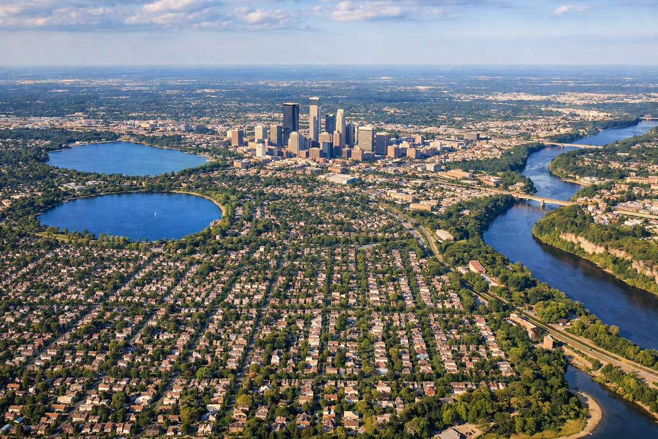
Landing at MSP
LEFTLeft side on descent into MSP provides views of the Twin Cities metropolitan area and the Minnesota River valley. Standard approaches to MSP from the north typically descend on a southwesterly heading, making the left window ideal for seeing the urban sprawl and geographic transition from forest to developed landscape.
Landmarks on this routeAll landmarks →
Will your flight be in sunlight?
Pick a date and time in the Sun Map to watch the sun move across your whole flight.
About This Route
Which side of the plane should I sit on flying from Chisholm Hibbing (HIB) to Minneapolis St Paul International (MSP)?
Sit on the Left side of the plane for the best views on flights from Hibbing to Minneapolis. While takeoff favors the right for the Iron Range views, the landing approach provides more dramatic and varied geography. The descent into MSP on the left side showcases the Minnesota River valley, the Mississippi River, and the urban transition—more visually interesting than the relatively uniform forest during climb-out.
What can I see during takeoff from Chisholm Hibbing in Hibbing?
During takeoff from Chisholm Hibbing (HIB), sit on the Right side for the best views. Right side captures the Iron Range landscape and the chain of lakes that define the Hibbing area. Hibbing typically departs to the south or southeast, and the right window frames the forested terrain and water features that characterize this region. Notable sights include: Mesabi Iron Range (visible as cleared mining areas and open pit patterns), Embarrass River valley, chain of small lakes dotting the boreal forest, Highway 169 corridor.
What can I see when landing at Minneapolis St Paul International in Minneapolis?
When landing at Minneapolis St Paul International (MSP), sit on the Left side for the best views. Left side on descent into MSP provides views of the Twin Cities metropolitan area and the Minnesota River valley. Standard approaches to MSP from the north typically descend on a southwesterly heading, making the left window ideal for seeing the urban sprawl and geographic transition from forest to developed landscape. Notable sights include: Minnesota River valley (distinct linear feature), Twin Cities urban area and suburban sprawl, Mississippi River confluence, St. Paul downtown skyline.
How long is the flight from Hibbing to Minneapolis?
The flight from Chisholm Hibbing (HIB) to Minneapolis St Paul International (MSP) takes about 55 minutes. The shortest flight path between them is 174 miles (280 km); winds and air traffic control usually add a few percent.
What does the Hibbing to Minneapolis flight path pass over?
The flight path crosses from the Mesabi Iron Range through central Minnesota's lake country and boreal forest transition zone. Notable midpoint features include Mille Lacs Lake (if visible to the east depending on exact routing), the gradual transition from mining-affected landscape to pristine forest and wetlands, and the beginning of the Minnesota River valley system as you approach the Twin Cities. The landscape gradually shifts from the rocky, lake-dotted Iron Range terrain to flatter, more densely forested areas with extensive wetland complexes.