While takeoff favors the left for mountain views, the landing approach offers more dramatic and varied geography—the Minnesota River system, Mississippi River confluence, and the Twin Cities themselves create a more compelling visual narrative. Right-side seats capture the best of both the approach descent and the final urban geography.
Flown HLN to MSP? Did we get it right?
Flight Path
Helena to Minneapolis is 910 miles (1,465 km), a flight of about 2 hours 15 minutes.
The flight path crosses central Montana and North Dakota, passing over the Missouri River breaks near Fort Benton, the high plains of north-central Montana, and the transition zone into the Red River Valley. The landscape shifts from mountainous terrain to rolling prairie to increasingly flat agricultural land. The Missouri River is visible during the central portion of the flight, appearing as a distinct ribbon through the plains. The Bearpaw Mountains appear as a low range to the north of the direct track. As the flight approaches Minnesota, the terrain flattens significantly and water features become more prominent—small lakes and wetlands dot the landscape, particularly visible in the final 45 minutes as the flight enters the Minnesota lake country.
Great circle distance and headings ›

Phase by phase
Takeoff from HLN
LEFTHelena Regional typically departs to the north or northeast. Left-side seats capture the Northern Rocky Mountains immediately after climb-out, with the Continental Divide and multiple peaks in sharp relief against the sky.
Landing at MSP
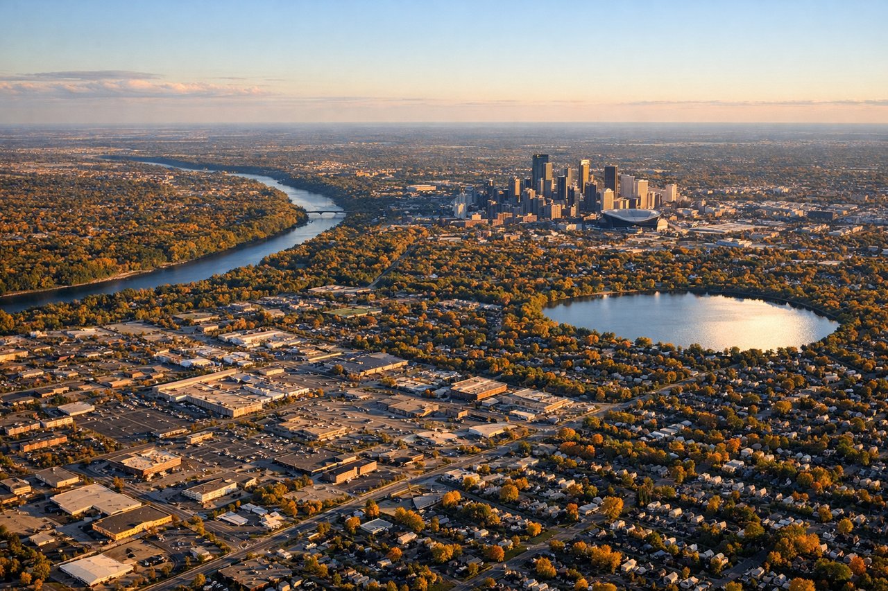
RIGHTApproaching Minneapolis-St. Paul typically uses runways aligned northeast-southwest or east-west depending on wind. Right-side seats on descent capture the Minnesota River valley, the confluence with the Mississippi River, and the distinctive urban sprawl of the Twin Cities with downtown Minneapolis and St. Paul clearly separated.
Will your flight be in sunlight?
Pick a date and time in the Sun Map to watch the sun move across your whole flight.
About This Route
Which side of the plane should I sit on flying from Helena Rgnl (HLN) to Minneapolis St Paul International (MSP)?
Sit on the Right side of the plane for the best views on flights from Helena to Minneapolis. While takeoff favors the left for mountain views, the landing approach offers more dramatic and varied geography—the Minnesota River system, Mississippi River confluence, and the Twin Cities themselves create a more compelling visual narrative. Right-side seats capture the best of both the approach descent and the final urban geography.
What can I see during takeoff from Helena Rgnl in Helena?
During takeoff from Helena Rgnl (HLN), sit on the Left side for the best views. Helena Regional typically departs to the north or northeast. Left-side seats capture the Northern Rocky Mountains immediately after climb-out, with the Continental Divide and multiple peaks in sharp relief against the sky. Notable sights include: Northern Rocky Mountains (Continental Divide), Prickly Pear Valley to the east, Last Chance Gulch drainage, Scratchgravel Hills to the north.
What can I see when landing at Minneapolis St Paul International in Minneapolis?
When landing at Minneapolis St Paul International (MSP), sit on the Right side for the best views. Approaching Minneapolis-St. Paul typically uses runways aligned northeast-southwest or east-west depending on wind. Right-side seats on descent capture the Minnesota River valley, the confluence with the Mississippi River, and the distinctive urban sprawl of the Twin Cities with downtown Minneapolis and St. Paul clearly separated. Notable sights include: Minnesota River valley, Mississippi River confluence, downtown Minneapolis skyline, St. Paul downtown district.
How long is the flight from Helena to Minneapolis?
The flight from Helena Rgnl (HLN) to Minneapolis St Paul International (MSP) takes about 2 hours 15 minutes. The shortest flight path between them is 910 miles (1,465 km); winds and air traffic control usually add a few percent.
What does the Helena to Minneapolis flight path pass over?
The flight path crosses central Montana and North Dakota, passing over the Missouri River breaks near Fort Benton, the high plains of north-central Montana, and the transition zone into the Red River Valley. The landscape shifts from mountainous terrain to rolling prairie to increasingly flat agricultural land. The Missouri River is visible during the central portion of the flight, appearing as a distinct ribbon through the plains. The Bearpaw Mountains appear as a low range to the north of the direct track. As the flight approaches Minnesota, the terrain flattens significantly and water features become more prominent—small lakes and wetlands dot the landscape, particularly visible in the final 45 minutes as the flight enters the Minnesota lake country.