While takeoff offers pleasant regional views, the landing approach into San Francisco provides far more dramatic and iconic scenery—the Golden Gate Bridge and San Francisco Bay are among the most visually distinctive landmarks in North American aviation, making left-side seats the clear winner for this route.
Flown HSV to SFO? Did we get it right?
Flight Path
Huntsville to San Francisco is 1,986 miles (3,195 km), a flight of about 4 hours 15 minutes.
The flight path crosses the Sierra Nevada mountains (visible as a major north-south ridge with snow-capped peaks in winter/spring), the Great Basin's high desert terrain with sparse vegetation and geometric valley patterns, and the Central Valley of California with its extensive agricultural grid. The Cascade Range appears to the north as the aircraft passes over northern California. Lake Tahoe may be visible as a bright blue alpine lake if the flight path passes near it. The transition from the humid Southeast to the arid interior West is geographically dramatic, with vegetation density and terrain relief changing significantly across the 1,800-mile route.
Great circle distance and headings ›


Phase by phase
Takeoff from HSV
RIGHTRight-side seats offer views of the Tennessee River valley and the Cumberland Plateau as the aircraft climbs northwest out of Huntsville. The river's meandering path and surrounding forested terrain are distinctive from altitude.
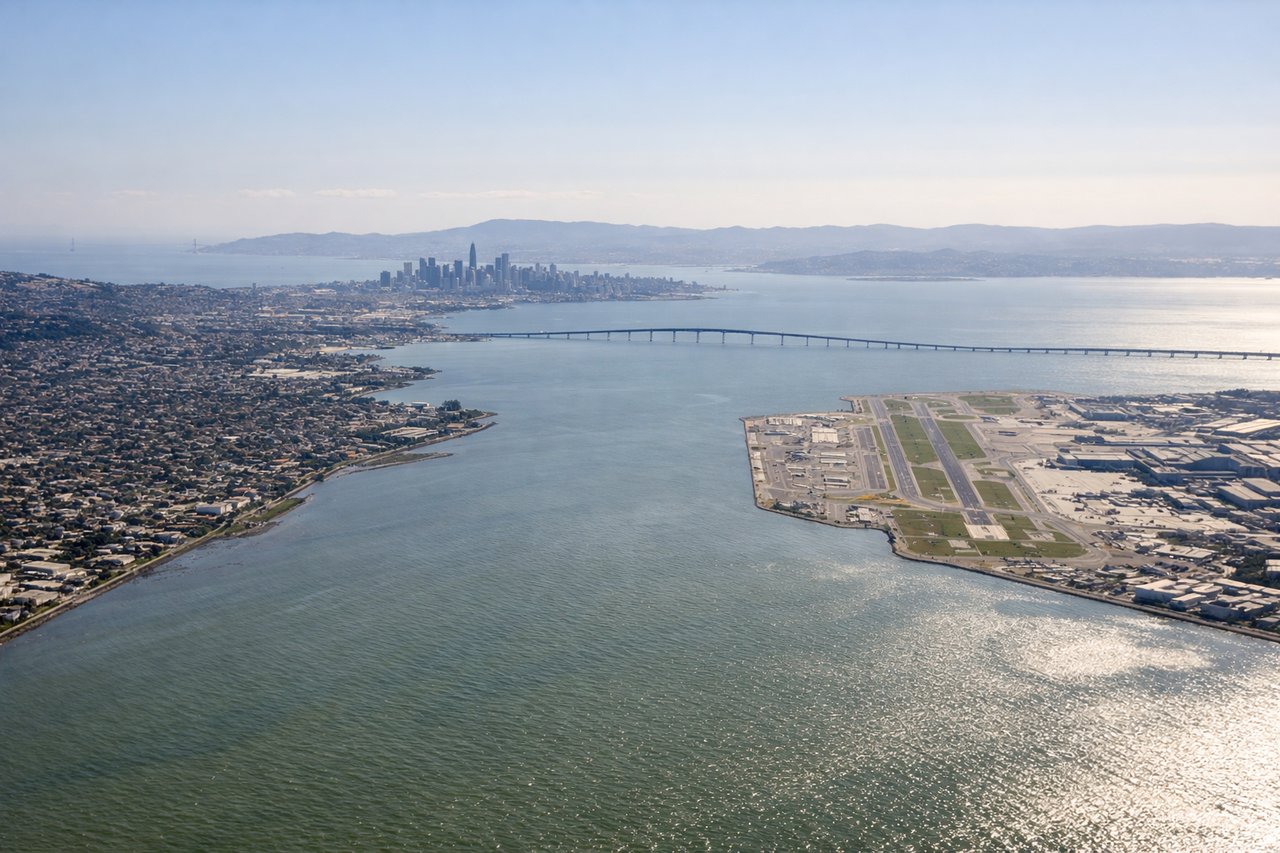
Landing at SFO
LEFTLeft-side seats provide excellent views of the San Francisco Bay, the Golden Gate Bridge, and the San Francisco Peninsula during the descent and approach from the east. The bay's distinctive geography and the bridge are iconic visual markers.
Will your flight be in sunlight?
Pick a date and time in the Sun Map to watch the sun move across your whole flight.
About This Route
Which side of the plane should I sit on flying from Huntsville International Airport (HSV) to San Francisco International (SFO)?
Sit on the Left side of the plane for the best views on flights from Huntsville to San Francisco. While takeoff offers pleasant regional views, the landing approach into San Francisco provides far more dramatic and iconic scenery—the Golden Gate Bridge and San Francisco Bay are among the most visually distinctive landmarks in North American aviation, making left-side seats the clear winner for this route.
What can I see during takeoff from Huntsville International Airport in Huntsville?
During takeoff from Huntsville International Airport (HSV), sit on the Right side for the best views. Right-side seats offer views of the Tennessee River valley and the Cumberland Plateau as the aircraft climbs northwest out of Huntsville. The river's meandering path and surrounding forested terrain are distinctive from altitude. Notable sights include: Tennessee River, Cumberland Plateau escarpment, Guntersville Lake, forested valleys of northern Alabama.
What can I see when landing at San Francisco International in San Francisco?
When landing at San Francisco International (SFO), sit on the Left side for the best views. Left-side seats provide excellent views of the San Francisco Bay, the Golden Gate Bridge, and the San Francisco Peninsula during the descent and approach from the east. The bay's distinctive geography and the bridge are iconic visual markers. Notable sights include: San Francisco Bay, Golden Gate Bridge, San Francisco Peninsula, Oakland Hills.
How long is the flight from Huntsville to San Francisco?
The flight from Huntsville International Airport (HSV) to San Francisco International (SFO) takes about 4 hours 15 minutes. The shortest flight path between them is 1,986 miles (3,195 km); winds and air traffic control usually add a few percent.
What does the Huntsville to San Francisco flight path pass over?
The flight path crosses the Sierra Nevada mountains (visible as a major north-south ridge with snow-capped peaks in winter/spring), the Great Basin's high desert terrain with sparse vegetation and geometric valley patterns, and the Central Valley of California with its extensive agricultural grid. The Cascade Range appears to the north as the aircraft passes over northern California. Lake Tahoe may be visible as a bright blue alpine lake if the flight path passes near it. The transition from the humid Southeast to the arid interior West is geographically dramatic, with vegetation density and terrain relief changing significantly across the 1,800-mile route.