Chita to Hanoi is 2,166 miles (3,486 km), a flight of about 4 hours 45 minutes.
While takeoff favors the right for Siberian geography, the landing approach to Hanoi on the left side offers the more dramatic and sustained visual experience—the Red River Delta and karst formations are among Southeast Asia's most distinctive aerial features and dominate the final 30 minutes of descent.
Flight Path
The flight crosses the Yablonovy Mountains (first 90 minutes), then transitions over the Amur River basin and Heilongjiang Province in northeastern China. Around the midpoint (2.5-3 hours), you'll pass over the Amur River itself—a major geographic boundary. The route then crosses into Yunnan and Guangxi provinces, passing east of the Hengduan Mountains. The final approach crosses the Gulf of Tonkin and enters Vietnamese airspace over the Red River Delta. Notable water features include the Amur River (visible as a broad, meandering feature), various Chinese reservoirs in Heilongjiang, and the transition to tropical terrain as you approach Hanoi.
Great circle distance and headings ›

Phase by phase
Takeoff from HTA
RIGHTChita typically departs eastbound (Runway 06/24 operations favor 06 heading). Right-side seats capture the Chita River valley and the transition from the Yablonovy Mountains to the south as you climb out over the Transbaikal region.
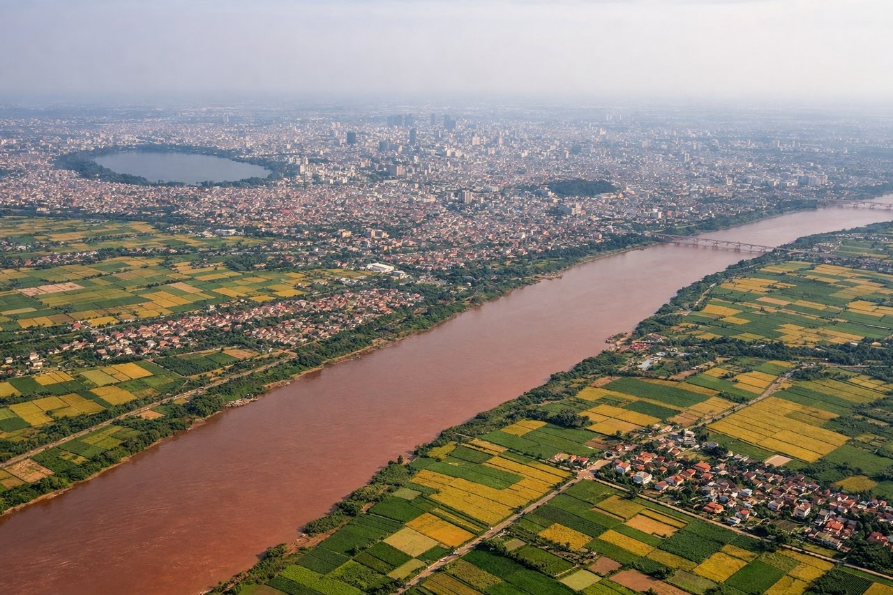
Landing at HAN
LEFTHanoi's Noibai typically uses Runway 29L/11R for international arrivals. Descending from the northeast on approach to Runway 11R, left-side seats provide direct views of the Red River Delta, Haiphong Bay, and the karst limestone formations that dominate the approach corridor.
Landmarks on this routeAll landmarks →
Will your flight be in sunlight?
Pick a date and time in the Sun Map to watch the sun move across your whole flight.
About This Route
Which side of the plane should I sit on flying from Kadala (HTA) to Noibai International (HAN)?
Sit on the Left side of the plane for the best views on flights from Chita to Hanoi. While takeoff favors the right for Siberian geography, the landing approach to Hanoi on the left side offers the more dramatic and sustained visual experience—the Red River Delta and karst formations are among Southeast Asia's most distinctive aerial features and dominate the final 30 minutes of descent.
What can I see during takeoff from Kadala in Chita?
During takeoff from Kadala (HTA), sit on the Right side for the best views. Chita typically departs eastbound (Runway 06/24 operations favor 06 heading). Right-side seats capture the Chita River valley and the transition from the Yablonovy Mountains to the south as you climb out over the Transbaikal region. Notable sights include: Chita River valley (immediate foreground), Yablonovy Mountains (southern ridge, receding), Lake Krasnoye (small, visible 15-20 miles southeast), Trans-Siberian Railway corridor (linear feature threading the valley).
What can I see when landing at Noibai International in Hanoi?
When landing at Noibai International (HAN), sit on the Left side for the best views. Hanoi's Noibai typically uses Runway 29L/11R for international arrivals. Descending from the northeast on approach to Runway 11R, left-side seats provide direct views of the Red River Delta, Haiphong Bay, and the karst limestone formations that dominate the approach corridor. Notable sights include: Red River Delta (extensive agricultural grid, visible 30+ miles out), Haiphong Bay (water body with shipping traffic, southeast of approach path), Karst limestone peaks (Cat Ba Island and surrounding formations, distinctive cone shapes), Hanoi city sprawl (visible 15-20 miles on descent).
How long is the flight from Chita to Hanoi?
The flight from Kadala (HTA) to Noibai International (HAN) takes about 4 hours 45 minutes. The shortest flight path between them is 2,166 miles (3,486 km); winds and air traffic control usually add a few percent.
What does the Chita to Hanoi flight path pass over?
The flight crosses the Yablonovy Mountains (first 90 minutes), then transitions over the Amur River basin and Heilongjiang Province in northeastern China. Around the midpoint (2.5-3 hours), you'll pass over the Amur River itself—a major geographic boundary. The route then crosses into Yunnan and Guangxi provinces, passing east of the Hengduan Mountains. The final approach crosses the Gulf of Tonkin and enters Vietnamese airspace over the Red River Delta. Notable water features include the Amur River (visible as a broad, meandering feature), various Chinese reservoirs in Heilongjiang, and the transition to tropical terrain as you approach Hanoi.