Huế to Hanoi is 355 miles (572 km), a flight of about 1 hour 15 minutes.
Right-side seats capture the Truong Son Mountains during the entire northbound flight, providing sustained scenic interest from takeoff through cruise. While left offers the Red River approach into Hanoi, the mountain views are more visually dramatic and continuous.
Flight Path
Truong Son Mountains running north-south along the western side of the flight corridor; the Gianh River valley (central Vietnam); transition from Hue's tropical coastal plains to the Red River delta's flatter terrain; scattered karst formations visible in the northern approach to Hanoi
Great circle distance and headings ›Phase by phase
Takeoff from HUI
RIGHTRight-side seats offer views of the Truong Son Mountains as the aircraft climbs northwestward from Phu Bai. The range runs parallel to the initial flight path and provides dramatic elevation changes visible from 8,000–15,000 feet.
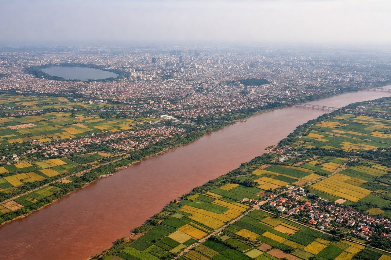
Landing at HAN
LEFTLeft-side seats provide views of the Red River valley and the approach into Hanoi from the south. The river's distinctive serpentine path and the city's sprawl become increasingly visible during descent, especially between 8,000 and 3,000 feet.
Will your flight be in sunlight?
Pick a date and time in the Sun Map to watch the sun move across your whole flight.
About This Route
Which side of the plane should I sit on flying from Phu Bai International Airport (HUI) to Noibai International (HAN)?
Sit on the Right side of the plane for the best views on flights from Huế to Hanoi. Right-side seats capture the Truong Son Mountains during the entire northbound flight, providing sustained scenic interest from takeoff through cruise. While left offers the Red River approach into Hanoi, the mountain views are more visually dramatic and continuous.
What can I see during takeoff from Phu Bai International Airport in Huế?
During takeoff from Phu Bai International Airport (HUI), sit on the Right side for the best views. Right-side seats offer views of the Truong Son Mountains as the aircraft climbs northwestward from Phu Bai. The range runs parallel to the initial flight path and provides dramatic elevation changes visible from 8,000–15,000 feet. Notable sights include: Truong Son Mountains (northwest), Perfume River valley (immediate vicinity), Hue city grid (below), coastal plains extending east toward the South China Sea.
What can I see when landing at Noibai International in Hanoi?
When landing at Noibai International (HAN), sit on the Left side for the best views. Left-side seats provide views of the Red River valley and the approach into Hanoi from the south. The river's distinctive serpentine path and the city's sprawl become increasingly visible during descent, especially between 8,000 and 3,000 feet. Notable sights include: Red River (main approach corridor), Hanoi city sprawl (northern horizon), Truong Son foothills (western side), agricultural plains of the Red River delta.
How long is the flight from Huế to Hanoi?
The flight from Phu Bai International Airport (HUI) to Noibai International (HAN) takes about 1 hour 15 minutes. The shortest flight path between them is 355 miles (572 km); winds and air traffic control usually add a few percent.
What does the Huế to Hanoi flight path pass over?
Truong Son Mountains running north-south along the western side of the flight corridor; the Gianh River valley (central Vietnam); transition from Hue's tropical coastal plains to the Red River delta's flatter terrain; scattered karst formations visible in the northern approach to Hanoi