The left side offers a brief glimpse of the Blue Ridge Mountains during departure and the Indianapolis skyline along the White River during arrival, while the right side shows mostly featureless suburban and farmland terrain throughout.
Flown IAD to IND? Did we get it right?
Flight Path
Washington to Indianapolis is 475 miles (765 km), a flight of about 1 hour 45 minutes.
Appalachian ridge-and-valley terrain in West Virginia, the Ohio River valley near Parkersburg, and flat farmland stretching across Ohio and Indiana
Great circle distance and headings ›Phase by phase
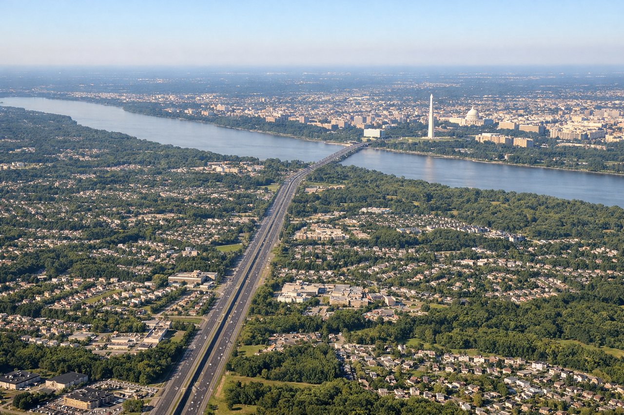
Takeoff from IAD
LEFTDeparting IAD, westbound flights typically bank south before turning onto a westerly heading, giving left-side passengers a brief look at the Piedmont hills and the distant Blue Ridge Mountains and Shenandoah Valley. The right side mostly shows flat Northern Virginia suburbs and highway sprawl.

Landing at IND
LEFTOn approach into IND, the typical southwest-aligned landing pattern (runway 23) brings the aircraft in from the northeast, giving left-side passengers a view across the White River toward the modest Indianapolis downtown skyline. The right side mostly faces open farmland with no distinguishing features.
Will your flight be in sunlight?
Pick a date and time in the Sun Map to watch the sun move across your whole flight.
About This Route
Which side of the plane should I sit on flying from Washington Dulles International (IAD) to Indianapolis International (IND)?
Sit on the Left side of the plane for the best views on flights from Washington to Indianapolis. The left side offers a brief glimpse of the Blue Ridge Mountains during departure and the Indianapolis skyline along the White River during arrival, while the right side shows mostly featureless suburban and farmland terrain throughout.
What can I see during takeoff from Washington Dulles International in Washington?
During takeoff from Washington Dulles International (IAD), sit on the Left side for the best views. Departing IAD, westbound flights typically bank south before turning onto a westerly heading, giving left-side passengers a brief look at the Piedmont hills and the distant Blue Ridge Mountains and Shenandoah Valley. The right side mostly shows flat Northern Virginia suburbs and highway sprawl. Notable sights include: Blue Ridge Mountains, Shenandoah Valley foothills, Potomac River bends, Virginia Piedmont farmland.
What can I see when landing at Indianapolis International in Indianapolis?
When landing at Indianapolis International (IND), sit on the Left side for the best views. On approach into IND, the typical southwest-aligned landing pattern (runway 23) brings the aircraft in from the northeast, giving left-side passengers a view across the White River toward the modest Indianapolis downtown skyline. The right side mostly faces open farmland with no distinguishing features. Notable sights include: Indianapolis downtown skyline, White River, Eagle Creek Reservoir, Indiana farmland grid.
How long is the flight from Washington to Indianapolis?
The flight from Washington Dulles International (IAD) to Indianapolis International (IND) takes about 1 hour 45 minutes. The shortest flight path between them is 475 miles (765 km); winds and air traffic control usually add a few percent.
What does the Washington to Indianapolis flight path pass over?
Appalachian ridge-and-valley terrain in West Virginia, the Ohio River valley near Parkersburg, and flat farmland stretching across Ohio and Indiana