The right side wins overall because the takeoff view over Indianapolis is genuinely rewarding and clear, and during the cruise the right side faces south, giving views of the Ohio River valley crossing and the Kentucky and West Virginia terrain. The left side has a slight edge on landing but the right side delivers more consistently across the full flight.
Flown IND to IAD? Did we get it right?
Flight Path
Indianapolis to Washington is 475 miles (765 km), a flight of about 1 hour 30 minutes.
The flight crosses central Indiana farmland, then the Ohio River near Cincinnati or slightly northeast of it, then into the rolling hills of southern Ohio and West Virginia. The terrain becomes noticeably more dissected and hilly over eastern Kentucky and West Virginia, with the Appalachian ridges becoming visible as the aircraft approaches Virginia. The New River Gorge area of West Virginia may be visible on clear days. The route then crosses the Shenandoah Valley and the Blue Ridge before descending into the Dulles corridor.
Great circle distance and headings ›Phase by phase

Takeoff from IND
RIGHTIND typically departs east on runway 5R/23L or uses runway 14/32. Departing eastward, the right side gives you a clear view back over downtown Indianapolis and the White River corridor as the aircraft banks northeast toward the route. The city grid and Lucas Oil Stadium are identifiable from low altitude.
Landing at IAD
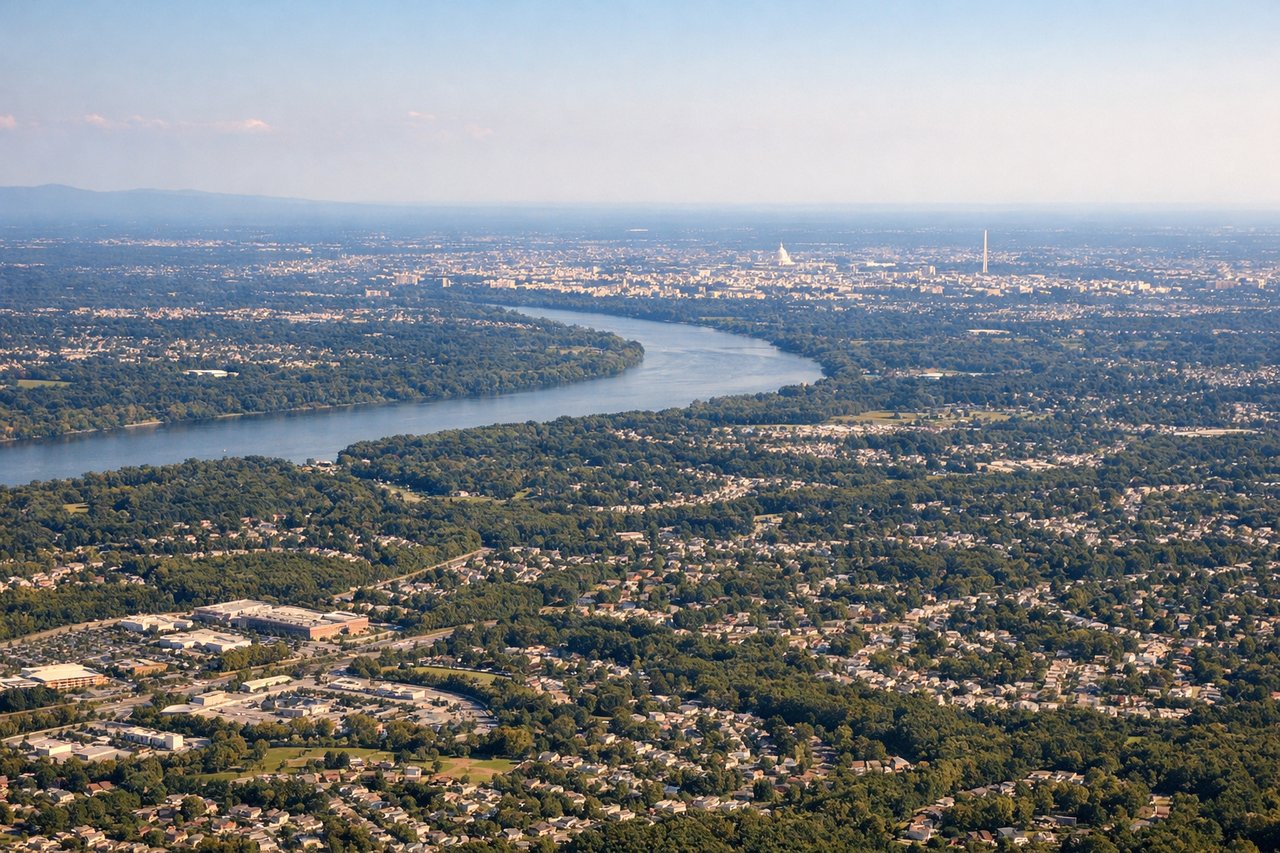
LEFTIAD approaches typically come from the west on runway 19L/R or 01L/R. On a westerly approach heading east, the left side faces south and gives views of the Virginia piedmont, the Potomac River valley, and as you descend, the northern Virginia suburbs. The right side faces north toward Maryland but the left captures the more geographically interesting terrain transition from Blue Ridge foothills to the piedmont.
Will your flight be in sunlight?
Pick a date and time in the Sun Map to watch the sun move across your whole flight.
About This Route
Which side of the plane should I sit on flying from Indianapolis International (IND) to Washington Dulles International (IAD)?
Sit on the Right side of the plane for the best views on flights from Indianapolis to Washington. The right side wins overall because the takeoff view over Indianapolis is genuinely rewarding and clear, and during the cruise the right side faces south, giving views of the Ohio River valley crossing and the Kentucky and West Virginia terrain. The left side has a slight edge on landing but the right side delivers more consistently across the full flight.
What can I see during takeoff from Indianapolis International in Indianapolis?
During takeoff from Indianapolis International (IND), sit on the Right side for the best views. IND typically departs east on runway 5R/23L or uses runway 14/32. Departing eastward, the right side gives you a clear view back over downtown Indianapolis and the White River corridor as the aircraft banks northeast toward the route. The city grid and Lucas Oil Stadium are identifiable from low altitude. Notable sights include: Downtown Indianapolis skyline, Lucas Oil Stadium, White River, Eagle Creek Reservoir to the northwest.
What can I see when landing at Washington Dulles International in Washington?
When landing at Washington Dulles International (IAD), sit on the Left side for the best views. IAD approaches typically come from the west on runway 19L/R or 01L/R. On a westerly approach heading east, the left side faces south and gives views of the Virginia piedmont, the Potomac River valley, and as you descend, the northern Virginia suburbs. The right side faces north toward Maryland but the left captures the more geographically interesting terrain transition from Blue Ridge foothills to the piedmont. Notable sights include: Blue Ridge Mountains on the western horizon, Potomac River valley, Shenandoah Valley, northern Virginia suburban sprawl.
How long is the flight from Indianapolis to Washington?
The flight from Indianapolis International (IND) to Washington Dulles International (IAD) takes about 1 hour 30 minutes. The shortest flight path between them is 475 miles (765 km); winds and air traffic control usually add a few percent.
What does the Indianapolis to Washington flight path pass over?
The flight crosses central Indiana farmland, then the Ohio River near Cincinnati or slightly northeast of it, then into the rolling hills of southern Ohio and West Virginia. The terrain becomes noticeably more dissected and hilly over eastern Kentucky and West Virginia, with the Appalachian ridges becoming visible as the aircraft approaches Virginia. The New River Gorge area of West Virginia may be visible on clear days. The route then crosses the Shenandoah Valley and the Blue Ridge before descending into the Dulles corridor.