The right side tracks the northern edge of the flight path, revealing the Rockies' foothills near the Colorado-New Mexico border, the high plateau around Flagstaff, and on arrival the San Gabriel Mountains and Los Angeles skyline — a far richer set of landmarks than the largely flat plains and open sky visible to the left.
Flown IND to LAX? Did we get it right?
Flight Path
Indianapolis to Los Angeles is 1,810 miles (2,913 km), a flight of about 4 hours 15 minutes.
The route crosses the high plains of western Kansas and southeastern Colorado, passing near the Sangre de Cristo Mountains along the Colorado-New Mexico border before crossing the Colorado Plateau near Flagstaff, Arizona, and the Mojave Desert into Southern California.
Great circle distance and headings ›


Phase by phase

Takeoff from IND
RIGHTDeparting IND on runway 23 (the prevailing configuration) sends the plane southwest over flat central Indiana farmland, so neither side is dramatic, but the right side offers a brief look at Eagle Creek Park and Reservoir and the northwest Indianapolis suburbs before the ground flattens into featureless cropland on both sides.
Landing at LAX
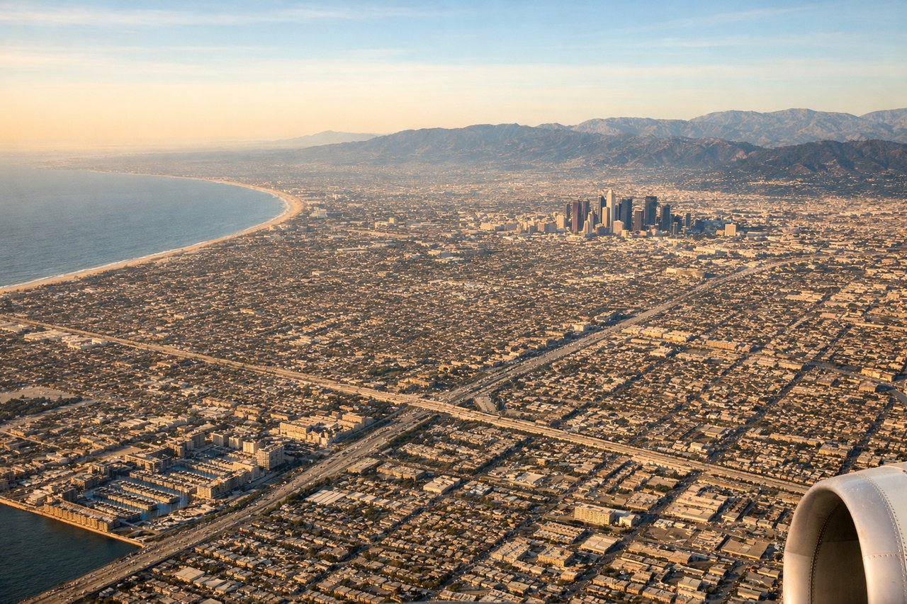
RIGHTOn the typical west-flow arrival into LAX, the aircraft descends from the east across the San Bernardino and San Gabriel Valleys before turning toward the coast, keeping the San Gabriel Mountains and the Downtown Los Angeles skyline prominently on the right, while the left side mostly shows flat suburban sprawl until the ocean appears just before touchdown.
Will your flight be in sunlight?
Pick a date and time in the Sun Map to watch the sun move across your whole flight.
About This Route
Which side of the plane should I sit on flying from Indianapolis International (IND) to Los Angeles International (LAX)?
Sit on the Right side of the plane for the best views on flights from Indianapolis to Los Angeles. The right side tracks the northern edge of the flight path, revealing the Rockies' foothills near the Colorado-New Mexico border, the high plateau around Flagstaff, and on arrival the San Gabriel Mountains and Los Angeles skyline — a far richer set of landmarks than the largely flat plains and open sky visible to the left.
What can I see during takeoff from Indianapolis International in Indianapolis?
During takeoff from Indianapolis International (IND), sit on the Right side for the best views. Departing IND on runway 23 (the prevailing configuration) sends the plane southwest over flat central Indiana farmland, so neither side is dramatic, but the right side offers a brief look at Eagle Creek Park and Reservoir and the northwest Indianapolis suburbs before the ground flattens into featureless cropland on both sides. Notable sights include: Eagle Creek Reservoir, northwest Indianapolis suburbs, patchwork farmland of central Indiana.
What can I see when landing at Los Angeles International in Los Angeles?
When landing at Los Angeles International (LAX), sit on the Right side for the best views. On the typical west-flow arrival into LAX, the aircraft descends from the east across the San Bernardino and San Gabriel Valleys before turning toward the coast, keeping the San Gabriel Mountains and the Downtown Los Angeles skyline prominently on the right, while the left side mostly shows flat suburban sprawl until the ocean appears just before touchdown. Notable sights include: San Gabriel Mountains, Downtown Los Angeles skyline, San Gabriel Valley sprawl, Santa Monica Bay ahead.
How long is the flight from Indianapolis to Los Angeles?
The flight from Indianapolis International (IND) to Los Angeles International (LAX) takes about 4 hours 15 minutes. The shortest flight path between them is 1,810 miles (2,913 km); winds and air traffic control usually add a few percent.
What does the Indianapolis to Los Angeles flight path pass over?
The route crosses the high plains of western Kansas and southeastern Colorado, passing near the Sangre de Cristo Mountains along the Colorado-New Mexico border before crossing the Colorado Plateau near Flagstaff, Arizona, and the Mojave Desert into Southern California.