The right side wins on cruise variety, with distant views of the southern Rocky Mountain foothills, the red-rock canyon country of southern Utah near Lake Powell and Zion, and then the iconic Las Vegas Strip lined up on final approach. The left side offers a solid Blue Ridge takeoff and a possible Lake Mead glimpse, but overall has fewer standout moments.
Flown IAD to LAS? Did we get it right?
Flight Path
Washington to Las Vegas is 2,061 miles (3,316 km), a flight of about 4 hours 50 minutes.
The route crosses the Ohio Valley and Great Plains before reaching the southern Rocky Mountain foothills near the Sangre de Cristo/San Juan ranges, then continues over the Four Corners region and the red-rock plateau country of southern Utah (Lake Powell and Zion vicinity) before descending across the Mojave Desert into the Las Vegas Valley.
Great circle distance and headings ›


Phase by phase
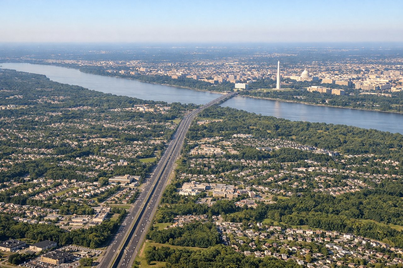
Takeoff from IAD
LEFTClimbing out westbound from Dulles, the left side faces south across the Piedmont toward the layered ridgelines of the Blue Ridge Mountains and the Shenandoah Valley, the first real relief after the flat Northern Virginia suburbs. The right side mostly shows flatter farmland toward Maryland with less definition.
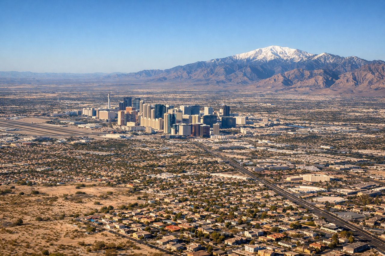
Landing at LAS
RIGHTArriving from the east, flights descend into Las Vegas and typically land westbound on runway 26, which puts the Strip's hotel towers just off the nose on the right side during final approach. The Spring Mountains rise beyond the valley as a dramatic backdrop, something the left side, facing mostly open desert, doesn't get.
Will your flight be in sunlight?
Pick a date and time in the Sun Map to watch the sun move across your whole flight.
About This Route
Which side of the plane should I sit on flying from Washington Dulles International (IAD) to Mc Carran International (LAS)?
Sit on the Right side of the plane for the best views on flights from Washington to Las Vegas. The right side wins on cruise variety, with distant views of the southern Rocky Mountain foothills, the red-rock canyon country of southern Utah near Lake Powell and Zion, and then the iconic Las Vegas Strip lined up on final approach. The left side offers a solid Blue Ridge takeoff and a possible Lake Mead glimpse, but overall has fewer standout moments.
What can I see during takeoff from Washington Dulles International in Washington?
During takeoff from Washington Dulles International (IAD), sit on the Left side for the best views. Climbing out westbound from Dulles, the left side faces south across the Piedmont toward the layered ridgelines of the Blue Ridge Mountains and the Shenandoah Valley, the first real relief after the flat Northern Virginia suburbs. The right side mostly shows flatter farmland toward Maryland with less definition. Notable sights include: Blue Ridge Mountains, Shenandoah Valley, Bull Run Mountains, Piedmont farmland.
What can I see when landing at Mc Carran International in Las Vegas?
When landing at Mc Carran International (LAS), sit on the Right side for the best views. Arriving from the east, flights descend into Las Vegas and typically land westbound on runway 26, which puts the Strip's hotel towers just off the nose on the right side during final approach. The Spring Mountains rise beyond the valley as a dramatic backdrop, something the left side, facing mostly open desert, doesn't get. Notable sights include: Las Vegas Strip, Downtown Las Vegas, Spring Mountains, Las Vegas Valley desert floor.
How long is the flight from Washington to Las Vegas?
The flight from Washington Dulles International (IAD) to Mc Carran International (LAS) takes about 4 hours 50 minutes. The shortest flight path between them is 2,061 miles (3,316 km); winds and air traffic control usually add a few percent.
What does the Washington to Las Vegas flight path pass over?
The route crosses the Ohio Valley and Great Plains before reaching the southern Rocky Mountain foothills near the Sangre de Cristo/San Juan ranges, then continues over the Four Corners region and the red-rock plateau country of southern Utah (Lake Powell and Zion vicinity) before descending across the Mojave Desert into the Las Vegas Valley.