Washington to Santa Fe is 1,584 miles (2,550 km), a flight of about 3 hours 30 minutes.
The right side wins overall because the approach into Santa Fe on the right is genuinely spectacular — the Sangre de Cristo and Jemez Mountains framing the high desert city is one of the more dramatic arrival views in the American Southwest. The left side takeoff from Dulles is good but the right side more than compensates across the full flight.
Flight Path
The flight crosses the Appalachian ridges briefly after departure, then transitions to the flat Ohio and Indiana farmland, followed by the Missouri Ozarks, then the Oklahoma and Texas panhandle high plains. The most dramatic midpoint geography is crossing into New Mexico where the Sangre de Cristo range and the high desert plateau of the Colorado Plateau begin to dominate, with the Rio Grande rift valley visible on descent.
Great circle distance and headings ›.jpeg?width=600)

.jpg?width=600)
Phase by phase
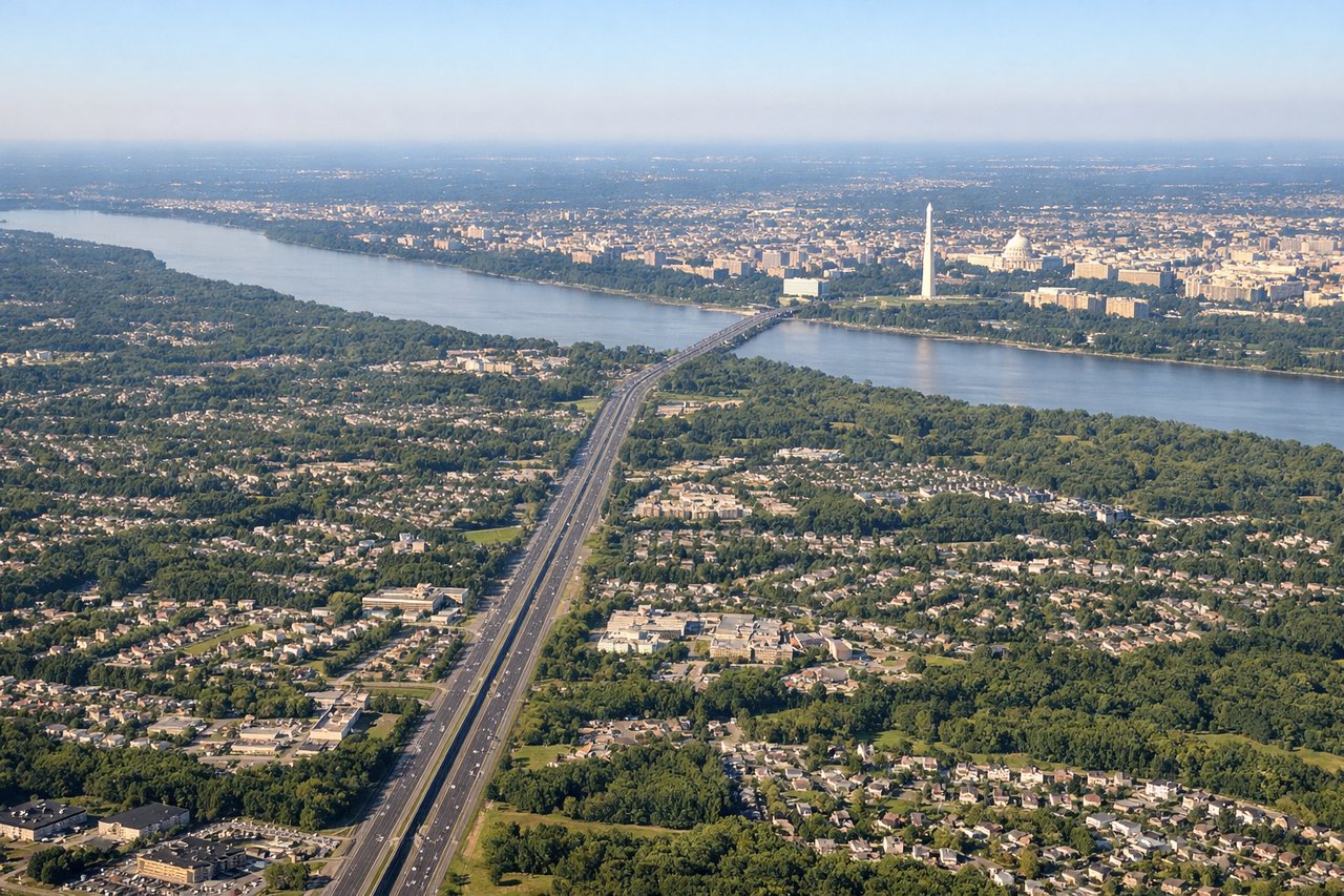
Takeoff from IAD
LEFTDulles typically departs westbound on runway 19R/01L or eastbound on 30. On a westbound departure toward Santa Fe, climbing out to the west and southwest, the left side picks up the Blue Ridge Mountains and Shenandoah Valley as the aircraft turns. The right side faces north toward suburban sprawl with less visual interest.
Landing at SAF
RIGHTSanta Fe Municipal typically uses runway 02/20, with arrivals often from the south or southeast on runway 20. On approach from the east-northeast, the right side faces south and southwest, giving a direct view of the Jemez Mountains, the Rio Grande valley, and the Sangre de Cristo Mountains framing Santa Fe itself. The left side looks north toward less dramatic terrain.
Landmarks on this routeAll landmarks →
Will your flight be in sunlight?
Pick a date and time in the Sun Map to watch the sun move across your whole flight.
About This Route
Which side of the plane should I sit on flying from Washington Dulles International (IAD) to Santa Fe Muni (SAF)?
Sit on the Right side of the plane for the best views on flights from Washington to Santa Fe. The right side wins overall because the approach into Santa Fe on the right is genuinely spectacular — the Sangre de Cristo and Jemez Mountains framing the high desert city is one of the more dramatic arrival views in the American Southwest. The left side takeoff from Dulles is good but the right side more than compensates across the full flight.
What can I see during takeoff from Washington Dulles International in Washington?
During takeoff from Washington Dulles International (IAD), sit on the Left side for the best views. Dulles typically departs westbound on runway 19R/01L or eastbound on 30. On a westbound departure toward Santa Fe, climbing out to the west and southwest, the left side picks up the Blue Ridge Mountains and Shenandoah Valley as the aircraft turns. The right side faces north toward suburban sprawl with less visual interest. Notable sights include: Blue Ridge Mountains, Shenandoah Valley, Loudoun County farmland patchwork, Potomac River visible briefly to the northeast.
What can I see when landing at Santa Fe Muni in Santa Fe?
When landing at Santa Fe Muni (SAF), sit on the Right side for the best views. Santa Fe Municipal typically uses runway 02/20, with arrivals often from the south or southeast on runway 20. On approach from the east-northeast, the right side faces south and southwest, giving a direct view of the Jemez Mountains, the Rio Grande valley, and the Sangre de Cristo Mountains framing Santa Fe itself. The left side looks north toward less dramatic terrain. Notable sights include: Sangre de Cristo Mountains, Jemez Mountains, Rio Grande valley, Santa Fe city grid and downtown plaza area.
How long is the flight from Washington to Santa Fe?
The flight from Washington Dulles International (IAD) to Santa Fe Muni (SAF) takes about 3 hours 30 minutes. The shortest flight path between them is 1,584 miles (2,550 km); winds and air traffic control usually add a few percent.
What does the Washington to Santa Fe flight path pass over?
The flight crosses the Appalachian ridges briefly after departure, then transitions to the flat Ohio and Indiana farmland, followed by the Missouri Ozarks, then the Oklahoma and Texas panhandle high plains. The most dramatic midpoint geography is crossing into New Mexico where the Sangre de Cristo range and the high desert plateau of the Colorado Plateau begin to dominate, with the Rio Grande rift valley visible on descent.