Santa Fe to Washington is 1,584 miles (2,550 km), a flight of about 4 hours 15 minutes.
Right-side seats capture the dramatic Sangre de Cristo Mountains during departure, which is the most visually striking single feature on this route. While left-side landing views are good, the takeoff scenery from the right is more distinctive and memorable.
Flight Path
Oklahoma Panhandle (flat, sparse terrain), Texas Panhandle (Llano Estacado caprock visible as subtle escarpment), Arkansas River valley (linear vegetation feature), Ozark Plateau (rolling forested terrain in Missouri and Arkansas), Mississippi River valley (broad floodplain visible as lighter terrain with meandering river course), Appalachian foothills (eastern approach to Dulles)
Great circle distance and headings ›.jpg?width=600)

.jpeg?width=600)
Phase by phase
Takeoff from SAF
RIGHTRight-side seats offer views of the Sangre de Cristo Mountains immediately east of Santa Fe during climb-out. The aircraft departs northeast, so the right wing points toward these dramatic peaks as you gain altitude over the high desert plateau.
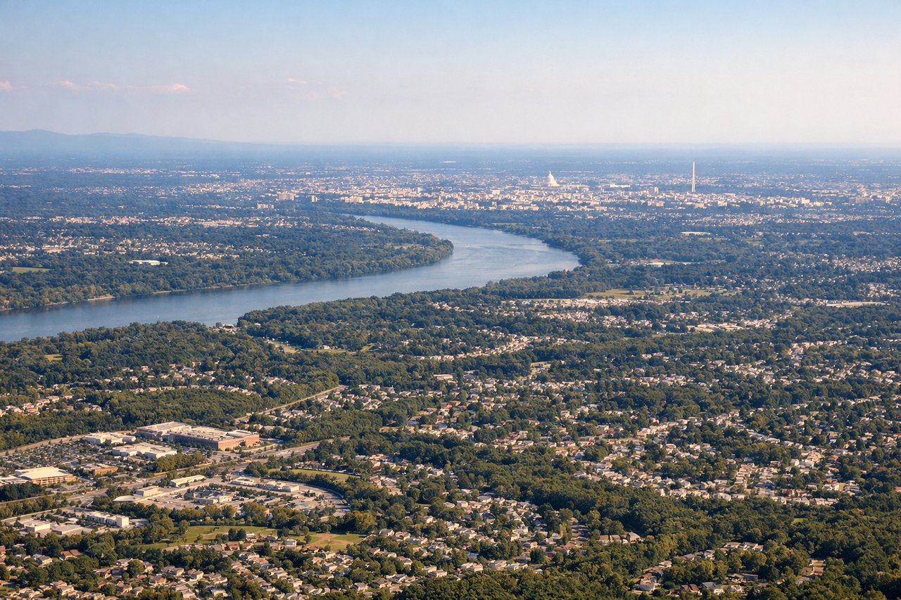
Landing at IAD
LEFTLeft-side seats provide excellent views during the descent approach to Dulles. The aircraft descends from the west over the Piedmont region, and left-side windows face north toward the Blue Ridge Mountains and south toward the Appalachian foothills, both prominent on approach.
Landmarks on this routeAll landmarks →
Will your flight be in sunlight?
Pick a date and time in the Sun Map to watch the sun move across your whole flight.
About This Route
Which side of the plane should I sit on flying from Santa Fe Muni (SAF) to Washington Dulles International (IAD)?
Sit on the Right side of the plane for the best views on flights from Santa Fe to Washington. Right-side seats capture the dramatic Sangre de Cristo Mountains during departure, which is the most visually striking single feature on this route. While left-side landing views are good, the takeoff scenery from the right is more distinctive and memorable.
What can I see during takeoff from Santa Fe Muni in Santa Fe?
During takeoff from Santa Fe Muni (SAF), sit on the Right side for the best views. Right-side seats offer views of the Sangre de Cristo Mountains immediately east of Santa Fe during climb-out. The aircraft departs northeast, so the right wing points toward these dramatic peaks as you gain altitude over the high desert plateau. Notable sights include: Sangre de Cristo Mountains (eastern escarpment), Santa Fe city grid below, Jemez Mountains (northwest, distant), Rio Grande valley (west, visible as linear vegetation corridor).
What can I see when landing at Washington Dulles International in Washington?
When landing at Washington Dulles International (IAD), sit on the Left side for the best views. Left-side seats provide excellent views during the descent approach to Dulles. The aircraft descends from the west over the Piedmont region, and left-side windows face north toward the Blue Ridge Mountains and south toward the Appalachian foothills, both prominent on approach. Notable sights include: Blue Ridge Mountains (north, visible as ridgeline), Appalachian foothills (south and southeast), Potomac River valley (visible as linear feature), Washington DC urban sprawl (approaching from west).
How long is the flight from Santa Fe to Washington?
The flight from Santa Fe Muni (SAF) to Washington Dulles International (IAD) takes about 4 hours 15 minutes. The shortest flight path between them is 1,584 miles (2,550 km); winds and air traffic control usually add a few percent.
What does the Santa Fe to Washington flight path pass over?
Oklahoma Panhandle (flat, sparse terrain), Texas Panhandle (Llano Estacado caprock visible as subtle escarpment), Arkansas River valley (linear vegetation feature), Ozark Plateau (rolling forested terrain in Missouri and Arkansas), Mississippi River valley (broad floodplain visible as lighter terrain with meandering river course), Appalachian foothills (eastern approach to Dulles)