Santa Fe to Denver is 303 miles (488 km), a flight of about 1 hour 5 minutes.
The left side wins both takeoff and landing. During the cruise portion heading north-northeast, the left side also tracks closer to the Sangre de Cristo range transitioning to the Spanish Peaks and Wet Mountains of southern Colorado, offering continuous mountain reference points along the western horizon.
Flight Path
The flight crosses the Taos Plateau and Rio Grande del Norte National Monument in southern New Mexico, then tracks over the San Luis Valley — a broad flat graben valley flanked by the Sangre de Cristo Mountains to the east and the San Juan Mountains to the west. The Spanish Peaks near Walsenburg are a distinctive landmark on the left side. The southern Colorado plains then give way to the Denver Basin as you descend.
Great circle distance and headings ›.jpg?width=600)
.jpg?width=600)
Phase by phase
Takeoff from SAF
LEFTSanta Fe Municipal typically departs runway 20 (southbound) or runway 02 (northbound). On a northbound departure toward Denver, the left (west) side gives you the Jemez Mountains and the Rio Grande canyon cutting through the plateau. The Sangre de Cristo Mountains dominate the right side but the western view captures the broader high desert mesa landscape with the Rio Grande gorge visible.
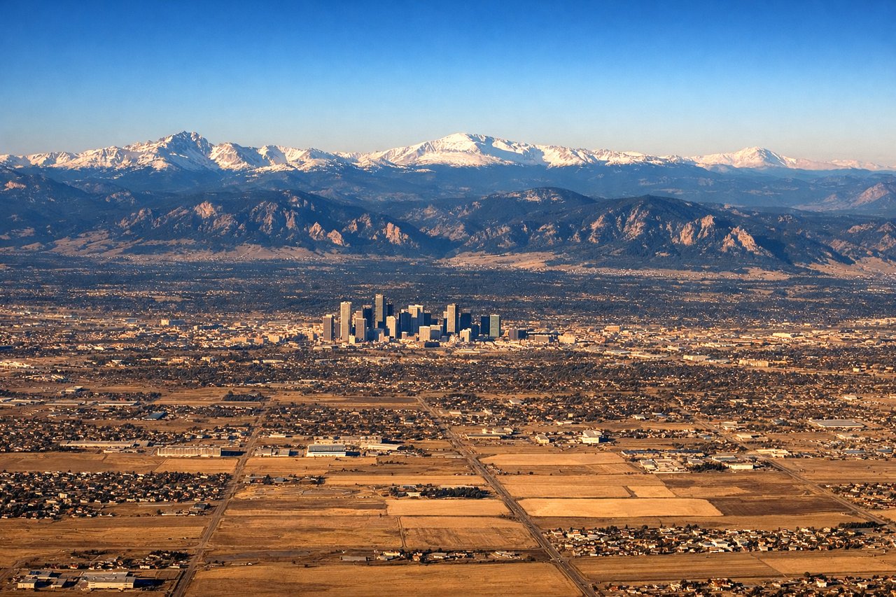
Landing at DEN
LEFTDenver International sits on the plains east of the city, and aircraft typically approach from the south or southeast on runways oriented roughly north-south. On approach from the south, the left (west) side gives a clear view of the Denver skyline against the Front Range backdrop, with the Rocky Mountain foothills and the distinctive white tent roof of DEN itself visible. This is the classic Colorado postcard view.
Landmarks on this routeAll landmarks →
Will your flight be in sunlight?
Pick a date and time in the Sun Map to watch the sun move across your whole flight.
About This Route
Which side of the plane should I sit on flying from Santa Fe Muni (SAF) to Denver International (DEN)?
Sit on the Left side of the plane for the best views on flights from Santa Fe to Denver. The left side wins both takeoff and landing. During the cruise portion heading north-northeast, the left side also tracks closer to the Sangre de Cristo range transitioning to the Spanish Peaks and Wet Mountains of southern Colorado, offering continuous mountain reference points along the western horizon.
What can I see during takeoff from Santa Fe Muni in Santa Fe?
During takeoff from Santa Fe Muni (SAF), sit on the Left side for the best views. Santa Fe Municipal typically departs runway 20 (southbound) or runway 02 (northbound). On a northbound departure toward Denver, the left (west) side gives you the Jemez Mountains and the Rio Grande canyon cutting through the plateau. The Sangre de Cristo Mountains dominate the right side but the western view captures the broader high desert mesa landscape with the Rio Grande gorge visible. Notable sights include: Sangre de Cristo Mountains (right/east), Jemez Mountains (left/west), Rio Grande canyon and plateau, Santa Fe city grid below.
What can I see when landing at Denver International in Denver?
When landing at Denver International (DEN), sit on the Left side for the best views. Denver International sits on the plains east of the city, and aircraft typically approach from the south or southeast on runways oriented roughly north-south. On approach from the south, the left (west) side gives a clear view of the Denver skyline against the Front Range backdrop, with the Rocky Mountain foothills and the distinctive white tent roof of DEN itself visible. This is the classic Colorado postcard view. Notable sights include: Denver skyline against the Front Range, Rocky Mountain foothills, DEN's white tensile roof structure, the flat checkerboard of the Denver metro grid.
How long is the flight from Santa Fe to Denver?
The flight from Santa Fe Muni (SAF) to Denver International (DEN) takes about 1 hour 5 minutes. The shortest flight path between them is 303 miles (488 km); winds and air traffic control usually add a few percent.
What does the Santa Fe to Denver flight path pass over?
The flight crosses the Taos Plateau and Rio Grande del Norte National Monument in southern New Mexico, then tracks over the San Luis Valley — a broad flat graben valley flanked by the Sangre de Cristo Mountains to the east and the San Juan Mountains to the west. The Spanish Peaks near Walsenburg are a distinctive landmark on the left side. The southern Colorado plains then give way to the Denver Basin as you descend.