Houston to Alexandria is 190 miles (306 km), a flight of about 45 minutes.
While takeoff offers industrial and waterway interest on the left, the landing approach on the right provides more visually distinctive natural features—the Cane River's curves and the transition from forest to developed area are more compelling than Houston's sprawl. Right side captures the more scenic portion of this short regional flight.
Flight Path
The flight path crosses central Louisiana's relatively flat terrain, passing over mixed pine and hardwood forests, scattered small towns, and agricultural areas. The Neches River and Sabine River valleys may be visible depending on exact routing. The landscape transitions gradually from the Houston coastal plain's industrial character to the piney woods and farmland of east-central Louisiana.
Great circle distance and headings ›Phase by phase
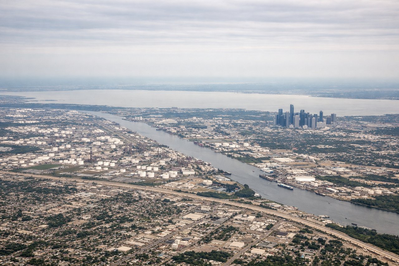
Takeoff from IAH
LEFTLeft side offers views of the Houston Ship Channel and Galveston Bay as the aircraft climbs northeast out of IAH. You'll see the industrial corridor and water features that define the Houston metro area's eastern edge.
Landing at AEX
RIGHTRight side provides views of the Cane River and the Alexandria urban area during descent. You'll see the river's distinctive curves and the city's layout along the waterway as you approach AEX from the northeast.
Landmarks on this routeAll landmarks →
Will your flight be in sunlight?
Pick a date and time in the Sun Map to watch the sun move across your whole flight.
About This Route
Which side of the plane should I sit on flying from George Bush Intcntl Houston (IAH) to Alexandria International (AEX)?
Sit on the Right side of the plane for the best views on flights from Houston to Alexandria. While takeoff offers industrial and waterway interest on the left, the landing approach on the right provides more visually distinctive natural features—the Cane River's curves and the transition from forest to developed area are more compelling than Houston's sprawl. Right side captures the more scenic portion of this short regional flight.
What can I see during takeoff from George Bush Intcntl Houston in Houston?
During takeoff from George Bush Intcntl Houston (IAH), sit on the Left side for the best views. Left side offers views of the Houston Ship Channel and Galveston Bay as the aircraft climbs northeast out of IAH. You'll see the industrial corridor and water features that define the Houston metro area's eastern edge. Notable sights include: Houston Ship Channel, Galveston Bay, Trinity River confluence, Port of Houston industrial complex.
What can I see when landing at Alexandria International in Alexandria?
When landing at Alexandria International (AEX), sit on the Right side for the best views. Right side provides views of the Cane River and the Alexandria urban area during descent. You'll see the river's distinctive curves and the city's layout along the waterway as you approach AEX from the northeast. Notable sights include: Cane River, Alexandria city center, Red River valley, Louisiana pine forests.
How long is the flight from Houston to Alexandria?
The flight from George Bush Intcntl Houston (IAH) to Alexandria International (AEX) takes about 45 minutes. The shortest flight path between them is 190 miles (306 km); winds and air traffic control usually add a few percent.
What does the Houston to Alexandria flight path pass over?
The flight path crosses central Louisiana's relatively flat terrain, passing over mixed pine and hardwood forests, scattered small towns, and agricultural areas. The Neches River and Sabine River valleys may be visible depending on exact routing. The landscape transitions gradually from the Houston coastal plain's industrial character to the piney woods and farmland of east-central Louisiana.