While both sides cross the same long stretch of flat Great Plains and Canadian prairie, the right side delivers the flight's two best moments: a skyline glimpse during the Houston departure turn and a genuinely spectacular Anchorage approach with Denali and the Chugach Mountains in view, edging out the left side's more subtle Rockies and Wrangell-St. Elias glimpses at cruise altitude.
Flown IAH to ANC? Did we get it right?
Flight Path
Houston to Anchorage is 3,261 miles (5,248 km), a flight of about 6 hours 45 minutes.
Great Plains of Kansas and Nebraska, Canadian prairies of Saskatchewan/Alberta, the eastern foothills of the Canadian Rockies, and the remote icefields of the Wrangell-St. Elias Range near the Yukon-Alaska border
Great circle distance and headings ›


Phase by phase

Takeoff from IAH
RIGHTIAH departures often roll south on runway 15 before banking onto the northwest course toward Anchorage, and that turn swings downtown Houston's skyline and Lake Houston into view on the right side. The left side mostly shows flat, undifferentiated suburban sprawl.
Landing at ANC
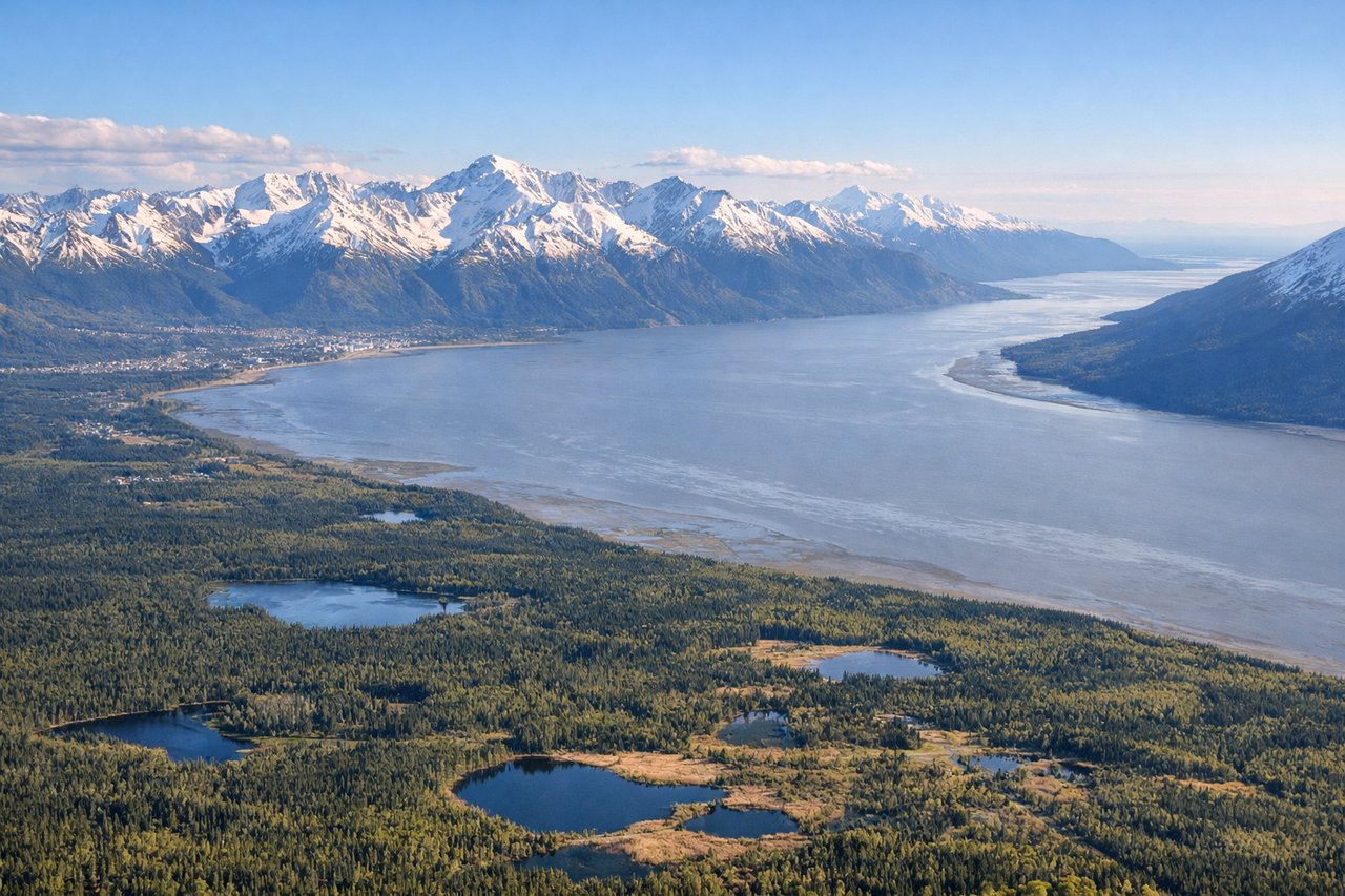
RIGHTOn the descent into Anchorage the flight path approaches from the northeast, and the right side faces north across the Susitna lowlands toward the Alaska Range, where Denali's massive summit is visible in the distance on clear days. The Chugach Mountains and Knik Arm also unfold on this side as the city comes into view below.
Will your flight be in sunlight?
Pick a date and time in the Sun Map to watch the sun move across your whole flight.
About This Route
Which side of the plane should I sit on flying from George Bush Intcntl Houston (IAH) to Ted Stevens Anchorage International (ANC)?
Sit on the Right side of the plane for the best views on flights from Houston to Anchorage. While both sides cross the same long stretch of flat Great Plains and Canadian prairie, the right side delivers the flight's two best moments: a skyline glimpse during the Houston departure turn and a genuinely spectacular Anchorage approach with Denali and the Chugach Mountains in view, edging out the left side's more subtle Rockies and Wrangell-St. Elias glimpses at cruise altitude.
What can I see during takeoff from George Bush Intcntl Houston in Houston?
During takeoff from George Bush Intcntl Houston (IAH), sit on the Right side for the best views. IAH departures often roll south on runway 15 before banking onto the northwest course toward Anchorage, and that turn swings downtown Houston's skyline and Lake Houston into view on the right side. The left side mostly shows flat, undifferentiated suburban sprawl. Notable sights include: Downtown Houston skyline, Lake Houston, IAH terminal complex, Houston's northern suburban grid.
What can I see when landing at Ted Stevens Anchorage International in Anchorage?
When landing at Ted Stevens Anchorage International (ANC), sit on the Right side for the best views. On the descent into Anchorage the flight path approaches from the northeast, and the right side faces north across the Susitna lowlands toward the Alaska Range, where Denali's massive summit is visible in the distance on clear days. The Chugach Mountains and Knik Arm also unfold on this side as the city comes into view below. Notable sights include: Denali (Mount McKinley), Alaska Range, Chugach Mountains, Knik Arm.
How long is the flight from Houston to Anchorage?
The flight from George Bush Intcntl Houston (IAH) to Ted Stevens Anchorage International (ANC) takes about 6 hours 45 minutes. The shortest flight path between them is 3,261 miles (5,248 km); winds and air traffic control usually add a few percent.
What does the Houston to Anchorage flight path pass over?
Great Plains of Kansas and Nebraska, Canadian prairies of Saskatchewan/Alberta, the eastern foothills of the Canadian Rockies, and the remote icefields of the Wrangell-St. Elias Range near the Yukon-Alaska border