The left side captures both the Houston skyline/bay area on departure and the striking turquoise reef and cayes on arrival, while the right side offers mostly flat terrain and open Gulf water with little variation.
Flown IAH to BZE? Did we get it right?
Flight Path
Houston to Belize City is 968 miles (1,557 km), a flight of about 2 hours 10 minutes.
Open Gulf of Mexico waters giving way to the low, flat Yucatan Peninsula coastline near Chetumal Bay before descending into Belize's coastal cayes and barrier reef.
Great circle distance and headings ›Phase by phase
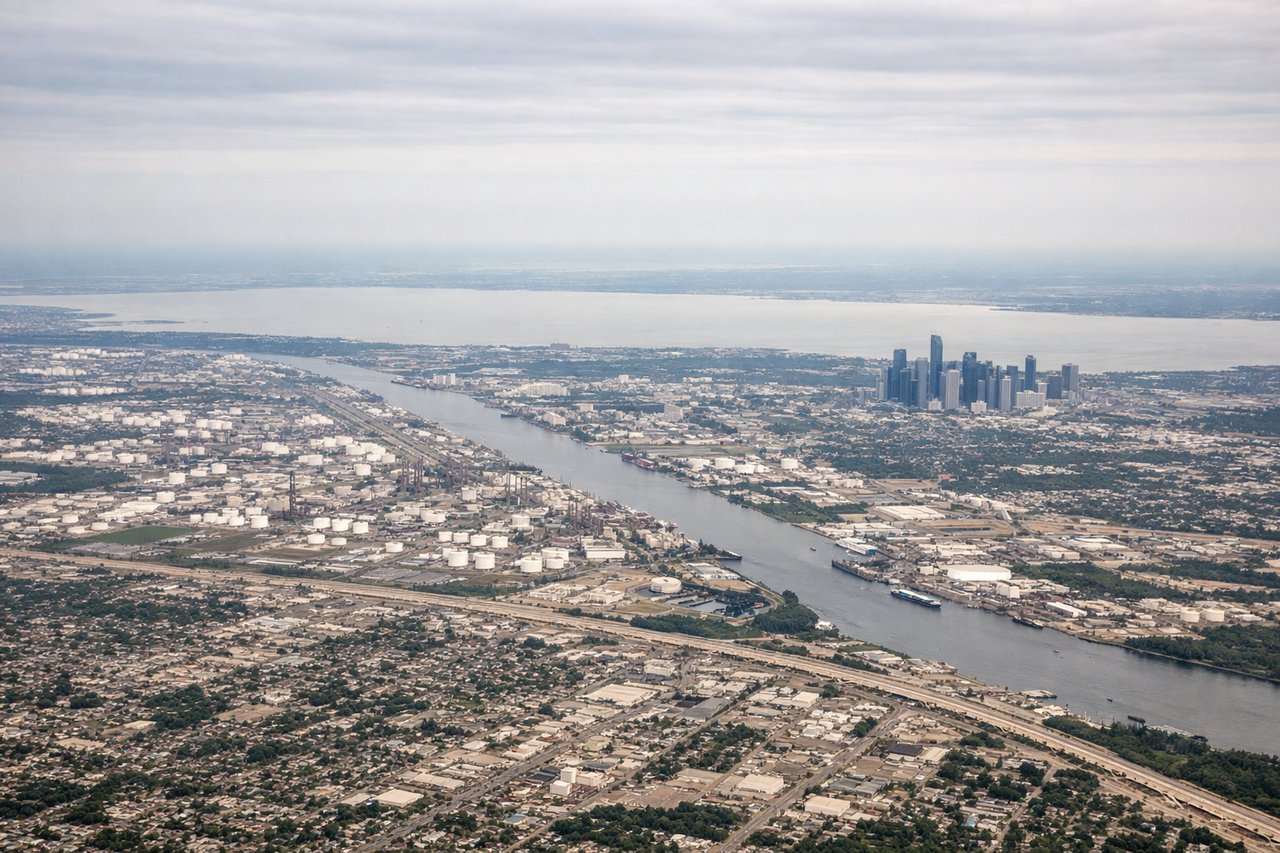
Takeoff from IAH
LEFTDeparting IAH southbound on the 15 runways, the initial turn and climb put downtown Houston's skyline and the Ship Channel/Galveston Bay area on the left (east) side, while the right side shows only flat suburban sprawl.
Landing at BZE
LEFTOn approach into Belize City from the north over the Caribbean, the aircraft tracks along the coast where the turquoise shallows, cayes, and the Belize Barrier Reef are visible on the left side before the final turn onto runway 07/25.
Will your flight be in sunlight?
Pick a date and time in the Sun Map to watch the sun move across your whole flight.
About This Route
Which side of the plane should I sit on flying from George Bush Intcntl Houston (IAH) to Philip S W Goldson International (BZE)?
Sit on the Left side of the plane for the best views on flights from Houston to Belize City. The left side captures both the Houston skyline/bay area on departure and the striking turquoise reef and cayes on arrival, while the right side offers mostly flat terrain and open Gulf water with little variation.
What can I see during takeoff from George Bush Intcntl Houston in Houston?
During takeoff from George Bush Intcntl Houston (IAH), sit on the Left side for the best views. Departing IAH southbound on the 15 runways, the initial turn and climb put downtown Houston's skyline and the Ship Channel/Galveston Bay area on the left (east) side, while the right side shows only flat suburban sprawl. Notable sights include: Downtown Houston skyline, Houston Ship Channel, Galveston Bay.
What can I see when landing at Philip S W Goldson International in Belize City?
When landing at Philip S W Goldson International (BZE), sit on the Left side for the best views. On approach into Belize City from the north over the Caribbean, the aircraft tracks along the coast where the turquoise shallows, cayes, and the Belize Barrier Reef are visible on the left side before the final turn onto runway 07/25. Notable sights include: Belize Barrier Reef, Turneffe Atoll, Ambergris Caye, Belize City coastline.
How long is the flight from Houston to Belize City?
The flight from George Bush Intcntl Houston (IAH) to Philip S W Goldson International (BZE) takes about 2 hours 10 minutes. The shortest flight path between them is 968 miles (1,557 km); winds and air traffic control usually add a few percent.
What does the Houston to Belize City flight path pass over?
Open Gulf of Mexico waters giving way to the low, flat Yucatan Peninsula coastline near Chetumal Bay before descending into Belize's coastal cayes and barrier reef.