The takeoff from Houston offers more dramatic urban scenery and water features than the landing approach into Midland, which crosses monotonous High Plains terrain. Left seats capture the Houston metropolitan area and Ship Channel clearly during departure.
Flown IAH to MAF? Did we get it right?
Flight Path
Houston to Midland is 428 miles (689 km), a flight of about 1 hour 15 minutes.
The flight path crosses central Texas High Plains with scattered ranch land, small towns including Hearne and Calvert, and the gradually flattening terrain transitioning from the Gulf Coastal Plain into the Permian Basin. No major mountain ranges or significant water bodies are visible along this route at cruise altitude.
Great circle distance and headings ›Phase by phase
Takeoff from IAH
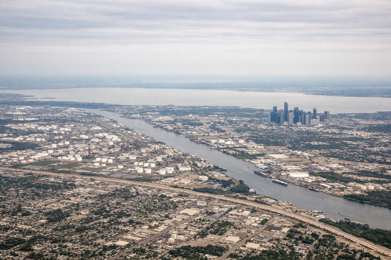
LEFTLeft side offers views of the Houston metropolitan area, including downtown skyline and the Ship Channel corridor. The aircraft departs westbound, so the left wing shows the city grid and urban sprawl spreading inland.
Landing at MAF
RIGHTRight side provides views of the Permian Basin landscape and the approach into Midland. As the aircraft descends from the east, the right wing shows the characteristic flat, arid terrain with scattered oil derricks and the city of Midland itself.
Will your flight be in sunlight?
Pick a date and time in the Sun Map to watch the sun move across your whole flight.
About This Route
Which side of the plane should I sit on flying from George Bush Intcntl Houston (IAH) to Midland International (MAF)?
Sit on the Left side of the plane for the best views on flights from Houston to Midland. The takeoff from Houston offers more dramatic urban scenery and water features than the landing approach into Midland, which crosses monotonous High Plains terrain. Left seats capture the Houston metropolitan area and Ship Channel clearly during departure.
What can I see during takeoff from George Bush Intcntl Houston in Houston?
During takeoff from George Bush Intcntl Houston (IAH), sit on the Left side for the best views. Left side offers views of the Houston metropolitan area, including downtown skyline and the Ship Channel corridor. The aircraft departs westbound, so the left wing shows the city grid and urban sprawl spreading inland. Notable sights include: Downtown Houston skyline, Houston Ship Channel, Galveston Bay (distant southeast), Lake Houston.
What can I see when landing at Midland International in Midland?
When landing at Midland International (MAF), sit on the Right side for the best views. Right side provides views of the Permian Basin landscape and the approach into Midland. As the aircraft descends from the east, the right wing shows the characteristic flat, arid terrain with scattered oil derricks and the city of Midland itself. Notable sights include: Midland city lights and urban area, Permian Basin oil fields, flat High Plains terrain, Andrews County landscape.
How long is the flight from Houston to Midland?
The flight from George Bush Intcntl Houston (IAH) to Midland International (MAF) takes about 1 hour 15 minutes. The shortest flight path between them is 428 miles (689 km); winds and air traffic control usually add a few percent.
What does the Houston to Midland flight path pass over?
The flight path crosses central Texas High Plains with scattered ranch land, small towns including Hearne and Calvert, and the gradually flattening terrain transitioning from the Gulf Coastal Plain into the Permian Basin. No major mountain ranges or significant water bodies are visible along this route at cruise altitude.