The left side has a decent Houston departure view, but the right side delivers the payoff on arrival with Camelback Mountain, the McDowell range, and Four Peaks on final into PHX. The desert mountain scenery approaching Phoenix is more visually dramatic than anything on the left during the flat Texas and New Mexico cruise.
Flown IAH to PHX? Did we get it right?
Flight Path
Houston to Phoenix is 1,007 miles (1,620 km), a flight of about 2 hours 45 minutes.
The flight tracks northwest over the Texas Hill Country west of San Antonio, then crosses the Chihuahuan Desert of far west Texas near the Davis Mountains and Trans-Pecos region. Over New Mexico, the route passes north of El Paso and the Franklin Mountains, then crosses the desolate Lordsburg Playa and the Gila River valley in southern Arizona before descending into the Phoenix Basin through the Sonoran Desert.
Great circle distance and headings ›Phase by phase
Takeoff from IAH
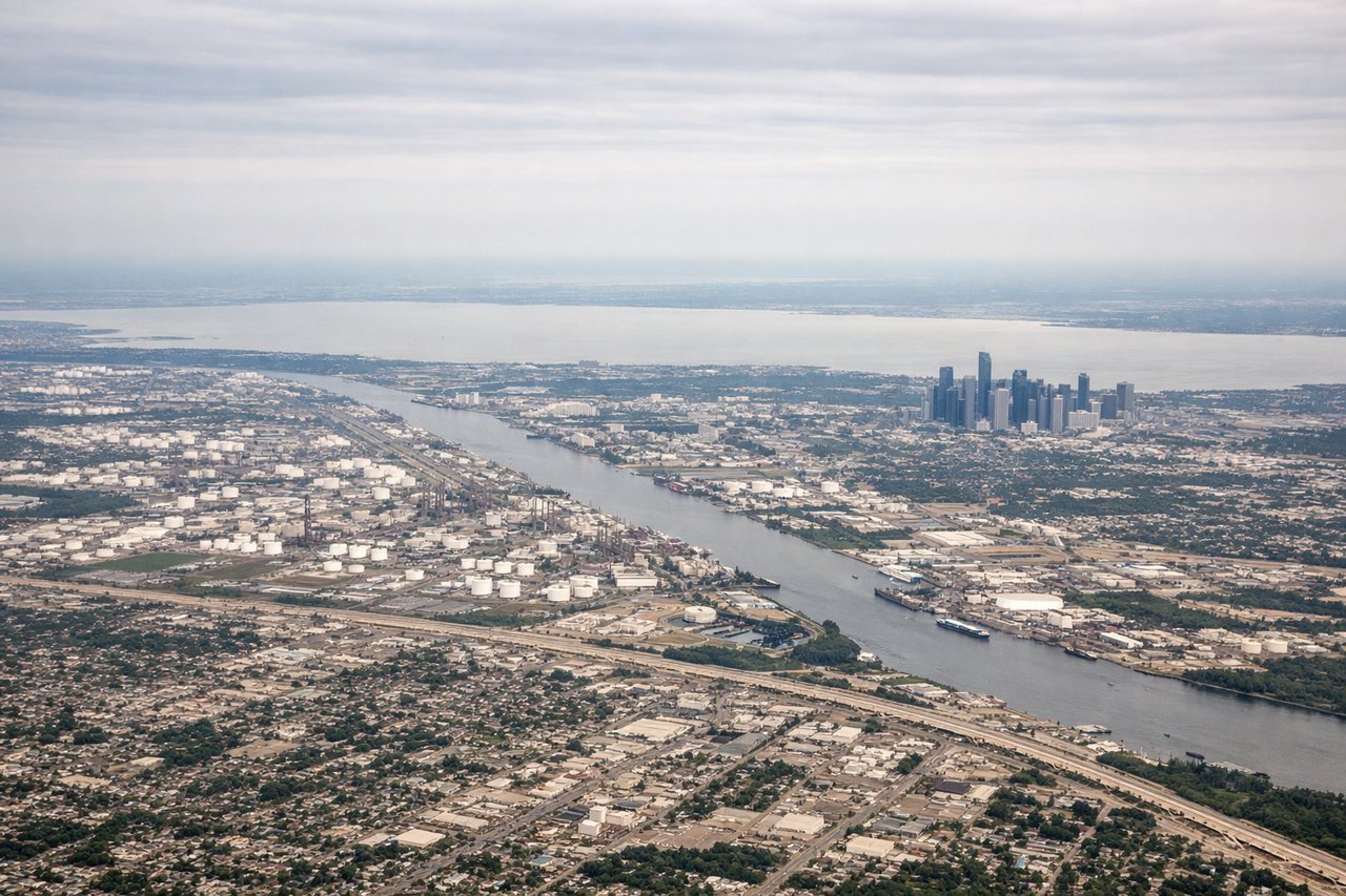
LEFTIAH departures heading northwest on runway 27L/27R put the left side facing south, giving views over downtown Houston's skyline and the Ship Channel industrial complex. The right side faces north into suburban sprawl with little of interest.
Landing at PHX
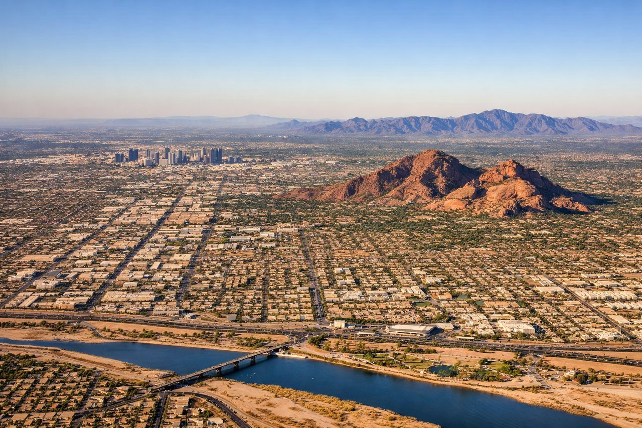
RIGHTPHX typically uses runways 26L/26R or 25L/25R for westward landings, meaning the approach comes from the east. The right side faces north toward the McDowell Mountains and Four Peaks, while the left faces south over South Mountain Park. Right side gives the more dramatic desert mountain scenery on final approach.
Will your flight be in sunlight?
Pick a date and time in the Sun Map to watch the sun move across your whole flight.
About This Route
Which side of the plane should I sit on flying from George Bush Intcntl Houston (IAH) to Phoenix Sky Harbor International (PHX)?
Sit on the Right side of the plane for the best views on flights from Houston to Phoenix. The left side has a decent Houston departure view, but the right side delivers the payoff on arrival with Camelback Mountain, the McDowell range, and Four Peaks on final into PHX. The desert mountain scenery approaching Phoenix is more visually dramatic than anything on the left during the flat Texas and New Mexico cruise.
What can I see during takeoff from George Bush Intcntl Houston in Houston?
During takeoff from George Bush Intcntl Houston (IAH), sit on the Left side for the best views. IAH departures heading northwest on runway 27L/27R put the left side facing south, giving views over downtown Houston's skyline and the Ship Channel industrial complex. The right side faces north into suburban sprawl with little of interest. Notable sights include: Downtown Houston skyline, Houston Ship Channel and refineries, Lake Houston to the northeast (right side briefly), Galveston Bay glinting to the southeast.
What can I see when landing at Phoenix Sky Harbor International in Phoenix?
When landing at Phoenix Sky Harbor International (PHX), sit on the Right side for the best views. PHX typically uses runways 26L/26R or 25L/25R for westward landings, meaning the approach comes from the east. The right side faces north toward the McDowell Mountains and Four Peaks, while the left faces south over South Mountain Park. Right side gives the more dramatic desert mountain scenery on final approach. Notable sights include: McDowell Mountains to the northeast, Four Peaks massif on the horizon, Camelback Mountain close in, downtown Phoenix grid visible below.
How long is the flight from Houston to Phoenix?
The flight from George Bush Intcntl Houston (IAH) to Phoenix Sky Harbor International (PHX) takes about 2 hours 45 minutes. The shortest flight path between them is 1,007 miles (1,620 km); winds and air traffic control usually add a few percent.
What does the Houston to Phoenix flight path pass over?
The flight tracks northwest over the Texas Hill Country west of San Antonio, then crosses the Chihuahuan Desert of far west Texas near the Davis Mountains and Trans-Pecos region. Over New Mexico, the route passes north of El Paso and the Franklin Mountains, then crosses the desolate Lordsburg Playa and the Gila River valley in southern Arizona before descending into the Phoenix Basin through the Sonoran Desert.