The landing approach to Puerto Natales over the Paine Massif and Patagonian fjords is genuinely extraordinary—dramatic granite peaks, glaciated terrain, and turquoise channels create a 4.0+ experience. The takeoff from Houston is flat and urban (2.5). The right side captures one of the world's most visually distinctive approaches, while the left side offers only typical Gulf Coast departure scenery.
Flown IAH to PNT? Did we get it right?
Flight Path
Houston to Puerto Natales is 5,809 miles (9,349 km), a flight of about 9 hours 15 minutes.
Gulf of Mexico coastline (Yucatan Peninsula visible on southern route), Caribbean waters, Central American highlands (Guatemala/Honduras mountains), Pacific coast of Central America, Colombian/Ecuadorian Andes, Amazon Basin transition zone, Peruvian Andes, Atacama Desert (northern Chile), Chilean Lake District volcanoes, Patagonian steppe and fjord systems
Great circle distance and headings ›


Phase by phase
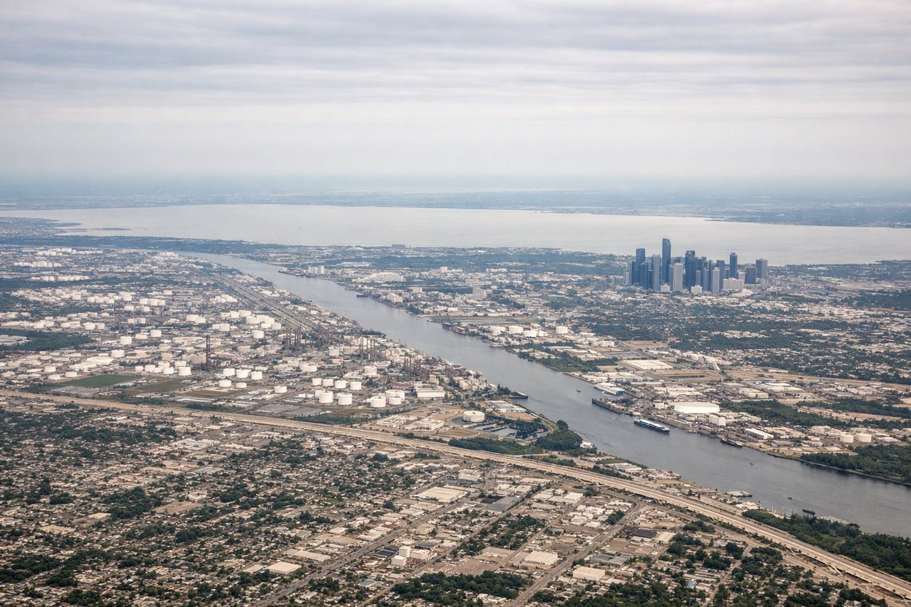
Takeoff from IAH
LEFTHouston's urban sprawl and the Ship Channel are visible during northbound departure, offering brief city scenery before transitioning to flat Gulf Coast terrain.
Landing at PNT
RIGHTThe approach to Puerto Natales descends over the Beagle Channel, Paine Massif peaks, and the dramatic fjord landscape of southern Patagonia—one of the world's most visually striking approaches with glaciated mountains, turquoise water, and sharp granite peaks.
Will your flight be in sunlight?
Pick a date and time in the Sun Map to watch the sun move across your whole flight.
About This Route
Which side of the plane should I sit on flying from George Bush Intcntl Houston (IAH) to Lieutenant Julio Gallardo Airport (PNT)?
Sit on the Right side of the plane for the best views on flights from Houston to Puerto Natales. The landing approach to Puerto Natales over the Paine Massif and Patagonian fjords is genuinely extraordinary—dramatic granite peaks, glaciated terrain, and turquoise channels create a 4.0+ experience. The takeoff from Houston is flat and urban (2.5). The right side captures one of the world's most visually distinctive approaches, while the left side offers only typical Gulf Coast departure scenery.
What can I see during takeoff from George Bush Intcntl Houston in Houston?
During takeoff from George Bush Intcntl Houston (IAH), sit on the Left side for the best views. Houston's urban sprawl and the Ship Channel are visible during northbound departure, offering brief city scenery before transitioning to flat Gulf Coast terrain. Notable sights include: Houston skyline, Buffalo Bayou, Galveston Bay (distant), flat Texas coastal plains.
What can I see when landing at Lieutenant Julio Gallardo Airport in Puerto Natales?
When landing at Lieutenant Julio Gallardo Airport (PNT), sit on the Right side for the best views. The approach to Puerto Natales descends over the Beagle Channel, Paine Massif peaks, and the dramatic fjord landscape of southern Patagonia—one of the world's most visually striking approaches with glaciated mountains, turquoise water, and sharp granite peaks. Notable sights include: Paine Massif (three granite towers), Beagle Channel, Última Esperanza Sound, glaciated peaks of the Southern Patagonian Andes.
How long is the flight from Houston to Puerto Natales?
The flight from George Bush Intcntl Houston (IAH) to Lieutenant Julio Gallardo Airport (PNT) takes about 9 hours 15 minutes. The shortest flight path between them is 5,809 miles (9,349 km); winds and air traffic control usually add a few percent.
What does the Houston to Puerto Natales flight path pass over?
Gulf of Mexico coastline (Yucatan Peninsula visible on southern route), Caribbean waters, Central American highlands (Guatemala/Honduras mountains), Pacific coast of Central America, Colombian/Ecuadorian Andes, Amazon Basin transition zone, Peruvian Andes, Atacama Desert (northern Chile), Chilean Lake District volcanoes, Patagonian steppe and fjord systems