The left side wins overall because of the dramatic Andes approach into Santiago, which offers one of the most visually striking mountain landings in commercial aviation, plus a modestly more interesting coastal departure from Houston.
Flight Path
Yucatan Peninsula coastline, Caribbean Sea, Colombian Andes foothills, Amazon Basin rainforest, Bolivian Altiplano, high Andes ridgeline near the Chile-Argentina border
Great circle distance and headings ›

Phase by phase
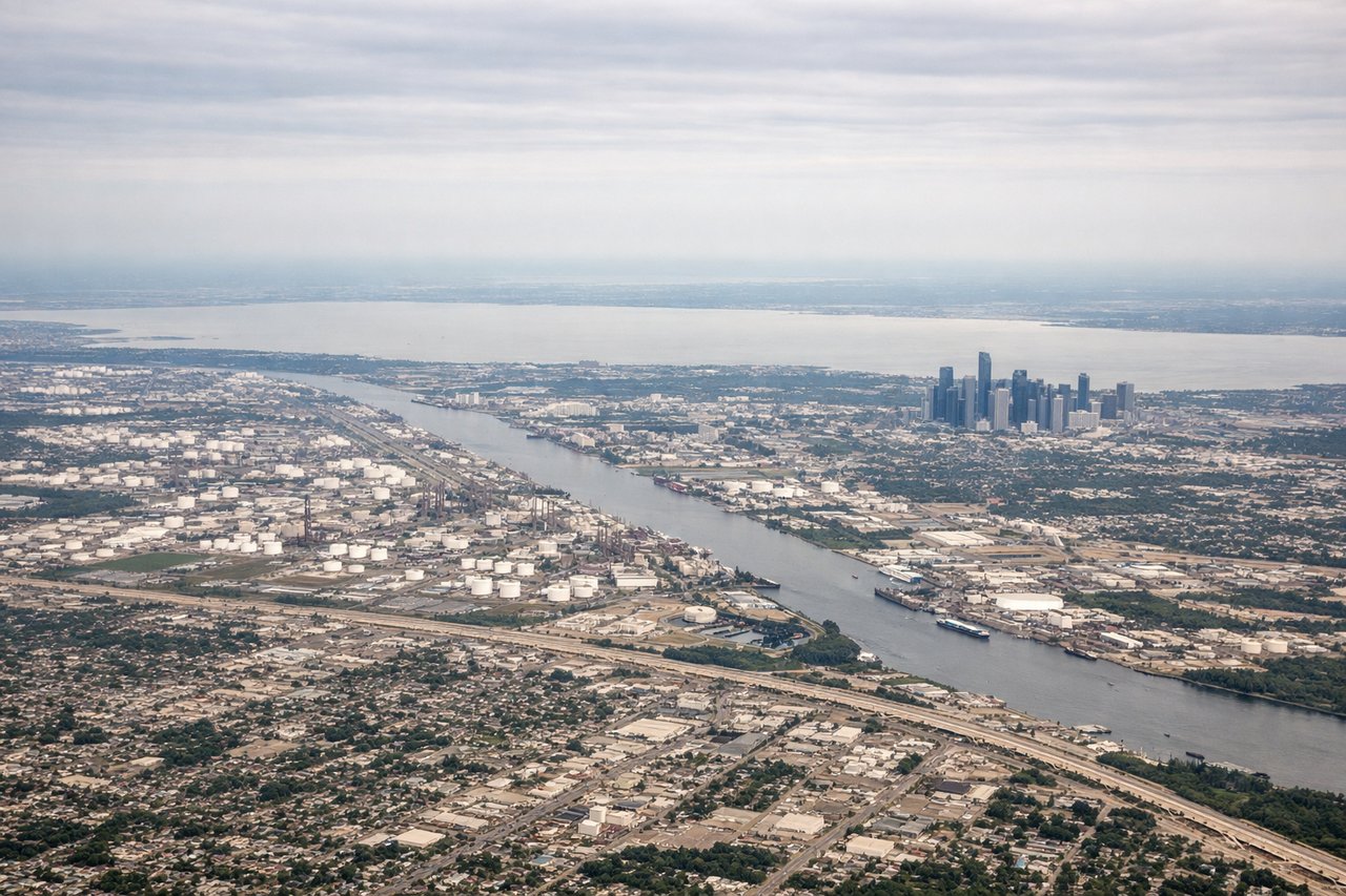
Takeoff from IAH
LEFTDeparting IAH southbound, the climb path curves over Galveston Bay and the upper Texas Gulf Coast, giving left-side passengers a view of the bay, barrier islands, and the brown-green wetlands before the aircraft heads out over open water. The right side mostly shows flat suburban Houston sprawl fading into haze.
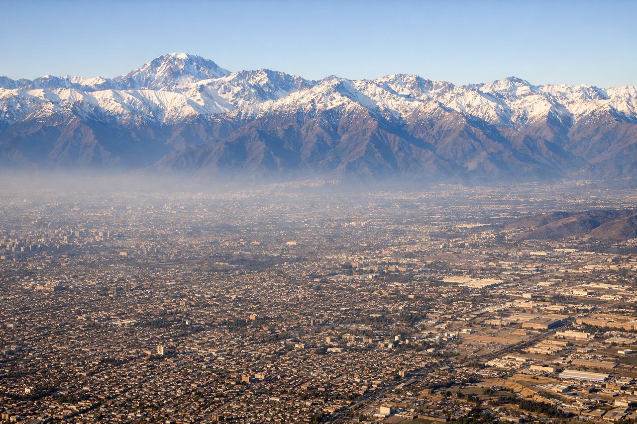
Landing at SCL
LEFTOn approach to SCL from the north, the aircraft descends along the Central Valley with the high, snow-capped Andes rising dramatically on the left side, while the right side only shows the lower, less distinctive Coastal Range and hazy Pacific in the far distance. The Andes wall near Santiago, with peaks over 6,000 meters, is the flight's visual highlight.
Landmarks on this routeAll landmarks →
Will your flight be in sunlight?
See exactly which side of the plane gets sun and shade at your departure time.
About This Route
Which side of the plane should I sit on flying from George Bush Intcntl Houston (IAH) to Arturo Merino Benitez International (SCL)?
Sit on the Left side of the plane for the best views on flights from Houston to Santiago. The left side wins overall because of the dramatic Andes approach into Santiago, which offers one of the most visually striking mountain landings in commercial aviation, plus a modestly more interesting coastal departure from Houston.
What can I see during takeoff from George Bush Intcntl Houston in Houston?
During takeoff from George Bush Intcntl Houston (IAH), sit on the Left side for the best views. Departing IAH southbound, the climb path curves over Galveston Bay and the upper Texas Gulf Coast, giving left-side passengers a view of the bay, barrier islands, and the brown-green wetlands before the aircraft heads out over open water. The right side mostly shows flat suburban Houston sprawl fading into haze. Notable sights include: Galveston Bay, Bolivar Peninsula, Houston Ship Channel industrial complex, Gulf of Mexico coastline.
What can I see when landing at Arturo Merino Benitez International in Santiago?
When landing at Arturo Merino Benitez International (SCL), sit on the Left side for the best views. On approach to SCL from the north, the aircraft descends along the Central Valley with the high, snow-capped Andes rising dramatically on the left side, while the right side only shows the lower, less distinctive Coastal Range and hazy Pacific in the far distance. The Andes wall near Santiago, with peaks over 6,000 meters, is the flight's visual highlight. Notable sights include: Andes Cordillera front range, snow-capped peaks near Cerro El Plomo, Santiago's Central Valley farmland, Maipo River valley.
How long is the flight from Houston to Santiago?
The flight from George Bush Intcntl Houston (IAH) to Arturo Merino Benitez International (SCL) takes 9h 35m.
What does the Houston to Santiago flight path pass over?
Yucatan Peninsula coastline, Caribbean Sea, Colombian Andes foothills, Amazon Basin rainforest, Bolivian Altiplano, high Andes ridgeline near the Chile-Argentina border