While takeoff favors the left side with Galveston Bay visibility, the landing approach on the right side offers significantly more dramatic scenery with the Great Smoky Mountains creating a memorable final descent. The mountain views outweigh the coastal plain departure, making the right side the better overall choice for this 2h 15m flight.
Flown IAH to TYS? Did we get it right?
Flight Path
Houston to Knoxville is 771 miles (1,241 km), a flight of about 2 hours 15 minutes.
Tennessee River valley, Appalachian ridge system running northeast-southwest, transition from Gulf Coastal Plain to Appalachian foothills, scattered lakes in Tennessee piedmont region
Great circle distance and headings ›Phase by phase
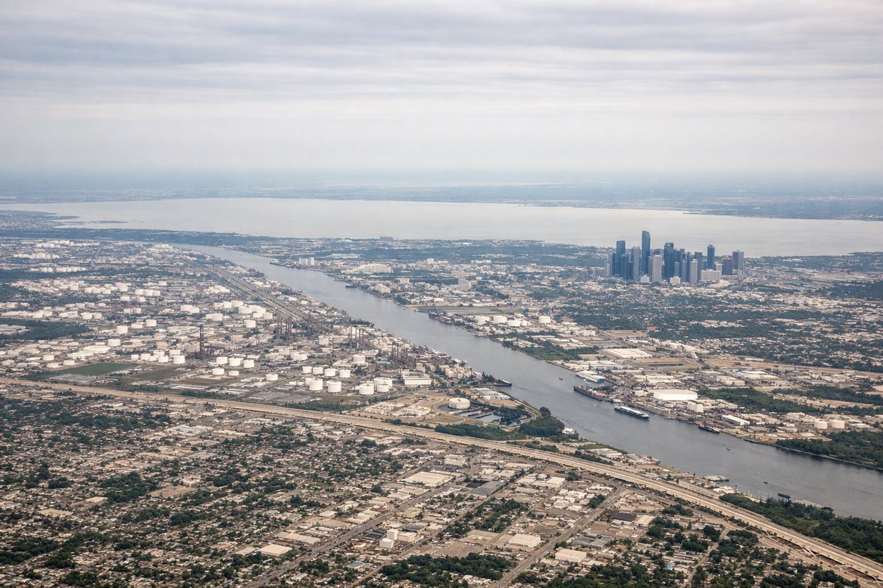
Takeoff from IAH
LEFTLeft side captures Houston's urban sprawl and the coastal plain during climb-out, with Galveston Bay visible in the distance. Right side shows inland flat terrain with minimal visual interest during departure.
Landing at TYS
RIGHTRight side offers the Smoky Mountains and foothills approaching Knoxville, with the Great Smoky Mountains National Park visible as a dramatic ridge line during descent. Left side shows only flat to gently rolling Appalachian foothills with less visual drama.
Will your flight be in sunlight?
Pick a date and time in the Sun Map to watch the sun move across your whole flight.
About This Route
Which side of the plane should I sit on flying from George Bush Intcntl Houston (IAH) to Mc Ghee Tyson (TYS)?
Sit on the Right side of the plane for the best views on flights from Houston to Knoxville. While takeoff favors the left side with Galveston Bay visibility, the landing approach on the right side offers significantly more dramatic scenery with the Great Smoky Mountains creating a memorable final descent. The mountain views outweigh the coastal plain departure, making the right side the better overall choice for this 2h 15m flight.
What can I see during takeoff from George Bush Intcntl Houston in Houston?
During takeoff from George Bush Intcntl Houston (IAH), sit on the Left side for the best views. Left side captures Houston's urban sprawl and the coastal plain during climb-out, with Galveston Bay visible in the distance. Right side shows inland flat terrain with minimal visual interest during departure. Notable sights include: Galveston Bay (southeast), Houston Ship Channel, Lake Houston, flat Gulf Coastal Plain extending to horizon.
What can I see when landing at Mc Ghee Tyson in Knoxville?
When landing at Mc Ghee Tyson (TYS), sit on the Right side for the best views. Right side offers the Smoky Mountains and foothills approaching Knoxville, with the Great Smoky Mountains National Park visible as a dramatic ridge line during descent. Left side shows only flat to gently rolling Appalachian foothills with less visual drama. Notable sights include: Great Smoky Mountains (southern horizon), Knoxville urban area, Tennessee River valley, Appalachian ridge lines.
How long is the flight from Houston to Knoxville?
The flight from George Bush Intcntl Houston (IAH) to Mc Ghee Tyson (TYS) takes about 2 hours 15 minutes. The shortest flight path between them is 771 miles (1,241 km); winds and air traffic control usually add a few percent.
What does the Houston to Knoxville flight path pass over?
Tennessee River valley, Appalachian ridge system running northeast-southwest, transition from Gulf Coastal Plain to Appalachian foothills, scattered lakes in Tennessee piedmont region