Indore to Bangalore is 670 miles (1,078 km), a flight of about 2 hours 5 minutes.
Throughout the flight, the right (west-facing) side offers a slightly more varied view of the Deccan Plateau's low hill formations near departure and the granite hillocks and reservoirs near Bangalore on arrival, while the left side remains dominated by flat, repetitive farmland.
Flight Path
The route crosses the interior Deccan Plateau over northern Karnataka and southern Maharashtra, passing near the Krishna River basin and rolling agricultural plains dotted with small reservoirs, with no major mountain ranges directly beneath the flight path.
Great circle distance and headings ›Phase by phase
Takeoff from IDR
RIGHTClimbing out of Indore, the right side faces west toward the Malwa Plateau's low mesa-like hills and the distant edge of the Vindhya Range, giving a bit more textured relief than the flatter farmland visible to the east.
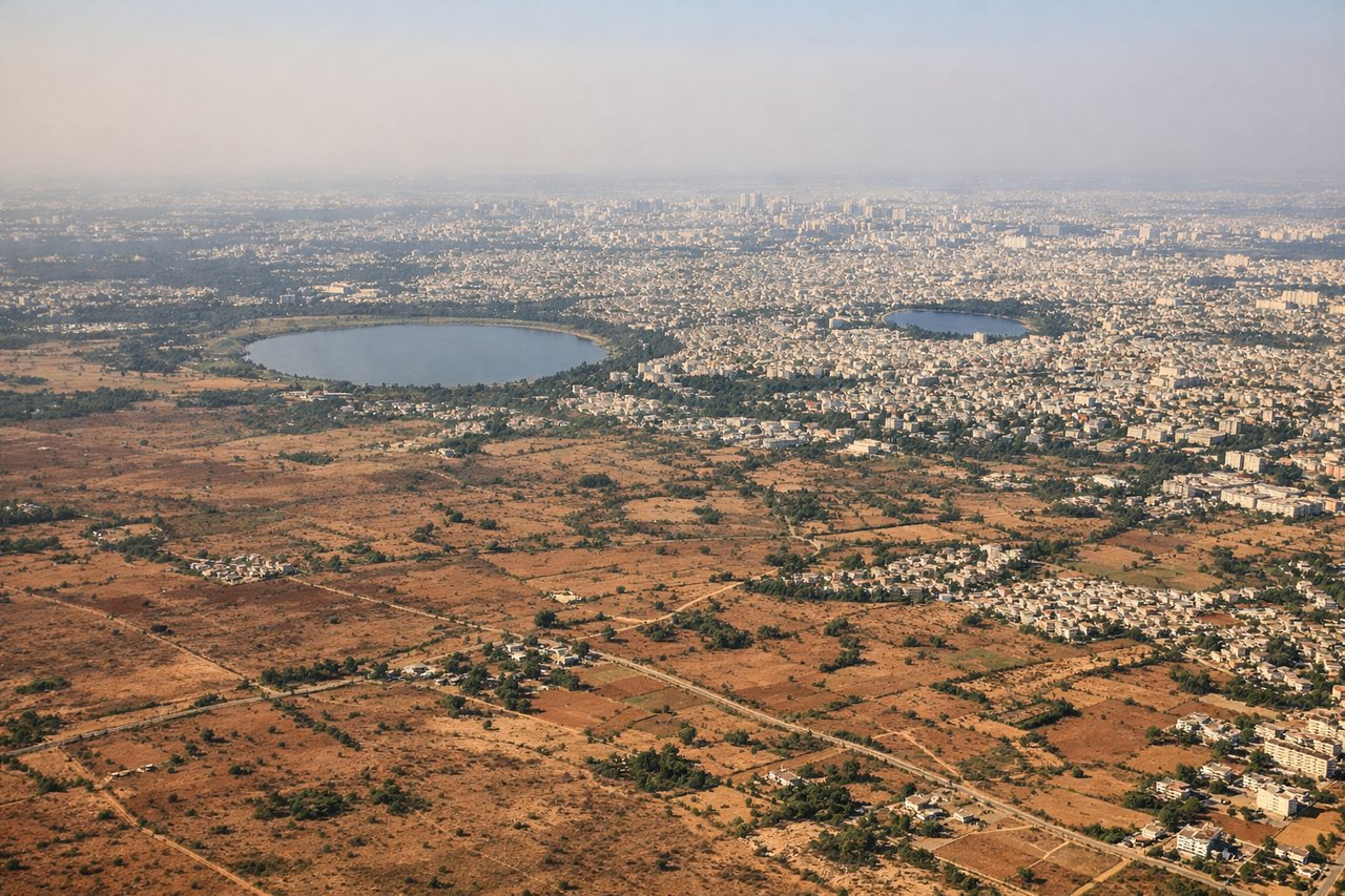
Landing at BLR
RIGHTOn approach into Bangalore from the north, the right side offers views toward the granite hillocks and reservoirs northwest of the city, including the rolling terrain near Nandi Hills, while the left side mostly overlooks flatter suburban sprawl.
Will your flight be in sunlight?
Pick a date and time in the Sun Map to watch the sun move across your whole flight.
About This Route
Which side of the plane should I sit on flying from Devi Ahilyabai Holkar (IDR) to Kempegowda International Airport Bengaluru (BLR)?
Sit on the Right side of the plane for the best views on flights from Indore to Bangalore. Throughout the flight, the right (west-facing) side offers a slightly more varied view of the Deccan Plateau's low hill formations near departure and the granite hillocks and reservoirs near Bangalore on arrival, while the left side remains dominated by flat, repetitive farmland.
What can I see during takeoff from Devi Ahilyabai Holkar in Indore?
During takeoff from Devi Ahilyabai Holkar (IDR), sit on the Right side for the best views. Climbing out of Indore, the right side faces west toward the Malwa Plateau's low mesa-like hills and the distant edge of the Vindhya Range, giving a bit more textured relief than the flatter farmland visible to the east. Notable sights include: Malwa Plateau farmland, distant Vindhya Range foothills, Indore city outskirts.
What can I see when landing at Kempegowda International Airport Bengaluru in Bangalore?
When landing at Kempegowda International Airport Bengaluru (BLR), sit on the Right side for the best views. On approach into Bangalore from the north, the right side offers views toward the granite hillocks and reservoirs northwest of the city, including the rolling terrain near Nandi Hills, while the left side mostly overlooks flatter suburban sprawl. Notable sights include: Nandi Hills escarpment, Hesaraghatta Lake, granite hillocks northwest of Bangalore, Bangalore's outer suburbs.
How long is the flight from Indore to Bangalore?
The flight from Devi Ahilyabai Holkar (IDR) to Kempegowda International Airport Bengaluru (BLR) takes about 2 hours 5 minutes. The shortest flight path between them is 670 miles (1,078 km); winds and air traffic control usually add a few percent.
What does the Indore to Bangalore flight path pass over?
The route crosses the interior Deccan Plateau over northern Karnataka and southern Maharashtra, passing near the Krishna River basin and rolling agricultural plains dotted with small reservoirs, with no major mountain ranges directly beneath the flight path.