The right side wins at takeoff with the Carolina coast, but the left side delivers the Manhattan and New York Harbor approach, which is one of the most visually dramatic arrivals anywhere. Over the flight, the left side also tracks closer to the Delaware Bay and the New Jersey coastline in the descent phase, giving more sustained geographic interest.
Flight Path
The flight tracks northeast up the Mid-Atlantic coast, passing over the North Carolina Outer Banks region, then crossing into Virginia and over the Hampton Roads area. It then follows the Delmarva Peninsula corridor, with the Chesapeake Bay visible to the west and the Atlantic to the east. Over New Jersey, the Pine Barrens appear as a dark forested expanse before the urban density of the New York metro area fills the view on descent.
Great circle distance and headings ›
.jpg?width=600)
.jpeg?width=600)
Phase by phase
Takeoff from ILM
RIGHTILM's primary departure runway 06 sends aircraft northeast over the Cape Fear River and the Atlantic coastline. The right side looks southeast over the barrier islands, Wrightsville Beach, and the open Atlantic, while the left side faces inland toward pine flatlands with little of interest.
Landing at EWR
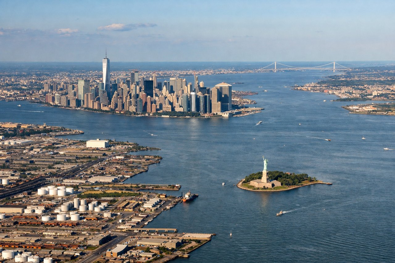
LEFTEWR's primary arrival runway 22L brings aircraft in from the northeast, descending over New York Harbor and the Hudson River. The left side faces southeast toward Lower Manhattan, the Statue of Liberty, and the Verrazano-Narrows Bridge — the most iconic urban approach view in the country.
Landmarks on this routeAll landmarks →
Will your flight be in sunlight?
See exactly which side of the plane gets sun and shade at your departure time.
About This Route
Which side of the plane should I sit on flying from Wilmington International (ILM) to Newark Liberty International (EWR)?
Sit on the Left side of the plane for the best views on flights from Wilmington to Newark. The right side wins at takeoff with the Carolina coast, but the left side delivers the Manhattan and New York Harbor approach, which is one of the most visually dramatic arrivals anywhere. Over the flight, the left side also tracks closer to the Delaware Bay and the New Jersey coastline in the descent phase, giving more sustained geographic interest.
What can I see during takeoff from Wilmington International in Wilmington?
During takeoff from Wilmington International (ILM), sit on the Right side for the best views. ILM's primary departure runway 06 sends aircraft northeast over the Cape Fear River and the Atlantic coastline. The right side looks southeast over the barrier islands, Wrightsville Beach, and the open Atlantic, while the left side faces inland toward pine flatlands with little of interest. Notable sights include: Cape Fear River, Wrightsville Beach barrier island, Masonboro Island, Atlantic Ocean coastline.
What can I see when landing at Newark Liberty International in Newark?
When landing at Newark Liberty International (EWR), sit on the Left side for the best views. EWR's primary arrival runway 22L brings aircraft in from the northeast, descending over New York Harbor and the Hudson River. The left side faces southeast toward Lower Manhattan, the Statue of Liberty, and the Verrazano-Narrows Bridge — the most iconic urban approach view in the country. Notable sights include: Lower Manhattan skyline, Statue of Liberty, Verrazano-Narrows Bridge, New York Harbor.
How long is the flight from Wilmington to Newark?
The flight from Wilmington International (ILM) to Newark Liberty International (EWR) takes Approximately 1 hour 20 minutes.
What does the Wilmington to Newark flight path pass over?
The flight tracks northeast up the Mid-Atlantic coast, passing over the North Carolina Outer Banks region, then crossing into Virginia and over the Hampton Roads area. It then follows the Delmarva Peninsula corridor, with the Chesapeake Bay visible to the west and the Atlantic to the east. Over New Jersey, the Pine Barrens appear as a dark forested expanse before the urban density of the New York metro area fills the view on descent.