Both sides score equally for the cruise phase over central Brazil's relatively flat terrain with scattered rivers and vegetation. However, the right side gains a decisive advantage during landing: the approach into São Paulo's metropolitan area provides dramatic urban scenery and density that far exceeds the modest river views during takeoff from Imperatriz. The landing experience dominates the passenger's memory of the flight.
Flown IMP to GRU? Did we get it right?
Flight Path
Imperatriz to Sao Paulo is 1,239 miles (1,993 km), a flight of about 2 hours 45 minutes.
Araguaia River valley, transition from Amazon cerrado to central Brazilian plateau, scattered settlements along BR-153 highway corridor, Goiás state agricultural lands, gradual elevation increase toward São Paulo highlands
Great circle distance and headings ›Phase by phase
Takeoff from IMP
LEFTImperatriz sits on the Tocantins River in the Amazon transition zone. Left-side departures (depending on runway 7/25 wind direction) may offer views of the river's meanders and surrounding cerrado-forest mosaic during initial climb. Right side faces inland scrubland with less visual interest.
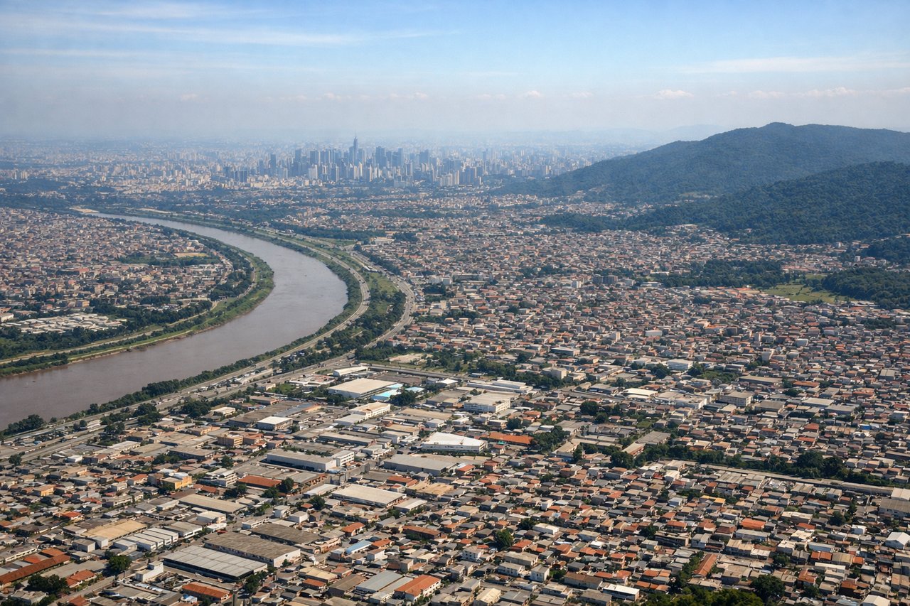
Landing at GRU
RIGHTGRU's approach from the south (typical for westerly flow on runways 28L/28R) brings aircraft over the densely populated São Paulo metropolitan area. Right-side passengers see the sprawling city, industrial zones, and suburban development during descent and final approach—far more visually engaging than the left side's approach over open terrain.
Will your flight be in sunlight?
Pick a date and time in the Sun Map to watch the sun move across your whole flight.
About This Route
Which side of the plane should I sit on flying from Imperatriz (IMP) to Guarulhos (GRU)?
Sit on the Right side of the plane for the best views on flights from Imperatriz to Sao Paulo. Both sides score equally for the cruise phase over central Brazil's relatively flat terrain with scattered rivers and vegetation. However, the right side gains a decisive advantage during landing: the approach into São Paulo's metropolitan area provides dramatic urban scenery and density that far exceeds the modest river views during takeoff from Imperatriz. The landing experience dominates the passenger's memory of the flight.
What can I see during takeoff from Imperatriz in Imperatriz?
During takeoff from Imperatriz (IMP), sit on the Left side for the best views. Imperatriz sits on the Tocantins River in the Amazon transition zone. Left-side departures (depending on runway 7/25 wind direction) may offer views of the river's meanders and surrounding cerrado-forest mosaic during initial climb. Right side faces inland scrubland with less visual interest. Notable sights include: Tocantins River meanders, cerrado vegetation patches, scattered settlement clusters, local airfield infrastructure.
What can I see when landing at Guarulhos in Sao Paulo?
When landing at Guarulhos (GRU), sit on the Right side for the best views. GRU's approach from the south (typical for westerly flow on runways 28L/28R) brings aircraft over the densely populated São Paulo metropolitan area. Right-side passengers see the sprawling city, industrial zones, and suburban development during descent and final approach—far more visually engaging than the left side's approach over open terrain. Notable sights include: São Paulo metropolitan sprawl, Guarulhos industrial corridor, Cantareira Mountains to the north, suburban residential grid patterns.
How long is the flight from Imperatriz to Sao Paulo?
The flight from Imperatriz (IMP) to Guarulhos (GRU) takes about 2 hours 45 minutes. The shortest flight path between them is 1,239 miles (1,993 km); winds and air traffic control usually add a few percent.
What does the Imperatriz to Sao Paulo flight path pass over?
Araguaia River valley, transition from Amazon cerrado to central Brazilian plateau, scattered settlements along BR-153 highway corridor, Goiás state agricultural lands, gradual elevation increase toward São Paulo highlands