Mount Isa to Hanoi is 3,681 miles (5,923 km), a flight of about 7 hours 30 minutes.
Right side scores 3.5 versus left's 2.5 due to superior scenery on both ends of the flight. Takeoff from Mount Isa shows mining operations and plateau terrain; cruise crosses the inland Australian outback with some river valleys; landing into Hanoi delivers the dramatic Red River Delta agricultural landscape and urban approach. Left side is dominated by open outback and Gulf of Tonkin ocean with minimal visual interest.
Flight Path
Gulf of Carpentaria coastline (northern Queensland), Arafura Sea crossing, Timor Sea, Tonkin Gulf approaches to Vietnam
Great circle distance and headings ›Phase by phase
Takeoff from ISA
RIGHTRight side captures Mount Isa's mining landscape and the transition from inland Queensland plateau terrain during northbound departure (runway 34). Left side faces open outback with minimal visual interest.
Landing at HAN
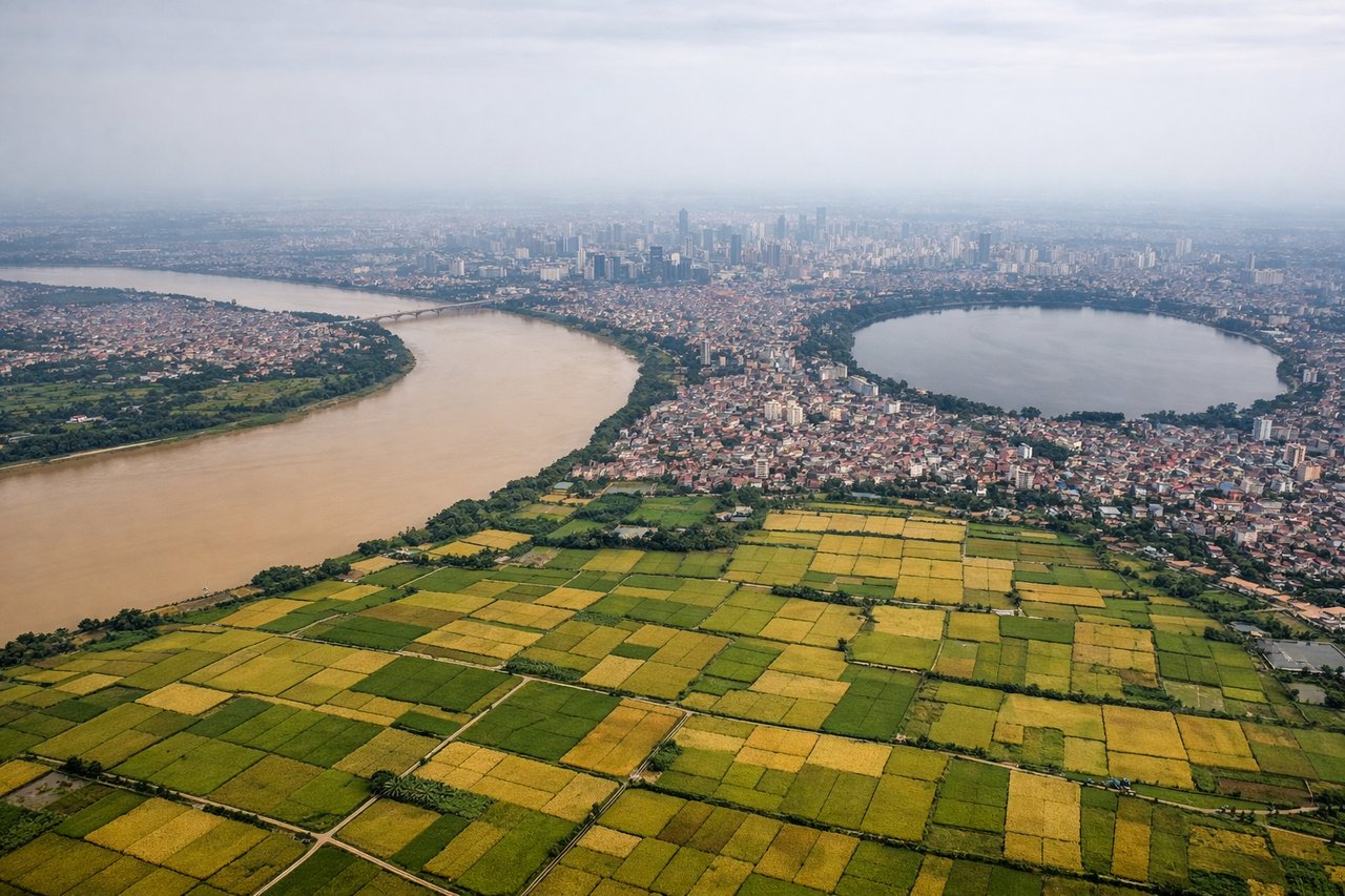
RIGHTRight side (starboard) offers superior approach scenery into Hanoi. During typical winter northeast monsoon operations (runway 29 landing), the aircraft descends over the Red River Delta with its distinctive agricultural patchwork, waterways, and the Red River itself visible before final approach into Noibai. Left side faces open Gulf of Tonkin with minimal landmarks.
Landmarks on this routeAll landmarks →
Will your flight be in sunlight?
Pick a date and time in the Sun Map to watch the sun move across your whole flight.
About This Route
Which side of the plane should I sit on flying from Mount Isa (ISA) to Noibai International (HAN)?
Sit on the Right side of the plane for the best views on flights from Mount Isa to Hanoi. Right side scores 3.5 versus left's 2.5 due to superior scenery on both ends of the flight. Takeoff from Mount Isa shows mining operations and plateau terrain; cruise crosses the inland Australian outback with some river valleys; landing into Hanoi delivers the dramatic Red River Delta agricultural landscape and urban approach. Left side is dominated by open outback and Gulf of Tonkin ocean with minimal visual interest.
What can I see during takeoff from Mount Isa in Mount Isa?
During takeoff from Mount Isa (ISA), sit on the Right side for the best views. Right side captures Mount Isa's mining landscape and the transition from inland Queensland plateau terrain during northbound departure (runway 34). Left side faces open outback with minimal visual interest. Notable sights include: Mount Isa town and mining operations, Leichhardt River valley, Queensland plateau escarpment.
What can I see when landing at Noibai International in Hanoi?
When landing at Noibai International (HAN), sit on the Right side for the best views. Right side (starboard) offers superior approach scenery into Hanoi. During typical winter northeast monsoon operations (runway 29 landing), the aircraft descends over the Red River Delta with its distinctive agricultural patchwork, waterways, and the Red River itself visible before final approach into Noibai. Left side faces open Gulf of Tonkin with minimal landmarks. Notable sights include: Red River Delta agricultural fields and waterways, Red River main channel, Hanoi city sprawl and urban districts, Noibai International Airport complex.
How long is the flight from Mount Isa to Hanoi?
The flight from Mount Isa (ISA) to Noibai International (HAN) takes about 7 hours 30 minutes. The shortest flight path between them is 3,681 miles (5,923 km); winds and air traffic control usually add a few percent.
What does the Mount Isa to Hanoi flight path pass over?
Gulf of Carpentaria coastline (northern Queensland), Arafura Sea crossing, Timor Sea, Tonkin Gulf approaches to Vietnam