Both sides score equally for the cruise segment over the Appalachian plateau and Pennsylvania valleys, but the right side wins overall due to superior landing approach scenery. The Potomac River, Washington D.C. metropolitan area, and Blue Ridge Mountains visible on approach to Dulles provide more dramatic and recognizable urban and natural landmarks than the left side's inland valleys during descent.
Flown ITH to IAD? Did we get it right?
Flight Path
Ithaca to Washington is 251 miles (403 km), a flight of about 1 hour 15 minutes.
Appalachian plateau terrain with scattered ridges and valleys; Pennsylvania's ridge-and-valley topography (Allegheny Mountains); Susquehanna River valley; transition from northern Appalachian highlands to the Piedmont region of Virginia; scattered reservoirs and river systems throughout the flight path
Great circle distance and headings ›Phase by phase
Takeoff from ITH
LEFTLeft side captures Cayuga Lake and the Finger Lakes region during climb-out from Ithaca, offering water and rolling terrain. Right side shows inland valleys with less distinctive features during the initial climb.
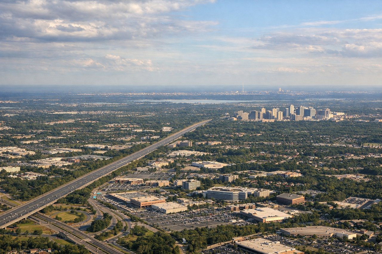
Landing at IAD
RIGHTRight side offers superior approach scenery into Dulles, with views of the Potomac River, Washington D.C.'s urban sprawl, and the Blue Ridge Mountains on the western horizon. Left side shows less distinctive terrain during the final descent corridor.
Will your flight be in sunlight?
Pick a date and time in the Sun Map to watch the sun move across your whole flight.
About This Route
Which side of the plane should I sit on flying from Ithaca Tompkins Regional Airport (ITH) to Washington Dulles International (IAD)?
Sit on the Right side of the plane for the best views on flights from Ithaca to Washington. Both sides score equally for the cruise segment over the Appalachian plateau and Pennsylvania valleys, but the right side wins overall due to superior landing approach scenery. The Potomac River, Washington D.C. metropolitan area, and Blue Ridge Mountains visible on approach to Dulles provide more dramatic and recognizable urban and natural landmarks than the left side's inland valleys during descent.
What can I see during takeoff from Ithaca Tompkins Regional Airport in Ithaca?
During takeoff from Ithaca Tompkins Regional Airport (ITH), sit on the Left side for the best views. Left side captures Cayuga Lake and the Finger Lakes region during climb-out from Ithaca, offering water and rolling terrain. Right side shows inland valleys with less distinctive features during the initial climb. Notable sights include: Cayuga Lake (directly below during climb), Seneca Lake (visible to the southwest), Ithaca College campus and downtown Ithaca (immediate ground reference), rolling Appalachian foothills.
What can I see when landing at Washington Dulles International in Washington?
When landing at Washington Dulles International (IAD), sit on the Right side for the best views. Right side offers superior approach scenery into Dulles, with views of the Potomac River, Washington D.C.'s urban sprawl, and the Blue Ridge Mountains on the western horizon. Left side shows less distinctive terrain during the final descent corridor. Notable sights include: Potomac River (major waterway defining the approach), Washington D.C. metropolitan area and urban grid (visible 20-30 miles out), Blue Ridge Mountains (western horizon), Dulles International Airport and its runways (final approach).
How long is the flight from Ithaca to Washington?
The flight from Ithaca Tompkins Regional Airport (ITH) to Washington Dulles International (IAD) takes about 1 hour 15 minutes. The shortest flight path between them is 251 miles (403 km); winds and air traffic control usually add a few percent.
What does the Ithaca to Washington flight path pass over?
Appalachian plateau terrain with scattered ridges and valleys; Pennsylvania's ridge-and-valley topography (Allegheny Mountains); Susquehanna River valley; transition from northern Appalachian highlands to the Piedmont region of Virginia; scattered reservoirs and river systems throughout the flight path